How Drone Mapping Helps Construction Projects Stay on Track in Nashville
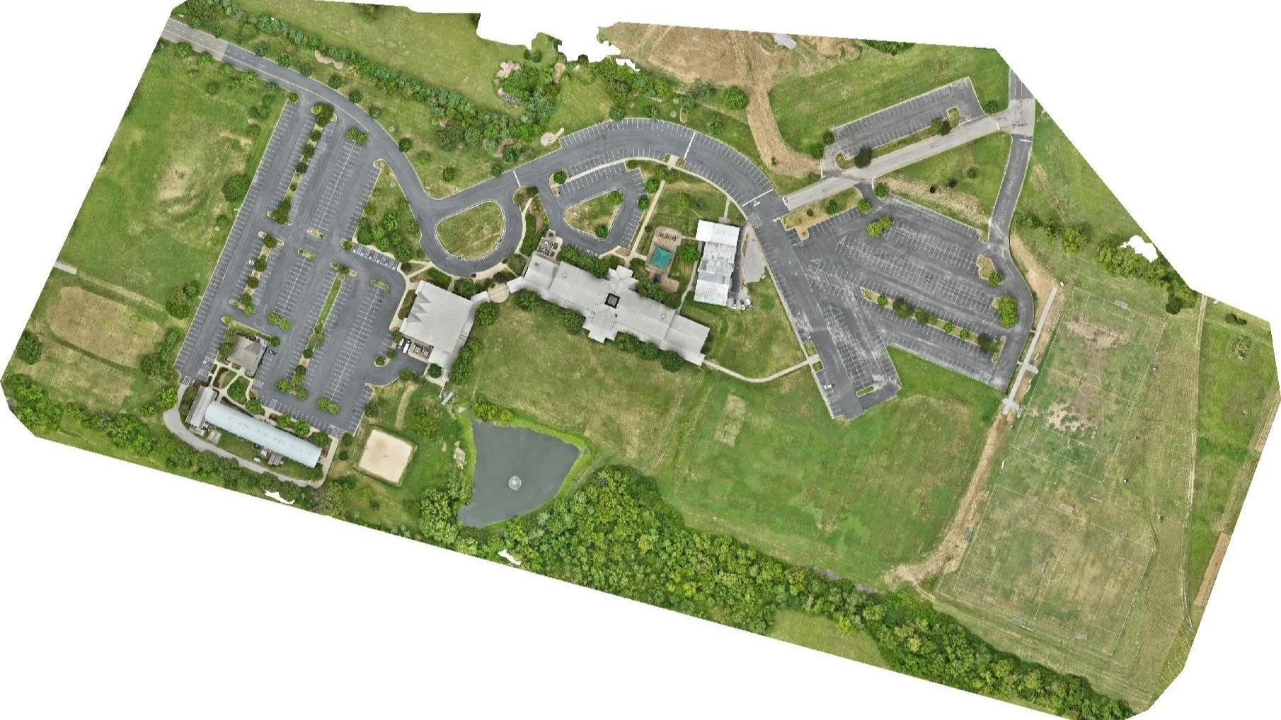
Nashville Drone Co Drone Map of Fellowship Bible Church in Brentwood, TN
In Nashville’s rapidly growing construction industry, deadlines are tight, budgets are scrutinized, and progress needs to be monitored in real-time. Whether it’s a commercial development downtown or a residential build in Franklin, drone mapping is transforming how construction teams work and communicate.
At Nashville Drone Co, we understand that drone mapping helps construction projects stay on tack. We help developers, contractors, and architects stay ahead with high resolution, actionable aerial data.
What Is Drone Mapping?
Drone mapping involves flying a drone over a construction site in a grid pattern to capture hundreds (or thousands) of high-resolution images. These images are stitched together using advanced software to create:
Orthomosaic maps (accurate top-down views of your site)
3D models and digital elevation models (DEMs)
Measurement tools for distances, volumes, and slopes
This data gives you a real-time, bird’s-eye view of your site, something that used to take days or weeks with manual surveying.
Benefits for Construction Teams
Track Progress Accurately
Drone mapping helps construction projects stay on track by making it easy to compare current site conditions to project plans or previous phases. Weekly or monthly updates let you monitor change over time without ever leaving the office
Boost Communication
Visual maps are an ideal tool for keeping stakeholders in the loop. From investors to clients to subcontractors, everyone understands a map, even if they’re not in Nashville.
Improve Safety and Reduce Costs
Drone mapping eliminates the need for some manual site visits and risky measurements on foot. With fewer boots on the ground, you reduce liability and improve team safety.
Spot Problems Early
Catch drainage issues, grading mistakes, or material misplacement before they become expensive fixes. Drone mapping helps keep construction projects on track by catching problems early.
Nashville Drone Co: Trusted by Middle Tennessee Developers
Not all drone service providers are created equal. Nashville Drone Co stands out for:
FAA Part 107 Certification
High-resolution aerial data
Fast turnaround
Orthomosaic mapping tailored to your needs
Experience working with commercial developers, land planners, and architects
We serve Nashville, Brentwood, Franklin, Nolensville, Columbia, Mount Juliet, and surrounding areas providing construction professionals with the tools they need to work smarter, safer, and faster.
Ready to Map Your Next Project?
Construction is moving fast in Nashville and so should your information. If you're a project manager, architect, or developer, drone mapping offers the visibility you need to stay in control.
Book your drone mapping session with Nashville Drone Co today and start seeing your project from a whole new angle. info@nashvilledrone.co