Which Drone Companies in Nashville Have Real Construction Site Experience?
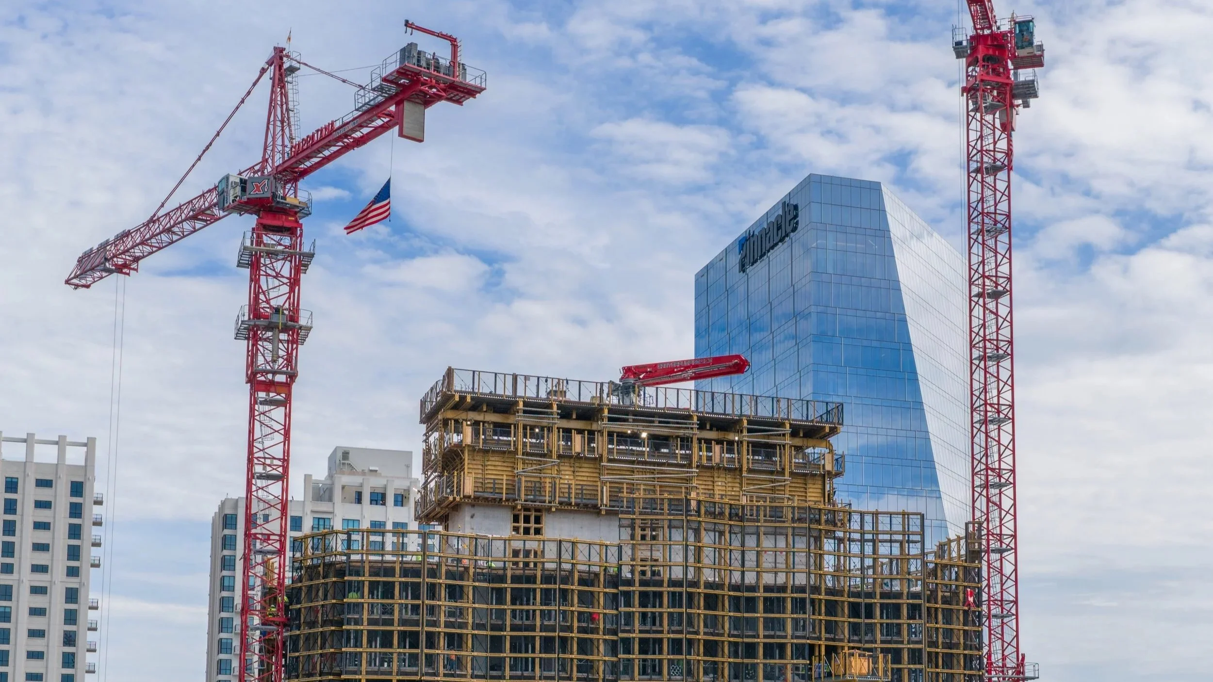
If you search for drone companies in the Nashville area, you will find no shortage of results. Plenty of operators can fly a quiet neighborhood or shoot a wedding venue on a calm afternoon. Far fewer have actually flown a working construction site, and that distinction matters more than most people realize until they watch it go wrong. We have spent the last several years building exactly that kind of experience at Nashville Drone Co, flying downtown high rises, sprawling commercial builds, civil development projects, and active concrete pours across Middle Tennessee. Our work has covered large scale commercial documentation including the new Walmart development in Lebanon, civil site work for Bell Inc, and recurring concrete pour coverage for Jones Concrete on both residential and commercial jobs, alongside our ongoing high rise progress photography downtown. That range of project types is not incidental. It reflects a specific approach to how construction sites need to be flown, one built around safety first and image quality second, because on a job site the order of those priorities is the whole game.
Why Construction Sites Are a Different Kind of Flying
Flying a drone over an open field or a finished property is relatively forgiving. Flying a drone over an active construction site is not, and anyone who has spent real time on one understands why almost immediately. There are cranes overhead, heavy equipment moving at ground level, workers on scaffolding, and a layout that can change from one week to the next as the structure itself grows. None of that is present on a typical residential shoot, and none of it can be treated casually.
High rise cranes are one of the biggest variables most people never think about. A tower crane is not locked in place when it is not actively lifting. Once the operator's shift ends, the crane is typically left free to rotate on its own, a practice called weathervaning, which allows the boom to swing with the wind rather than resist it. A crane that is fixed in a stiff wind can suffer serious structural stress, so leaving it free to move is actually the safer choice for the crane itself. It also means a boom that looks perfectly still one moment can begin swinging with no warning, and we treat every crane on every site as if it could move at any time, because it can.
Ground level brings its own set of hazards. Dump trucks, concrete mixers, and tractors move around a job site constantly, often without a fixed pattern, backing up unexpectedly or cutting across open areas to reach a delivery point. Drivers are focused on their own tasks, not watching the sky. We track that movement for the entire flight, adjusting flight paths and launch points on the fly rather than sticking to a plan made before arriving.
High Rise Experience Downtown
Nashville's downtown skyline has changed quickly, and we have been documenting that change from above on several of the city's most visible towers, including the Paramount ,The Motley and The Pendry. Flying near any high rise under construction means working within reach of active cranes, coordinating timing around lifts and crew shifts, and staying aware that airspace near dense downtown construction can shift day to day. We've written more about what that specific kind of work involves in our posts on high rise drone photography and timing a high rise shoot. For this piece, the short version is that every flight near these sites gets planned in advance and flown under FAA Part 107 certification, with current site conditions checked before the drone ever leaves the ground.
Large Scale Commercial Construction
Not every construction project involves a crane against the sky. Some of the most demanding drone work happens at ground level on sprawling commercial sites, and the new Walmart development in Lebanon is a good example. Projects of that scale cover many acres, with grading equipment, delivery trucks, and multiple work crews spread across the property at once. Capturing useful progress footage means understanding the layout well enough to know where equipment is likely to be and planning flight paths that stay clear of active work zones while still getting the wide, sweeping shots that show the full scope of the build.
Civil Development and Site Work
Civil construction brings a different rhythm than vertical building projects, and our work with Bell Inc has covered exactly that kind of site. Civil development often involves heavy earthmoving equipment working in patterns that are not always predictable from the air, along with utility work, grading, and drainage installation that changes the site's layout week to week. Documenting that progress accurately means returning to the same site repeatedly and adjusting to conditions that look different every time.
Concrete Pours With Jones Concrete
Few moments on a job site move faster or matter more than an active concrete pour, and we have built a strong working relationship with Jones Concrete covering both residential and commercial pours around the Nashville area. A pour brings mixer trucks arriving on a tight schedule, pump equipment running continuously, and crews working quickly before the concrete begins to set. There is very little room for a drone operator to be in the wrong place at the wrong time. Coordinating with the crew ahead of time and understanding where trucks will stage and where the pump line will run are part of getting usable footage without becoming part of the problem.
Safety Comes Before the Shot
Every one of these projects shares a common thread. At Nashville Drone Co, safety is the starting point of every flight, not an afterthought layered on at the end. That means arriving on site with proper personal protective equipment, a hard hat, a high visibility vest, and steel toe boots at minimum. It means checking in with site supervisors before ever launching, understanding where the day's active work zones are, and being willing to delay or reposition a flight if conditions change. It also means never assuming a crane is stationary just because it looks still, and never assuming a truck driver has seen the drone or knows where it is. That last point deserves more attention than it usually gets. A drone hovering at fifty feet is small, quiet from a distance, and easy for a driver focused on backing up a loaded dump truck to miss entirely. Rather than assuming visibility works in our favor, we plan every flight as though no one on the ground can see the drone at all, choosing launch and landing points well outside active traffic lanes and keeping a clear line of sight on both the aircraft and the equipment moving near it at all times.
This approach is part of why a number of the top construction companies working in the Nashville area have brought us back for repeat projects rather than treating drone footage as a one time add on. Construction teams that have worked with drone operators who did not understand job site hazards tend to be far more cautious about who they let fly near their crews and equipment going forward, and that caution has worked in our favor over time. Trust on a job site is not handed out after one good flight. It gets built slowly, project after project, by consistently showing up prepared and never treating a construction zone as anything less than an active workplace.
What to Look for in a Construction Drone Operator
For a construction company evaluating drone operators for the first time, a few questions tend to separate the ones with real site experience from the ones who have not yet learned these lessons the hard way. Has the operator flown near active cranes before, and can they explain how they account for crane movement during flight planning. Do they carry their own PPE without being asked. Are they comfortable adjusting a flight plan on short notice if a pour schedule shifts, or do they need everything locked in days ahead of time with no room to adapt. None of these questions have much to do with camera quality or how smooth the final footage looks, and that is exactly the point. Good footage is table stakes at this point, since most modern drones capture sharp, stable video without much difficulty. What separates operators on an active construction site is judgment, the kind that comes from having actually stood on enough job sites to know what can go wrong and how quickly it can happen. We've built that judgment across high rise towers, large commercial developments, civil construction, and active concrete pours throughout Middle Tennessee, and we bring the same approach to every new site, whether the goal is ongoing progress documentation or footage built for a marketing campaign.
Does The Drone Company Carry Insurance?
Insurance is another place worth asking a few direct questions, and it rarely gets the scrutiny it deserves. Companies with real construction experience carry ongoing drone insurance and hold current FAA certification as a standing part of how they operate, not something they scramble to arrange right before a job. They can provide a COI instantly to show their coverage. Some operators instead purchase a one day insurance policy timed to a specific shoot date. That may technically cover them on the day it was bought for, but construction schedules move constantly, a pour gets pushed back a week, a high rise flight gets rescheduled around weather or a crane lift, and it is easy for a one day policy to quietly lapse if nobody remembers to renew it before the new date. Nashville Drone Co retains ongoing drone flying insurance and we hold current FAA Part 107 certification at all times, so a shifted schedule never becomes a coverage gap nobody notices until it matters.
Contact Nashville Drone Co if you're managing a construction project in the Nashville area and need aerial documentation, whether for progress tracking, safety records, or promotional video. info@nashvilledrone.co
How to Compare Drone Photography and Video Companies in Nashville
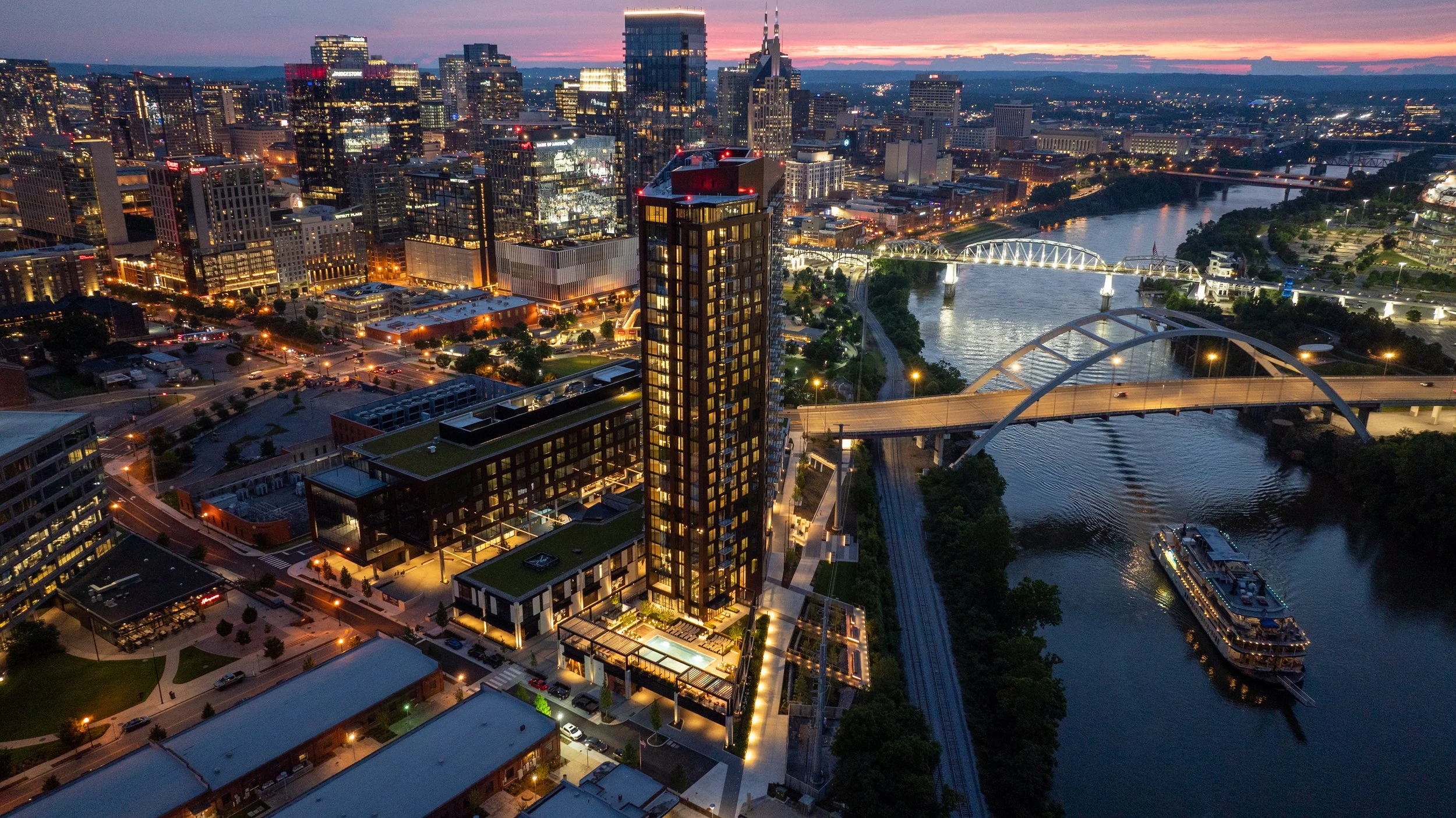
Anyone searching for a drone company in Nashville right now is looking at a page full of nearly identical service lists. Aerial photography. Construction documentation. Real estate video. Every site says roughly the same thing, in roughly the same order, using roughly the same language. None of that tells you what you actually need to know. Here's the one simple comparison that matters. Pull up each company's gallery and reel, side by side, and look at the work itself.
Forget the Service List. View the Reel and Gallery
A drone company's marketing page is written to be found. However, its gallery is where you find out if the company is any good. That's the part that can't be faked or filtered around, and it's the part most people skip past on their way to the contact form. Before hiring anyone, spend ten minutes actually watching the reel and scrolling the gallery.
5 questions to ask yourself About the Reel and Gallery
1) Are the photos sharp, high resolution, and genuinely clear?
Not "good enough for social media." Sharp enough to print on a banner in a sales office or a leasing lobby, because that's often exactly where these images end up.
2) What do the skies look like?
This is one of the fastest tells in the entire industry. A blown-out, flat white sky means the operator didn't manage exposure or didn't know how to correct it in post. A rich blue sky, or a well-shaded golden hour sky, means someone understood light before they ever launched the drone.
3) Does the video move like a film, or like a toy?
Cinematic drone footage has smooth, deliberate motion. Jerky stops, sudden direction changes, or footage that feels like someone is just flying a hobby drone around a building are signs of an operator without real production experience.
4) What does the color grading look like?
Flat, washed-out color or oversaturated, cartoonish color are both red flags. Good drone video has a color profile that looks intentional, consistent from shot to shot, and true to how the location actually looks.
5) Is exposure consistent, or all over the place?
Dark, muddy shadows in one shot and blown-out highlights in the next usually mean the operator is shooting on auto settings and hoping for the best, rather than dialing in exposure for each specific shot. None of this requires any technical background to spot. It just requires actually looking at the work instead of the words describing the work. What's sitting in a company's gallery right now is what will show up when the drone is over your project.
A Recent Example: The Paramount Photos
This exact scenario played out recently with a luxury high-rise client in Nashville. Early in the construction process, the developer's team hired a drone photography company to capture future views. The photos came back usable, in the sense that they were photos of the views. That was about the extent of it.
The client visited the sales office for the Paramount, the 60-story luxury high-rise from Giarratana Development in downtown Nashville, and saw Nashville Drone Co's photography project for Paramount on display. The difference in what they saw with the Paramount’s photos verses their photos was immediate. Sharper detail. Better composition. Skies that actually looked like skies. Color that was consistent from one image to the next instead of shifting depending on the time of day the photo happened to be taken. The client made the call to Nashville Drone Co not long after that visit to schedule new photos to be captured.
What separated the two sets of images wasn't luck. It came down to a handful of specific things: shooting at the right time of day for the light instead of whenever happened to be convenient, framing each shot with actual composition in mind rather than just centering the building in the frame, correcting exposure so skies stayed blue and shadows stayed detailed, and keeping color consistent across an entire batch of photos so a gallery or sales deck doesn't look like it was assembled from five different shoots. That consistency matters more than people expect going in. A single great photo is easy. A full set of consistently great photos, shot across different angles and times, is what separates a company that happens to own a drone from one that actually knows how to use it for marketing purposes.
Why Reel and Gallery Comparison Matters More for High-Rises and Commercial Projects
For a high-rise, construction site, or commercial real estate project, drone photography isn't decoration. It's often the primary sales and leasing tool before a building is even finished. Sales offices and leasing centers lean on these images to sell units and space that don't exist yet in any walkable form. If the photography is mediocre, it's not just an aesthetic problem, it's a sales problem.
In addition to the planned photos, Nashville Drone Co makes a point of capturing a standout image from a key elevation and view on every high-rise project, a single frame that sums up the prime view a resident or tenant could actually have. That one photo tends to become the anchor image for pre-sales materials, leasing brochures, or marketing decks, because it answers the exact question a buyer or tenant is asking: what will I actually see from up here?
Nashville Drone Co works across high-resolution stills, high-resolution 360 degree panoramic photography, construction progress documentation for towers still under construction, and architectural photography of finished buildings. The through line across all of it is the same standard: images clean and consistent enough to hand directly to a sales team without needing a disclaimer about lighting or quality.
What Clients Have Said About Nashville Drone Co
Feedback from recent projects has centered on a similar set of themes: reliability, quality, and speed of turnaround.
"Nashville Drone Co delivered exceptional drone video and aerial photography for our Paramount project. Nashville Drone Co owner, Keith Stancil, expertly captured stunning future condo views that are instrumental in our pre-sales and marketing efforts. His responsiveness, fast turnaround and creative approach to video marketing made the process seamless. We highly recommend Nashville Drone Co for top-tier aerial visuals." - Tony Giarratana of GIARRATANA, LLC, developer of the Paramount
"Nashville Drone Co is now our go-to drone video and photo company. What an absolute masterclass in service. Our team could not be more satisfied with their work." - Katie Garland, VP of Brokerage & Marketing at Charles Hawkins Co Commercial Real Estate
"Recently had the opportunity to collaborate with Keith Stancil/Nashville Drone Co on some drone content in Nashville, and it was a fantastic experience. From project alignment, scheduling, responsiveness, through to creative direction/feedback, Keith's professionalism and quality of work was appreciated." - Willow Mair of Axiom Builders, working on The Motley Nashville
"Nashville Drone Co did an incredible job. The visibility captured in the drone footage of the construction site allowed me and my team to have an incredible insight to the weekly progress made as well as help us track and ensure that safety protocol was constantly being adhered to and quality of erosion control was being up kept throughout the project. The quick turnaround time also came in handy as were using this footage for multiple reasons on a weekly basis. Highly recommend." - Ben Melton of McCrory Construction
Beyond the Gallery: Four Follow-Up Questions
Once a gallery has passed the eye test, there are a few practical questions worth asking before signing off on a drone company for a construction or real estate project.
1) How fast is turnaround?
Construction documentation is often needed on a weekly basis to track progress, monitor safety compliance, and keep erosion control and site conditions on record. A company that takes two weeks to deliver files isn't useful for a weekly reporting cycle, no matter how good the images look once they finally arrive.
2) Are they actually certified to fly commercially?
FAA Part 107 certification is the baseline requirement for any commercial drone operation in the United States, and it matters even more near a downtown corridor or an active job site with cranes and other aircraft in the airspace. Any company doing this work professionally should be able to speak to their certification and their understanding of airspace restrictions without hesitation.
3) Do they understand the marketing side, not just the flying side?
There's a real difference between someone who can pilot a drone competently and someone who understands how a photo is going to be used in a sales deck or a leasing brochure. The best work in this space tends to come from people who think about composition and story the same way a photographer or marketer would, not just a pilot checking boxes on a flight log.
4) Is their portfolio specific to the type of project involved?
A company with a strong gallery of wedding or landscape drone shots isn't necessarily the right fit for a 60-story high-rise or an active concrete pour. Look for a track record with the kind of project actually being planned, whether that's a residential tower, a commercial retail space, or a construction site under a tight documentation schedule.
None of these questions replace the gallery test. They're a second layer, useful once a company's actual work has already earned a closer look.
The Bottom Line
Skip the service descriptions and go straight to the gallery. Look at the skies. Look at the color. Watch whether the video moves smoothly or jerks around. Check whether the photos look consistent from one to the next, or like they were shot on five different settings across five different days. Whatever quality is sitting in that gallery today is exactly what will show up on-site. The Paramount comparison made that obvious to one client already. It tends to become obvious to anyone else who takes the time to actually look before they hire.
Contact Nashville Drone Co to view actual top level drone video and photography. info@nashvilledrone.co
Who Are the Best High-Rise Drone Photographers in Nashville?
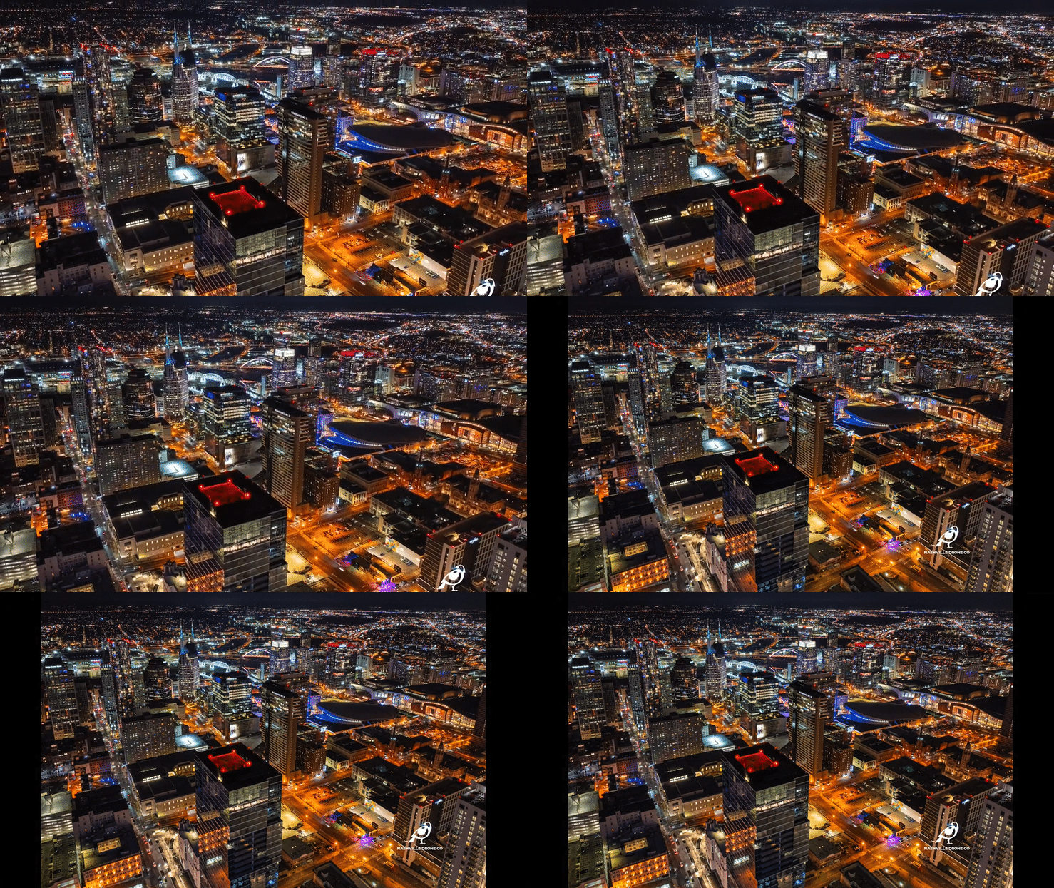
Nashville's skyline has changed faster than almost any city in the country over the past several years, and every one of those towers, from groundbreaking to topping out to grand opening, needed someone in the air documenting it. That's a very different job than flying a drone over a backyard or a small commercial building. High-rise drone photography comes with its own technical, legal, and creative demands, and one piece of it matters more than almost anything else on the marketing side: capturing future views before the building itself gets in the way of them. Here's what actually separates a high-rise drone photographer from a general drone operator in Nashville, and why future view capture sits at the center of that work.
The Window Begins Closing the Moment Construction Starts
Before a single beam goes up, a future high-rise site offers something that will never exist again in the same form, a completely open, unobstructed vantage point from what will eventually be the building's footprint. That window is short. Once site work begins, cranes go up, and the earliest structural elements start climbing, those same sightlines start disappearing, sometimes within weeks. This is the single biggest reason developers bring in a drone photographer before construction begins rather than after. Once a tower crane is installed on site, it becomes a permanent obstruction sitting directly in the flight path a photographer would otherwise use to capture what a 25th floor unit or a rooftop amenity space will eventually see. Some angles become impossible to recreate at all until the building itself is tall enough to shoot from, which can be two or three years later. Capturing those future views early solves a problem that has no other solution. It's the only point in a project's timeline where the empty air above the site can be photographed exactly the way a future resident or tenant would eventually experience it, with nothing in the way yet.
How Future View Capture Actually Works
Developers who understand this timing generally start well before the first crane arrives, and the process happens in two distinct stages.
Stage one: capturing the site before construction begins.
At this point, a drone photographer captures both high-resolution still photography and high-resolution 360 degree panoramic images from multiple elevations, all centered on the future building's location on the site. Since nothing has been built yet, these shots are taken from the open air directly above and around where the tower will eventually stand, at heights that correspond to different future floor levels. The goal is to build a library of clean, unobstructed images and panoramas that architects, renderers, and marketing teams can use as a foundation for pre-sales materials, long before there's an actual structure to photograph.
These early images typically feed directly into architectural renderings. A rendering team can composite a photorealistic skyline view into a unit floor plan or a marketing brochure using real aerial photography as the base layer, rather than relying purely on computer-generated backgrounds. The result reads as authentic because it is the sky, the skyline, the river, the neighborhood below, all captured from the actual coordinates and elevation where that view will eventually exist.
Stage two: capturing floor specific views once the floor plate base is in place.
Once construction reaches the point where the building's floor plate base is in place, the photography shifts from general future view capture to something much more targeted. At this stage, a drone photographer captures views from specific floors and specific floorplate locations, matching the exact vantage point a buyer in a specific unit would eventually have. A northeast facing unit on floor 30 gets its own capture. A southwest facing corner unit on floor 42 gets its own. These images are built specifically for use in the sales office, where a prospective buyer can see, with real photography rather than a rendering, exactly what their unit's view will look like once the building is finished.
This second stage is where the earlier future view library and the floor specific captures start working together. A rendering built from stage one gives a developer marketing material before there's anything to point a camera at. The floor specific captures in stage two give that same developer photography precise enough to close a sale with a specific buyer looking at a specific unit.
Why Future View Capture Requires More Than General Drone Skill
This kind of work asks for a level of planning that goes well beyond flying a drone and pointing a camera at a skyline. A photographer has to understand the building's final floor plan before it exists, calculate what elevation corresponds to which floor, and know exactly where on the site the future building's core will sit so that panoramic captures are centered correctly. None of that is guesswork. It requires coordinating with the developer's architectural plans and construction timeline from the very start.
Future view capture also requires an eye for composition and light that matches what a finished, photographed unit view will eventually need to look like in a sales deck, since these images often sit right next to professional interior renderings and need to hold up next to that level of polish.
Is the Price Worth the Deliverable?
Cost is usually one of the first questions a developer asks when comparing drone photographers, and it's a fair one. But it's the wrong question to ask on its own. What matters is what that price actually buys, because in this business, price and quality track together almost every time.
A cheap quote usually means a cheap result. Shooting on auto settings, skipping the planning needed to align a capture with a future floor plan, or simply lacking the experience to produce images that hold up next to a professional rendering, all of that shows up in the final photos. And with future view photography, there's rarely a second chance. Once cranes go up and construction blocks the sightlines, a poor capture can't just be redone next week. The vantage point itself may be gone for good.
Weighed against what these images are actually used for, hiring an experienced high-rise drone photographer is a small cost. A future view photo often isn't a decorative image sitting in a gallery. It's frequently the piece of marketing material a buyer looks at right before putting down a deposit on a unit that doesn't exist yet. If one well-executed photo helps close a single million-dollar condo sale, it has already paid for the entire photography budget many times over, with every other unit still left to sell.
That's the real math behind pricing here. The question isn't whether a lower quote exists somewhere. It's whether that lower quote produces an image sharp and convincing enough to actually do its job in a sales office. Given what's riding on that photo, real quality isn't an expense to minimize. It's one of the highest-return investments in the entire pre-sales process.
Nashville Drone Co and Future View Capture
Nashville Drone Co, founded and operated by Keith Stancil, has built this exact service into its high-rise work. Stancil brings over two decades of professional entertainment marketing experience into how future view capture is approached, treating each flight as a marketing asset built for a specific sales purpose rather than a generic aerial shot. He holds FAA Part 107 certification, the baseline requirement for legal commercial drone operation.
That approach shaped the early work on the Paramount, Giarratana Development's 60-story luxury high-rise in downtown Nashville. Before construction reached height, Nashville Drone Co captured high-resolution stills and 360 degree panoramic images from multiple elevations centered on the tower's future footprint, giving the development team a library of authentic aerial views to use in pre-sales renderings well before there was a building to photograph. As the project progressed and the floor plate base went in, that work shifted toward floor specific and floorplate specific captures, matched to actual unit locations for use directly in the sales office.
Across every high-rise project, Nashville Drone Co also makes a point of capturing at least one signature image from the highest usable elevation available, a single frame that sums up the best possible view the finished building will offer. That image tends to become the anchor photo for sales and leasing materials, because it answers the exact question every buyer or tenant is really asking before they commit, what will I actually see from up here? A photo captured for the Paramount and know as The Billion Dollar Photo is the best example of that from Nashville Drone Co . That particular photo became the centerfold of the Paramount sales brochure, a banner that covers the construction fence stretching an entire block on Church street and used for multiple ad campaigns on the back page cover of the Nashville Business Journal.
What Clients Have Said
Feedback from recent high-rise and commercial projects has centered on reliability, responsiveness, and the quality of the final images.
"Nashville Drone Co delivered exceptional drone video and aerial photography for our Paramount project. Nashville Drone Co owner, Keith Stancil, expertly captured stunning future condo views that are instrumental in our pre-sales and marketing efforts. His responsiveness, fast turnaround and creative approach to video marketing made the process seamless. We highly recommend Nashville Drone Co for top-tier aerial visuals." - Tony Giarratana of GIARRATANA, LLC, developer of the Paramount
"Recently had the opportunity to collaborate with Keith Stancil/Nashville Drone Co on some drone content in Nashville, and it was a fantastic experience. From project alignment, scheduling, responsiveness, through to creative direction/feedback, Keith's professionalism and quality of work was appreciated." - Willow Mair of Axiom Builders, working on The Motley Nashville, shared:
What to Ask Before Hiring for a High-Rise Project
A few questions separate a genuine high-rise drone specialist from a general drone operator taking on a job outside their usual scope.
1) Has the photographer captured future views before ground has even broken on a site, and do they understand how to plan those captures around a building's eventual floor plan?
2) Can they coordinate elevation and positioning precisely enough to match a specific future floor and unit location once the floor plate base is installed?
3) Are they FAA Part 107 certified and comfortable working near active job sites and controlled airspace?
4) Does their existing gallery show sharp, well composed, consistently color matched images, the same standard that applies to any drone company, but especially important when the images in question are meant to sell a home that doesn't exist yet.
The Bottom Line
The most valuable moment in high-rise drone photography often happens before the project looks like a high-rise at all. Capturing future views while the site is still open, then following that up with floor specific captures once the floor plate base goes in, gives a developer something no rendering alone can fully replicate which is real photography of the exact view a future buyer will actually have. Nashville Drone Co's early work on the Paramount reflects exactly that approach, treating future view capture not as a bonus service but as one of the most important steps in a high-rise's entire marketing timeline.
View Nashville Drone Co’s High Rise Gallery.
Contact Nashville Drone Co to get your high-rise project started. info@nashvilledrone.co
How Using Unlicensed Music in Commercial Videos Can Cost a Business Millions
Many business owners think they are on safe ground because a song was sitting right there in the Instagram or TikTok music library when they built their reel. Tap the song, drop it into the video, hit post. It feels no different than picking a filter. Legally, it is a completely different act, and a growing number of businesses are finding that out the hard way, sometimes for six or seven figures.
What is a Sync License
A sync license is the permission a business needs to pair a piece of recorded music with visual content, whether that is a commercial, a real estate walkthrough, a construction progress video, or a thirty second Instagram reel promoting a sale. It is called sync because the music is being synchronized to picture. Without it, using someone else's recording in a video is copyright infringement, full stop, regardless of how short the clip is or how popular the song already is on the platform where it was posted. This is the piece almost everyone misses. When Instagram or TikTok license a library of songs for users to add to their posts, that license covers personal, non-commercial use by an individual account. It does not extend to a business using that same song to promote a product, a service, or a brand. The platform's terms of service actually spell this out, but almost nobody reads that section before tapping a trending sound onto a promotional post.
A business posting content to sell something, build a following, or drive traffic is a commercial use, and commercial use requires its own license directly from the rights holder, separate from whatever agreement the platform has in place for personal content. There is no minimum length that makes this safe either. Using fifteen seconds of a song is still using the song. Fading the volume down does not fix it. Crediting the artist in the caption does not fix it. None of the workarounds people assume exist actually hold up, because the issue is not attribution, it is permission.
A lot of small business owners also assume that if a song is not currently under an active hit, or if it is a few years old, the risk has somehow faded. It has not. Copyright protection on a sound recording lasts for decades, and the label or publisher holding those rights has every financial incentive to keep enforcing them regardless of how long ago the song was released. An older track showing up in a business's reel is just as actionable as something climbing the charts right now.
What a Reel or TikTok Actually Needs to Stay Legal
The safest path for any business posting video content is to treat music the same way it would treat a photo or a piece of stock footage, as an asset that requires a documented right to use before it goes anywhere public. That means either licensing a track through a legitimate commercial music library built for this exact purpose, working with a production partner who already handles that licensing as part of the deliverable, or using royalty free music specifically cleared for commercial use rather than anything pulled from a platform's built in sound library. It also means keeping a record of that license on file, since a documented license is the fastest way to shut down an infringement claim if one ever shows up.
Kroger Is the Latest Example, and Not a Small One
If anyone still thinks this is a hypothetical risk, look at what happened to Kroger this year. Sony Music filed suit against Kroger in August 2026, naming nineteen separate Kroger entities as defendants, including Ralphs, Harris Teeter, King Soopers, Fred Meyer, and Murray's Cheese. The complaint alleges at least 392 unauthorized uses of Sony recordings across Kroger's social media accounts and paid influencer content, featuring artists including Mariah Carey, OutKast, Bill Withers, Harry Styles, and Miley Cyrus. At the statutory maximum of 150,000 dollars per work, Sony's filing puts potential exposure at close to 59 million dollars. What makes the Kroger case particularly damaging is the willfulness argument. Sony's complaint points out that Kroger had already entered into fourteen separate licensing agreements with the label between 2017 and 2025, agreements that explicitly covered internet and social media use. In other words, Kroger's own legal and marketing teams clearly understood that a license was required, since they had paid for one repeatedly in the past. Sony also says it sent infringement notices starting in June 2025, and that new unauthorized posts kept appearing more than a year later. That pattern is exactly what turns ordinary infringement into willful infringement, which is the difference between a modest penalty and a maximum one.
Kroger is far from alone. Sony has brought similar suits against Marriott, which settled for close to 140 million dollars, and against the University of Southern California over posts from its athletics accounts. Universal Music Group has sued Chili's parent company. Warner Music went after Crumbl. DSW recently settled a similar dispute. This is not one label making an example out of one retailer. It is a pattern across every major label group, moving through one recognizable brand after another.
The Technology Chasing Down Copyright Infringement Is Getting Faster
For years, this kind of infringement went largely unnoticed unless a song happened to go viral in a way that caught someone's attention. That window is closing quickly. Music publishers and labels are now using AI powered audio matching tools that scan social platforms at massive scale, identifying exact recordings inside posted video content in a fraction of the time it used to take a human reviewer. Companies building this technology can already scan a business's entire social media footprint, match audio fingerprints against a catalog of millions of tracks, and generate a documented infringement report within hours. Right now, that technology is being pointed at the biggest, most visible targets first, since that is where the largest financial recovery sits. Grocery chains, hotel groups, restaurant brands, universities, these are organizations with massive social followings, large marketing budgets, and enough posted content to make an audit worth running. But the tools themselves do not care about company size. Once a detection system can scan a brand's entire public content history in an afternoon, there is very little added cost to running that same scan against a regional contractor, a local real estate office, or a small chain of neighborhood restaurants. The economics of this kind of enforcement favor moving down market over time, not staying focused at the top. Small and mid sized businesses that assume they are too small to notice are relying on a gap that is shrinking every quarter, not one that is holding steady.
Why Nashville Drone Co Only Uses Pre-Licensed Music
Nashville Drone Co builds video content for a wide range of clients across the Nashville area, commercial developers, real estate brokerages, construction companies, concrete and paving contractors, and local businesses across every industry. Every one of those videos eventually gets posted somewhere, whether that is a company's own social channels, a sales presentation, or a website. That means every piece of music behind that footage needs to hold up if it ever gets scanned by exactly the kind of tools described above. Every video Nashville Drone Co produces uses pre-licensed music, sourced through libraries that carry the correct commercial usage rights for the way the content will actually be used and distributed. We do not pull trending audio off a social platform and drop it behind a client's construction time lapse or real estate listing video, even though that is exactly what a lot of smaller production shops still do without thinking twice about it. Our clients are trusting us to hand them a finished asset they can put their name on and post without worrying about what happens if a label's detection software eventually finds it, and that only works if the licensing is handled correctly before the video ever gets delivered.
The Real Cost of Cutting This Corner
The math on this is not close. A properly licensed music track for a commercial video typically costs somewhere between a few dollars and a few hundred dollars, depending on the license and how widely the content will be distributed. Compare that to statutory damages that can run as high as $150,000 dollars per infringed work under federal copyright law, multiplied across however many videos a business has posted using the same shortcut over the past several years. A local business that has been dropping trending songs into reels for two or three years could easily have dozens of infringing posts sitting on its account right now, each one a separate potential claim.
Businesses in Nashville putting out video content, whether that is a construction company documenting a project, a real estate office marketing a listing, or a local restaurant promoting a new menu, should treat music licensing with the same seriousness as any other legal or financial decision the business makes. The tools that catch this kind of infringement are only getting faster and cheaper to run, and the businesses getting swept up in these lawsuits right now are proof that this is not a risk worth gambling on to save a few dollars on a soundtrack.
Contact Nashville Drone Co for marketing videos that only use pre-licensed music. info@nashvilledrone.co
Where to Get Drone Flying Training in Nashville
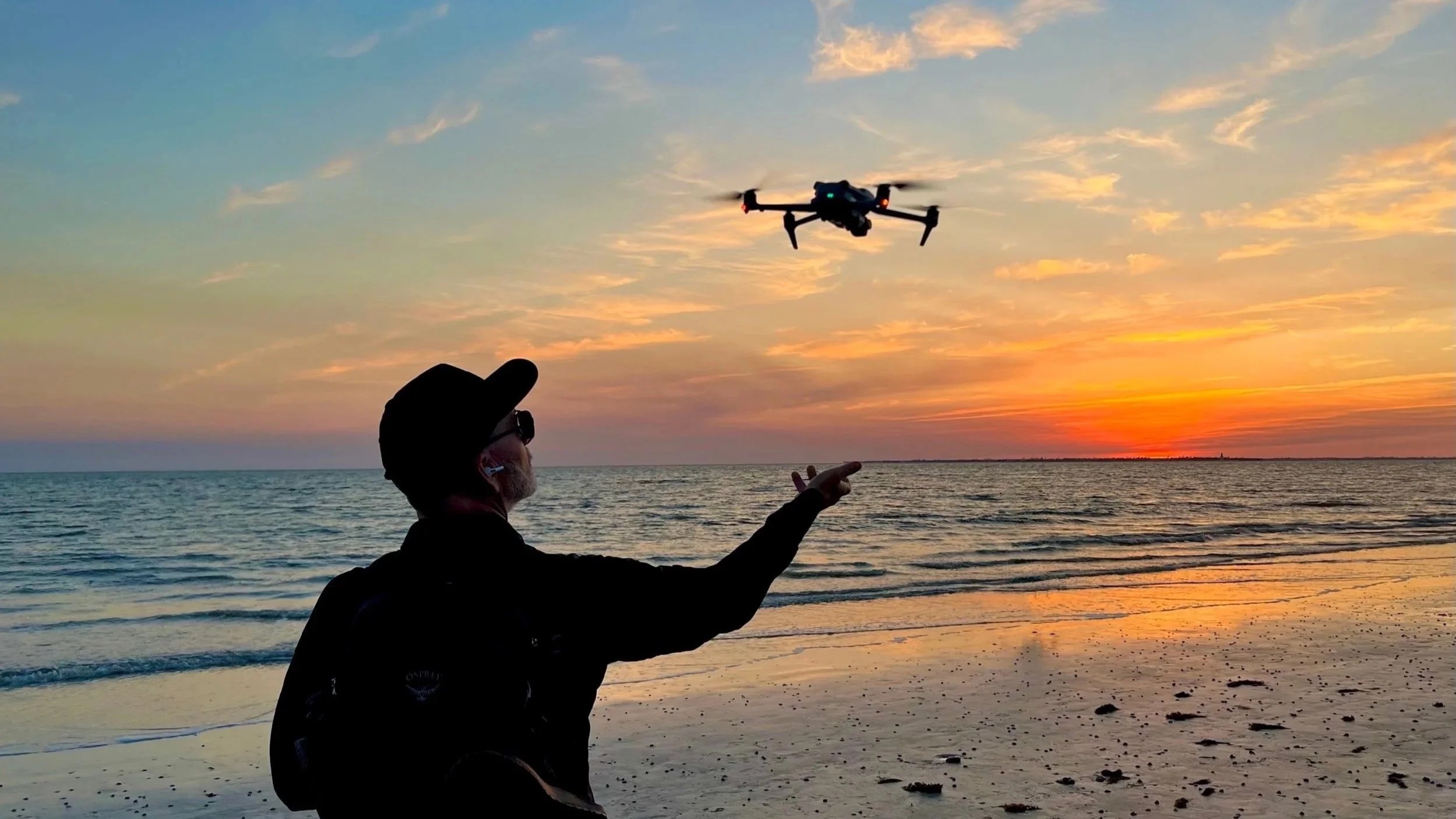
We often get asked about drone training. Somebody buys a DJI Mini for a weekend trip, falls in love with flying it, and a month later they are emailing us asking where in Nashville they can actually learn to do this the right way. Real estate agents want to shoot their own listings. Construction project managers want to track site progress without hiring someone every week. Wedding photographers want to add aerial shots to their packages. Parents want to film their kid's travel soccer games without crashing into a goalpost. The questions come from every direction, and the honest answer is that good local, hands on drone training in Nashville is harder to find than people expect.
Why Nashville Drone Co Started Offering Hourly Lessons
After enough of these conversations, we started offering hourly private drone lessons directly through Nashville Drone Co. Not a certification program, not a multi week bootcamp, just focused one on one time in the air with someone who flies commercially every week and can answer the questions that actually come up once you leave the parking lot and start flying real jobs. We work through the basics of manual flight, camera settings, how to read airspace on an app like B4UFLY or Aloft, and the kind of situational judgment that only comes from having flown hundreds of real assignments around cranes, power lines, stadiums, and neighborhoods full of curious kids who want to know if your drone has a camera on it.
An hour with us is not going to replace a full education in the drone industry, and we are upfront about that with everyone who books a session. What it will do is get someone comfortable behind the controller, help them understand what commercial flying in Nashville actually looks like day to day, and point them toward the deeper training they need if they want to go further, which for us means one place in particular.
What Actually Happens in an Hourly Lesson
People booking a lesson with us usually want to know what to expect, so here is the honest version. We start on the ground talking through pre-flight checks, battery management, and how to actually read the airspace map for wherever we are flying, since a big chunk of Nashville sits inside controlled airspace tied to BNA. From there it is hands on time with the controller, working through takeoff, basic maneuvers, and framing a shot the way you would for an actual client rather than just flying in circles over a backyard. We adjust the session based on what someone is trying to do with the drone, since a real estate agent wanting clean listing photos needs different skills than someone trying to film a kid's soccer game or map a construction site. By the end of an hour, most people leave with a much clearer sense of what they still need to learn and where the real gaps in their flying are, which is often more valuable than the flight time itself.
After a lesson or two, we then recommend next steps which focuses on where we received our extensive drone training.
Where Nashville Drone Co Learned to Fly
Nashville Drone Co did not figure all of this out on our own. Our training came from The Drone U, and it shaped how we run our drone business business today.
The Drone U is a Colorado based drone school that runs both on demand online courses and live, in person training experiences covering safety, mapping, construction applications, real estate work and more, along with a dedicated course built specifically to prepare students for the FAA Part 107 exam. We have gone through both formats ourselves, sitting through their online modules and also attending live training in person at their Colorado headquarters, and the two complement each other in a way that neither one manages alone. The online courses let you move at your own pace and go back through material as many times as you need. The live sessions put you in a classroom and in the field with working pilots asking the exact questions you are also thinking about, which tends to surface things a self paced course never would.
The Drone U co-founders, Paul Aiken and Rob Burdick, run the show, and calling them good teachers undersells what they actually do. They are patient with beginners without ever talking down to anyone, and they push more experienced pilots to think about their business in ways that go well beyond flying. A typical session with them covers a lot of ground. They walk through current FAA policy, including changes to Part 107 and how new rules like the operations over people categories or Remote ID actually apply in the field, not just on paper. They cover industry trends across the different verticals drone work touches, from mapping and surveying to construction documentation to real estate and event coverage. They get into the specifics of flying different aircraft platforms and how each one behaves differently depending on the job. None of it feels like a lecture. It feels like two people who have actually done this work walking you through what they wish someone had told them earlier.
The Drone U Monthly Coaching Call Changed How We Run Our Business
Somewhere in the middle of all the flying and technical training, The Drone U also runs a monthly coaching call, and that call ended up being one of the most valuable things we get from our relationship with them. It is not about flying at all. It is about running a drone business that actually makes money and scales past one person with a controller.
Paul and Rob teach and push people on pricing, client acquisition, systems, and the kind of operational discipline that separates a hobby from a real company. We have taken more than a few of the practices they talk through on those calls and put them directly into how Nashville Drone Co operates, and we can point to real business growth as a result. It is one thing to learn how to fly a drone well. It is another thing entirely to learn how to build a company around that skill, and that second part is where The Drone U has genuinely set us apart from a lot of other operators in this market.
Our founder, Keith Stancil, has been invited to be a guest on those coaching calls himself and has also appeared as a guest on the Drone U YouTube channel, talking through his own path building Nashville Drone Co. That relationship goes both directions at this point. We learn from them constantly, and they have been generous enough to have Keith share what has worked for us along the way.
Why Paul Aiken and Rob Burdick Stand Out in The Drone Industry
We have spent time around a lot of people in the drone world at this point, and the Drone U co-founders, Paul Aiken and Rob Burdick, genuinely care about this industry more than anyone else we have come across. That is not a small thing to say. It would be easy for a training company to sell courses and move on to the next customer. That is not how they operate. They want the people who go through their programs to actually succeed, and they stay invested in that success long after a course ends, which is exactly what a monthly coaching call and an open door for guest appearances actually represents.
Rob Burdick, co-founder of The Drone U, put it this way about our founder Keith Stancil:
"Keith is a person of solid character. He's professional, driven, and someone we genuinely enjoy working with. We think very highly of both Keith and the work Nashville Drone Co is doing. If you're looking for someone to provide drone services anywhere near the areas Keith serves, we think you'd be crazy not to give him a shout."
That kind of endorsement means something coming from people who have trained thousands of pilots and seen the difference between operators who take this seriously and operators who do not.
Where to Start If You Are Learning to Fly in Nashville
If someone in Nashville is serious about learning to fly, here is how we would point them. Start with a local hourly lesson with Nashville Drone Co if you want hands on time in the air with a working commercial pilot, someone who can answer real world questions about flying around this specific city, its airspace, and its job sites. From there, if you want to go deeper into certification, business building, and the kind of structured education that turns flying into an actual career or business, The Drone U is where we send people, because it is where we went ourselves and where we continue to learn.
Nashville does not have a long list of serious, structured drone training options sitting around waiting to be discovered. Between local, practical stick time and a nationally respected program built by people who genuinely care about this industry's future, there is a real path here for anyone who wants to take flying seriously rather than just owning a drone that sits in a closet after the first few flights.
If you are one of the many people who have reached out to us asking where to learn, that is the honest answer. Come fly with us for an hour to get comfortable and ask questions specific to Nashville, then go build a real foundation with The Drone U the same way we did.
Contact Nashville Drone Co to get your drone flying journey on the right path. info@nashvilledrone.com
How Nashville Drone Co Captures the Future Views For Nashville High Rises
A buyer walks into a sales office on the ninth floor of a building that has not been built yet. They are standing in a model unit, looking at a rendering on the wall, and asking the one question every pre-sale condo buyer eventually asks. What will I actually see from my balcony. That question is harder to answer honestly than most people realize. A computer generated rendering can show anything an artist wants it to show. An actual photograph taken from the precise elevation and orientation of a specific unit cannot lie the same way, which is exactly why it carries so much more weight in a sales conversation, and exactly why getting it right matters more than most buyers or even most developers fully appreciate.
Why a Rendering Is Not Enough
Most high rise developments lean on architectural renderings for their marketing, and there is nothing wrong with that as a starting point. Renderings are useful for showing massing, materials, and overall design intent. But when a buyer wants to know what unit 1204 will actually look out onto once the building tops out, a rendering is an artist's interpretation, not a documented fact. Skylines shift depending on exact height and angle. A view that looks open and unobstructed in a rendering can turn out to have a neighboring rooftop or a construction crane sitting directly in the sightline once the real elevation is accounted for. This is where a real photograph, captured from the exact height and compass heading of the actual unit, becomes a far more persuasive and far more honest sales tool. It also protects the developer. A buyer who purchases based on an accurate future view photo has a much harder time coming back later with a complaint that the view they were sold does not match reality. Accuracy up front prevents disputes down the line, and that is worth more to a developer than a prettier but less precise image.
The Planning Comes Before the Flight
Getting an accurate future view shot is not something we show up and improvise on site. It starts well before a drone ever leaves the ground. Nashville Drone Co works directly with the development team to pull the actual floor plans and elevation data for the units the sales office wants to feature. That means knowing the finished floor height above grade for a specific unit, not just an approximate number pulled from a brochure. High rise construction documents typically include finished floor elevations for every level, and matching those numbers to a GPS altitude reading in the field is the difference between a photo that represents unit 1204 and a photo that represents a floor or two off from where it should be, which changes the sightline more than people expect.
Orientation matters just as much as height. A unit facing southeast toward the river is going to have a completely different view than a unit one floor up facing northwest toward the Gulch, even in the same building. Before any flight, we confirm the exact compass heading the unit's windows or balcony face, then plan the drone position to match both the altitude and the heading as closely as the airspace and site conditions allow. On some projects that means flying from the exact footprint of the future building, if the site is still under construction and airspace allows it. On others it means working from an adjacent vantage point and calculating the offset needed to represent the true sightline. None of this happens without direct coordination with the people who know the building best. Our founder, Keith Stancil, works hand in hand with development and marketing teams on these projects, reviewing plans, confirming which units the sales office wants to prioritize, and walking through what the final image needs to communicate before a single photo is taken. That upfront planning conversation is often the difference between a shoot that produces a usable sales tool and one that produces a nice photo that does not actually answer the buyer's question.
Why Blue Hour Is the Best Time to Shoot Downtown Nashville
Timing the shoot matters just as much as positioning the drone correctly, and this is where a lot of aerial photography falls short. Most people default to shooting in full daylight because it is the easiest light to work with. Daylight is fine for a straightforward property overview, but it is rarely the most compelling light for a downtown skyline shot, and it is almost never the light that sells a future view the way blue hour does. Blue hour happens in the window just after sunset, before full darkness sets in. The sky holds onto a rich, deep blue rather than going black, while the building lights across the skyline have had enough time to switch on and start glowing. That combination is what makes blue hour special. A daytime photo of downtown Nashville is flat by comparison, with buildings reading mostly as silhouettes against a bright sky and very little separation between structures. A blue hour photo has real depth. The illuminated windows and architectural lighting on buildings like the AT&T tower, Nashville Yards, and the buildings along the Cumberland create layers of light against that saturated blue sky, and the result looks genuinely alive in a way daylight cannot replicate. It is, honestly, one of the prettiest windows of the day to be in the air over this city, and it photographs that way too.
Blue hour is also a narrow window, typically less than half an hour depending on the season, which means the planning conversation described above has to happen well before the drone takes off. Often times multiple night shoots are necessary. Multiple night shoots present even more of a challenge is matching up the look of all shots.
Bracketed Exposures Capture What a Single Photo Cannot
Blue hour light is beautiful, but it is also technically demanding. The sky is bright compared to the ground, and the lit up buildings themselves span a huge range of brightness, from a softly lit residential tower to a stadium or venue running at full brightness. A single exposure cannot capture that entire range without losing detail somewhere, either blowing out the brightest lights or crushing the darker parts of the skyline into black.
That is why we shoot bracketed exposures on every blue hour shot. Rather than taking one photo, the camera captures a series of images of the same frame at different exposure settings, from darker to brighter. Those exposures are then combined in post-production, pulling the best detail from each one. The sky retains its color and gradient instead of going flat, the brightly lit building signage stays sharp instead of turning into a white blob, and the shadowed areas of the skyline hold real detail instead of disappearing into black. The result is a photo that looks the way the scene actually felt standing there, rather than the compressed, contrasty version a single exposure would have produced.
Night Photography and Why the Editing Matters as Much as the Shot
Once full darkness sets in, Nashville's skyline becomes its own kind of subject. The Batman Building, the bridges over the Cumberland, Nissan Stadium, and the dense cluster of lit up towers downtown all make for a genuinely striking night image, and it is one of our favorite conditions to shoot in. Night photography from the air comes with its own challenges though. Standard night shots tend to look noisy, lose color accuracy, and flatten out the subtle variations in light that make a skyline interesting. We rely on a bracketed capture and editing approach specifically built for night conditions, layering and blending exposures to recover detail and color depth that a typical nighttime photo loses. The difference shows up most in the details most people do not consciously notice but definitely feel, the visible texture in a building facade instead of a flat glow, distinct color temperature differences between warm and cool building lighting, and a sky that still shows some depth instead of going pure black.
Why This Level of Detail Is Rare
Most drone operators are not set up to do this kind of work, and it has nothing to do with the drone itself. Matching a specific unit's finished floor elevation to a real world GPS altitude, coordinating around a narrow blue hour window, and running a bracketed editing workflow on every image takes real time on both ends of the shoot, and it takes someone on the planning side who understands construction documents well enough to pull the right numbers in the first place. It is far easier, and far more common, for an operator to fly up at some approximate height that looks about right, snap a single daytime photo, and call it done. That photo might look fine hanging in a lobby, but it is not something a sales team can put in front of a serious buyer and stand behind.
The Result Is a View Buyers Can Trust
All of this planning, elevation matching, timing, and editing technique exists to serve one goal. When someone stands in a sales office and asks what they will see from their future balcony, the photo on the wall should be an honest answer, not just an appealing one. That is the standard Nashville Drone Co holds every high rise future view project to, and it is a big part of why developers across Nashville trust us with the images that actually help sell units, not just decorate a lobby.
A visit to the sales offices for the Paramount or The Pendry in downtown Nashville shows this work in person. Both feature future view photography captured by Nashville Drone Co, giving prospective buyers an accurate, on site look at what their unit's view will actually be once the building is complete, rather than relying on renderings alone.
Contact Nashville Drone Co to get your drone photography project started. info@nashvilledrone.co
Every Friday Night, Nashville High Schools Are Rolling the Dice on an FAA Violation
Walk into any Nashville area high school football stadium on a Friday night this fall and look up. There is a good chance you will spot a small drone hovering somewhere between the press box and the fifty yard line, quietly filming both sidelines for coaching film. It has become as normal a part of high school football as chain gangs and concession stand nachos. Coaches love the footage. Coordinators use it to break down formations the next morning. Parents film it for their own highlight reels. What almost nobody in the stands realizes is that most of those drones are being flown illegally, and the schools hosting them are the ones left holding the liability.
After sitting through dozens of games at Franklin High School and Summit High School, located in Williamson County TN, I have yet to see a single drone operation that would hold up to an actual FAA compliance check. Both teams at each game typically have an aircraft in the air, and neither one is flying legally. That is not a knock on the pilots personally. Most of them are well meaning parents, booster club volunteers, students or local videographers who genuinely have no idea how many separate FAA rules they are breaking in a single flight. But ignorance of the regulation does not make the flight legal, and it does not make the school any less exposed if something goes wrong.
Filming for a Team Is Commercial Flying, Full Stop
The first misconception trips up almost everyone who picks up a drone for a football game. People assume that because they are not charging or running a business, they are flying recreationally. They are not. The moment footage is captured in connection with a school program, a booster club, or any kind of business purpose, including simply providing film to coaches for free as a favor, the FAA classifies that as commercial operation. Commercial operation requires the pilot to hold a Part 107 Remote Pilot Certificate. That is not a technicality. It is the entire foundation the rest of the FAA's operating rules are built on. A pilot without a Part 107 certificate flying over a football field is not just missing a piece of paper. They have skipped the aeronautical knowledge test that covers airspace, weather, loading, emergency procedures, and the very over-people rules discussed below. Most parents filming their kid's games on a $500 drone from Costco have never even heard of Part 107.
The Over People Rule Almost Nobody Understands Correctly
This is where things get genuinely complicated, and where even well intentioned pilots get it wrong in both directions. The FAA's current rule for flying over crowds, known as Operations Over People, sorts every drone into one of four categories based on weight and injury risk. Category 1 covers any aircraft that weighs 0.55 pounds or less at takeoff, counting the battery, the SD card, propeller guards, strobe light and literally everything else attached to the airframe, with no exposed rotating parts capable of cutting skin. A drone that qualifies for Category 1 is allowed to fly sustained flight directly over a packed grandstand and a field full of players, without a waiver, without special paperwork, as long as the pilot still holds Part 107. That threshold is exactly why DJI built the Mini line the way it did. The Mini 3, Mini 4 Pro, Mini 5 Pro and similar models sit right around 249 grams, a hair under the 0.55 pound cutoff, specifically to slide into Category 1. On paper, that means a stock DJI Mini flown by a certificated pilot could legally hover over the student section during a game. But here is where nearly every game day pilot loses the exemption without realizing it, and where the night game timing makes things worse. Staying under Category 1 means the drone has to weigh 0.55 pounds or less with absolutely everything attached, including propeller guards and the anti-collision strobe required for night flight, discussed below. A stock DJI Mini already sits right at that 249 gram line before anything else is added. Attach the required FAA propeller guard for flying over people and a night strobe bright enough to satisfy the FAA, and every single DJI Mini on the market goes over the limit. Once that happens, the aircraft drops into Category 2 or 3, and those categories require the manufacturer to have an accepted Declaration of Compliance on file with the FAA proving the aircraft meets specific injury thresholds. No consumer or prosumer drone sold in the United States currently has one. That means the only legal path left to fly a guarded, lit DJI Mini over that crowd is an actual 107.39 waiver, which almost none of the pilots showing up on Friday nights have.
The one DJI airframe that actually has enough weight margin to carry a propeller guard, a compliant strobe, and stay under 0.55 pounds is the DJI Neo, which starts at roughly 135 grams bare. But the Neo does not include built in FAA required Remote ID broadcast, so a pilot flying it commercially under Part 107 still has to attach an external Remote ID module, eating back into that margin. The Neo is also not known for handling low light conditions well, which matters a great deal at a drone flying over a stadium after sundown. In practice, that means a fully compliant, Category 1 legal setup for a night football game is narrow, deliberate, and rare. Nearly every drone showing up at high school football games on a Friday night in Williamson County is either an unmodified aircraft missing required night lighting, or a guarded and lit aircraft that has quietly slipped into a category it has no waiver for.
Night Flights Need a Strobe Visible for Three Statute Miles
Nearly every high school football game in Middle Tennessee kicks off after the sun goes down, or runs well past the end of civil twilight. FAA night operation rules require an anti-collision light that flashes and remains visible for three statute miles, along with pilot training specific to night flight. Every drone I have watched at Franklin and Summit high school are running factory lights barely visible from the sideline, let alone three miles out, and as explained above, adding a strobe bright enough to actually comply often pushes the aircraft out of its legal weight class in the first place. It is a genuinely difficult needle to thread, and almost nobody flying game footage right now has threaded it.
Remote ID Is Not Optional Anymore
Since 2024, virtually every drone flown under Part 107 has been required to broadcast Remote ID, essentially a digital license plate that lets the FAA and law enforcement identify the aircraft and its control station in real time. It is one more compliance layer that most weekend warrior operators either do not know exists or have never bothered to configure correctly.
Why This Becomes the School's Problem, Not Just the Pilot's
The FAA can fine an unlicensed pilot directly, and those fines can be large ($10K-$15K) and real. But schools should be far more worried about what happens in a civil courtroom than what happens in a federal enforcement fine. If a drone drops out of the sky over a student section, and it will eventually happen somewhere, the injured party's attorney is not going to stop at suing the pilot. They are going to name the school, the county school system and the athletic department for knowingly allowing an unlicensed, non-compliant aircraft to operate over spectators and players at a school sanctioned event. This is where general liability coverage typically fails everyone involved. Most standard event or facility insurance policies exclude aviation incidents outright, and virtually all of them exclude illegal operations specifically. A policy that would otherwise respond to a spectator injury can be voided the moment it comes out that the drone was flown without a Part 107 certificate, without a required waiver, or without proper lighting. Schools that allow drone filming at games without confirming coverage are effectively self insuring an aviation risk they never agreed to take on, and most athletic directors have no idea that is the arrangement they are in.
Are Nashville area schools aware of any of this? Based on what shows up at the games every week, the honest answer appears to be no. Nobody is asking pilots for a Part 107 certificate number before they launch. Nobody is asking whether the aircraft configuration still qualifies for Category 1, whether a waiver is on file, or whether the vendor carries drone specific liability coverage naming the school as an additional insured. It is treated the same as any parent with a camera, when it is legally closer to hiring an unlicensed contractor to operate a small aircraft over a crowd of minors.
What Legitimate Operators Have at Stake
There is a broader cost here that has nothing to do with any single school or stadium. Every time an unlicensed drone clips a light pole or drops into a crowd at a community event, it becomes a headline that shapes how the public and regulators view commercial drone work as a whole. Nashville Drone Co, like every operator that has invested in Part 107 certification, weight compliant configurations, proper night lighting, Remote ID compliance, and drone specific insurance, has a direct stake in how this plays out. The entire industry gets painted with the same brush when a hobbyist drone falls out of the sky at a football game, and that kind of incident is exactly the sort of thing that tends to invite tighter regulation, more restrictive local ordinances, and a harder path for everyone flying legally. What looks like a harmless parent volunteering to film Friday night games is, from a regulatory standpoint, an accident waiting to set back an entire industry that has spent years building credibility with the FAA and the public.
Athletic directors and booster clubs do not need a law degree to close most of this gap. Before letting any drone fly over a football field with players on it, ask the pilot for proof of the aircraft's total flying weight with the propeller guard and the anti-collision strobe actually attached, and confirm that weight is under 0.55 pounds. As of now, no DJI Mini model can carry both and stay under that line, so a Mini showing up with propeller guards and properly lit for a night game is already outside Category 1 and needs a waiver on file to be legal. The only DJI drone that realistically holds that weight with propellers guards and a strobe attached is the DJI Neo, and even that requires an external Remote ID module and has known limitations flying in low light, which is worth asking about directly for a night game. Anything short of clear, verifiable answers on weight, waiver status, and Remote ID means the drone in the air is very likely violating multiple FAA rules at once, with the school left to explain why it allowed that over a stadium full of students.
Nashville Drone Co is a commercial drone services company serving the Nashville area. info@nashvilledrone.co
When Is the Right Time to Capture Drone Photography of a High Rise Build?
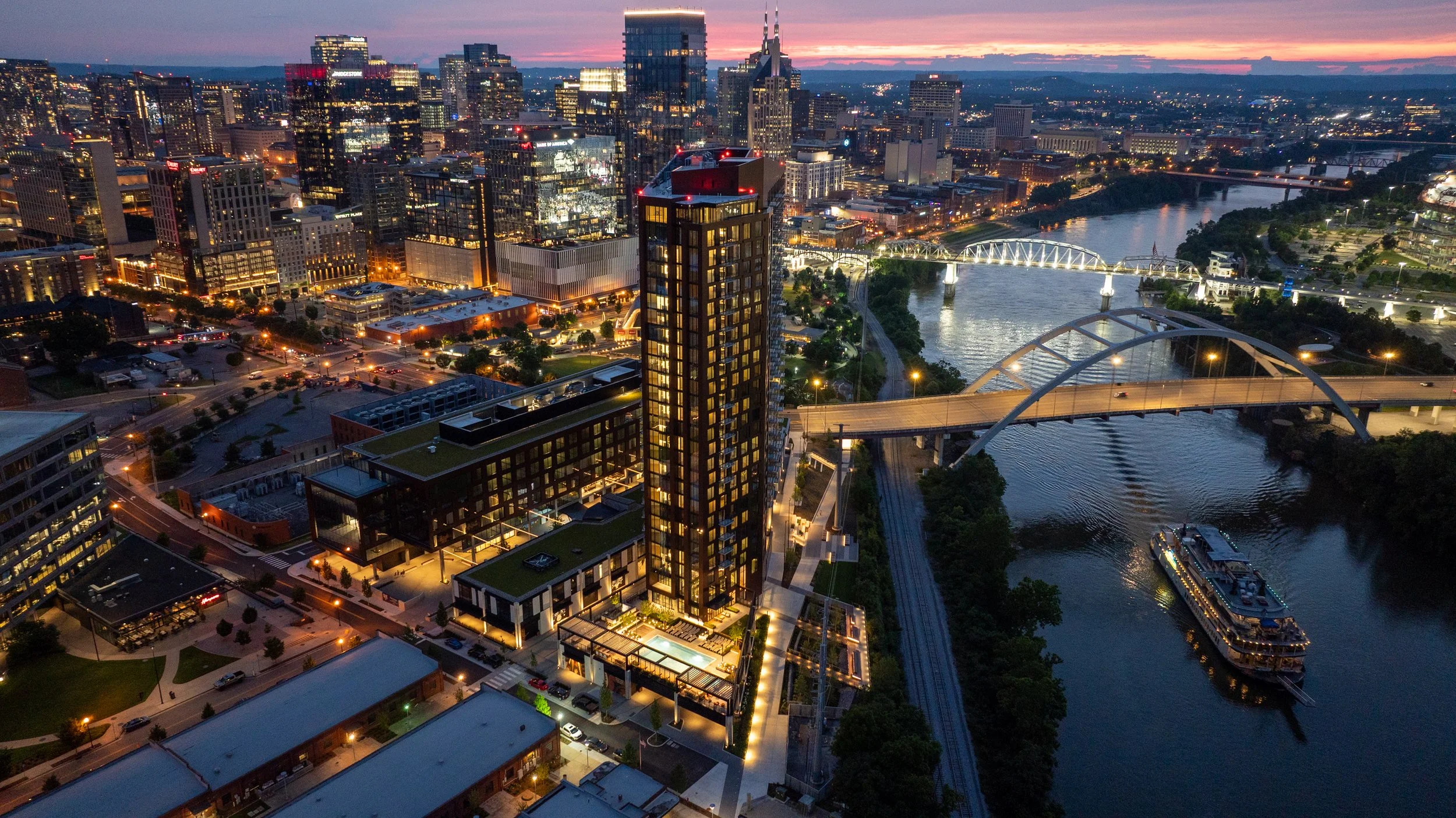
Nashville Drone Co South Bank Aerial Photo
Anyone who has watched a high rise climb out of the ground in Nashville knows the process moves fast. Steel and concrete stack floor by floor, and within months a skyline changes shape. What most developers do not realize until it is too late is that the same speed working in their favor on the construction schedule is working against them when it comes to capturing the views their future residents, tenants, and buyers will one day pay a premium for.
The honest answer to "when is the right time" is simple: earlier than you think, and before a crane goes up.
The Closing Window Nobody Talks About
Every high rise construction site has a brief period where the building's future sightlines are still fully accessible from the air. This window opens once the site is cleared and foundation work is underway, and it starts closing the moment the first tower crane is erected.
Cranes are a practical necessity on any vertical build, but they are also one of the biggest obstacles to clean aerial photography. A crane boom parked in front of a skyline view, a jib swinging through a shot, or a counterweight blocking the exact angle a future twelfth floor balcony will have; these are not problems a drone pilot can edit around later. Once the crane is in place, certain angles are simply gone for the duration of construction.
Floor height creates a second closing window. As soon as a floor is topped out and enclosed, the specific vantage point that floor would have offered is no longer accessible by drone. A drone cannot fly through a poured slab or a framed wall to capture what the view would have looked like from inside a unit that no longer has open air where the camera needs to be. That view existed for a matter of weeks during construction and then it was gone.
This is why timing is not a minor scheduling detail. It is the difference between having authentic, sellable imagery for every floor of a building and having none at all for the upper levels once the structure tops out.
The smartest developers treat drone photography as part of the construction schedule itself, not an afterthought that gets penciled in once the building is finished. That means checking in with the project's general contractor or site superintendent early, understanding the crane placement plan before it happens, and mapping out which floors need to be captured and on what timeline. A shoot planned around the framing schedule, floor by floor, can document sightlines that would otherwise be lost the moment steel or concrete closes them off. Waiting until the building is farther along almost always means losing access to the lower and middle floors, since those views close first while upper floors are still under construction.
What Happens After the Window Closes
Once the ideal aerial window has passed, developers are left with far more limited and far more expensive options.
Some developers turn to architectural renderings to fill the gap. Renderings have their place in a marketing package, particularly in the very early stages before a single beam goes up, but buyers and tenants have grown far more discerning. A rendering is understood to be an artist's interpretation. It shows what a view is supposed to look like under ideal conditions, not what it actually looks like on a hazy Tuesday afternoon or during a golden hour sunset over the Cumberland River. Real photography closes that credibility gap in a way no rendering ever will.
Is the Cost of Aerial Photography Worth It?
For a high rise development, this question almost always comes down to the value of the sale or lease being made. A single unit view can influence a buyer's decision on a six or seven figure purchase. A retail space view can determine whether a national tenant sees enough foot traffic and skyline exposure to sign a lease. The cost of a properly planned drone photography campaign is a small fraction of the value that a single strong sale or lease adds to a project's bottom line. Compare that against the alternative. Once a building is complete, capturing those same views again requires expensive still phoyography, coordination with the property, and in many cases limited access to floors that are already occupied. What would have taken a single flight during construction now requires a logistics plan, permissions, and a budget that dwarfs the original cost. There genuinely is one real opportunity to capture every floor's view efficiently, and it exists only during the build.
Why High Resolution Views Sell Space
Photography plays a different role at every stage of a project's sales and leasing cycle, but its impact on the closing decision is consistent. Buyers touring a condo before it is finished want to see, not imagine, what their morning coffee view will look like. Prospective retail tenants want to see their signage sightline from the street. Office leasing teams want to show a boardroom's skyline backdrop before the glass is even installed. High resolution aerial photography answers all of these questions with evidence instead of promises. A crisp, well composed image taken from the exact elevation and orientation of a specific unit does more to close a sale than pages of specifications ever could. These images end up on listing pages, in leasing brochures, in investor decks, and across social media campaigns that build anticipation months before a single unit is move in ready. A strong aerial photo library becomes one of the most reused assets in an entire marketing campaign, showing up again and again across channels long after the shoot itself is finished.
Giarratana Development has seen this play out firsthand with the future condos of their 60 story Paramount tower. One image in particular, captured by Nashville Drone Co from what will become the building's penthouse level, has taken on a life of its own inside the project's marketing efforts. The team has come to call it the Billion Dollar Photo, and it has since appeared across multiple ad campaigns tied to the building. It is the kind of shot that only exists because it was captured early, well before the floor it represents was fully enclosed. Giarratana also relies on the high resolution stills and 360 degree panoramic images taken during those early construction phases inside its sales presentation office, giving prospective condo buyers a way to stand in the room and see the actual view from any floor in the building, not a rendering of what that view is supposed to look like.
Sales teams often underestimate how long a single well timed photo shoot will keep paying off. A gallery captured during construction can carry a project from its earliest pre sale phase all the way through grand opening, then continue to serve as content for anniversary posts, press features, and case studies long after every unit is sold. Compare that to the cost of a single rendering package, which typically covers only a handful of predetermined angles and cannot be updated once the building's actual lighting, landscaping, and surrounding skyline are in place. Real photography adapts to whatever the marketing team needs next, whereas a rendering is locked the day it is delivered.
Nashville Drone Co's Approach to High Rise Timing
Nashville Drone Co has worked with high rise developers across Middle Tennessee who understand this timing challenge firsthand. The team plans shoots around construction milestones rather than waiting for a project to reach a convenient stopping point, coordinating directly with general contractors and development teams to capture each floor's unique vantage point before it becomes inaccessible. That kind of planning takes more than a drone and a clear sky. It requires an understanding of sun position and time of day for each specific compass direction a building faces, camera settings that hold detail in both the sky and the shaded building facade, and a precise method for calculating elevation so that a photo taken from what will become the twentieth floor is actually captured from the twentieth floor's true height above sea level, not an approximation. Nashville Drone Co built its process around exactly this kind of accuracy, treating every shoot as a technical exercise in matching a future floor plan to a real world elevation before that floor exists. This attention to detail has made Nashville Drone Co a familiar name to developers working on condo towers, mixed use projects, and commercial high rises throughout the region.
Beyond still photography, the team produces marketing video that walks viewers through a property's story, from the construction process itself to the finished views a resident or tenant will wake up to every day. These videos and photo galleries are frequently the centerpiece of a project's sales center presentation and digital marketing rollout.
Not Limited to Nashville
While the name reflects the company's home base, Nashville Drone Co regularly travels beyond Middle Tennessee for developers who need this same level of construction phase planning and accuracy in other markets. High rise timing challenges are not unique to any one city, and developers working in secondary and tertiary markets across the Southeast face the exact same closing windows once cranes go up and floors get enclosed. A development team with a project outside Nashville can bring the same construction schedule coordination, FAA certified flight operations, and elevation accuracy to their own market.
The Bottom Line
The right time to schedule drone photography for a high rise build is not after the ribbon cutting. It is during the earliest phases of construction, before cranes obstruct the skyline and before floors close off the exact vantage points future buyers and tenants will one day call home. Developers who plan for this window end up with a complete photo and video library that supports every stage of sales and leasing, from the first rendering shown to an investor to the final unit sold to a resident. Those who wait are left choosing between expensive workarounds and marketing materials that simply cannot compete with the real thing.
View Nashville Drone Co’s Gallery
Contact Nashville Drone Co to capture your future high rise views. info@nashvilledrone.co
Comments of Nashville Drone Co Regarding Securing the U.S. Drone Supply Chain FCC Docket No. 26-189
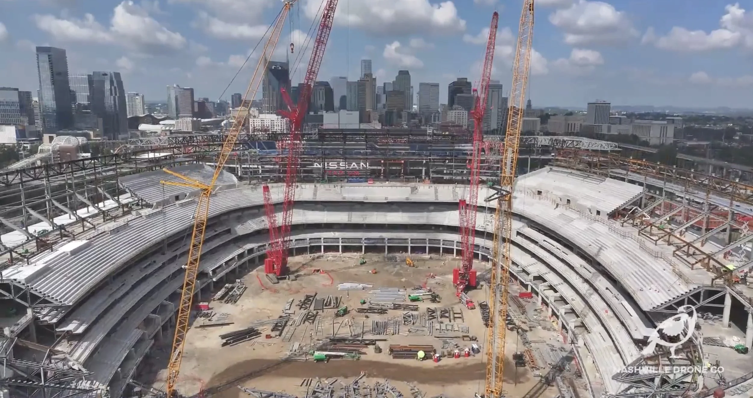
Nashville Drone Co Nissan Stadium Construction Photo
To the Federal Communications Commission:
My name is Keith Stancil, and I am the founder and president of Nashville Drone Co, a commercial drone operation based in Middle Tennessee. We serve land developers, general contractors, engineers, and commercial builders across the Nashville region, providing aerial photography, video, mapping, and progress documentation for projects ranging from single family developments to high rise towers in downtown Nashville. I appreciate the opportunity to submit these comments on the Commission's efforts to secure the domestic drone supply chain.
I want to be direct about where I stand. I support keeping foreign adversaries away from American infrastructure data, communications systems, and operational information. That is not a controversial position in this industry. What concerns me is the possibility that a well intentioned security rule gets written broadly enough that it sweeps up the everyday tools small commercial operators like mine depend on to do our jobs safely and well. I am writing to offer the perspective of someone flying drones over active construction sites every week, not from a policy office, but from the field.
Why Safety Has to Come First in Any Conversation About Sensors
Before I get into supply chain specifics, I want to explain how my company actually operates, because it shapes everything I am about to say. Our number one goal on every job site is flying safely. We are not just capturing pretty photos of a skyline. We are flying near cranes, near workers, near partially completed structures, and near other aircraft in increasingly crowded urban airspace. Safety is not a marketing line for us. It is the standard every flight gets held to before a single photo is ever taken.
LiDAR sensors are a meaningful part of how we accomplish that. On a construction site, conditions change daily. A crane arm swings into a new position, scaffolding goes up overnight, new equipment gets staged in a spot that was clear the week before. LiDAR gives our pilots real time terrain and obstacle awareness that a camera alone cannot provide, which means fewer close calls and safer flights around the exact kind of dynamic, hazardous environment a construction site represents. When I hear proposals that could restrict access to LiDAR sensors because the same underlying technology has military applications, my first concern is not inconvenience. It is that removing or pricing out this equipment makes flights over active job sites less safe for our pilots and everyone working below us.
I would ask the Commission to keep that distinction in mind throughout this process. A LiDAR sensor helping a drone avoid a crane cable is not the same national security question as a sensor collecting data for a foreign government. Those two things should not be regulated as though they are identical simply because they share a name.
What Our Work Actually Looks Like on the Ground
Nashville Drone Co supports land development and construction projects throughout Middle Tennessee. That means documenting site grading before a foundation is poured, tracking construction progress floor by floor on a high rise, and giving developers and their engineering teams accurate visual data they can use to make real decisions. On a recent high rise project in downtown Nashville, for example, our team worked with project engineers to plan flights around the building's evolving structure, using sensor data to fly safely at height while capturing usable footage for the developer's marketing and sales efforts.
This is common work for drone operators across the country, and it depends on affordable, reliable access to sensors like LiDAR and thermal imaging. Thermal cameras help contractors spot insulation gaps, moisture intrusion, and electrical issues long before they become expensive problems. LiDAR helps us map terrain accurately for grading and earthwork. None of this is exotic technology in our world. It is standard equipment that has become essential to how modern construction and land development projects get documented and managed.
If new rules make this equipment significantly more expensive, harder to source, or slower to get approved for replacement parts and updates, the cost does not stay contained to drone companies. It shows up in higher costs for developers, slower timelines for contractors, and ultimately higher costs for the homes and buildings going up across our region.
Separate the Real Threat From the Sensor Itself
I would encourage the Commission to focus regulation on the actual vulnerability, which in most cases is not the sensor but where the data collected by that sensor ends up. If a drone's operating software can quietly send flight data, site imagery, or terrain scans to a foreign server, that is the problem worth solving. Requiring manufacturers to support offline operation, disclose exactly where data is stored and transmitted, and allow independent verification of their software would do far more to protect national security than restricting access to a category of sensor that thousands of small businesses like mine rely on every day for safe, legitimate work.
I would also encourage a tiered approach to security requirements rather than a single blanket standard applied to every commercial drone regardless of its use. A drone flying near sensitive federal infrastructure is a very different risk than a drone documenting a residential subdivision or photographing floor views in a condo tower under construction. Treating those two scenarios identically does not make anyone safer. It just makes ordinary commercial work more expensive and more difficult without a corresponding security benefit.
Protect the Businesses Already Invested in This Technology
Many small drone operators, including my own company, have invested real money into equipment we expect to use for years. If new rules cut off access to replacement batteries, parts, firmware updates, or manufacturer support for equipment that is otherwise operating safely and securely, businesses like mine are left holding equipment we can no longer maintain or fly with confidence. I would ask the Commission to build in a reasonable path for existing equipment to continue receiving support as long as it can be verified as operating securely, rather than treating every piece of previously approved technology as suddenly obsolete.
A Faster, Clearer Path Forward Benefits Everyone
Drone technology moves fast. Sensors, software, and aircraft all improve on a timeline measured in months, not years. If the approval process for what counts as secure technology cannot keep pace with that rate of change, American operators will simply fall behind operators in other countries using more capable equipment. That does not make us safer. It puts small businesses like mine at a real disadvantage while doing little to address the underlying security concern.
I recognize the Commission and its federal partners have already taken steps toward more responsive review processes for defense related drone programs. I would encourage that same spirit, clear standards, defined timelines, and a real path to compliance rather than permanent exclusion, to extend into how commercial sensor technology gets evaluated as well.
Closing Thoughts From the Field
I did not write these comments as a policy expert. I wrote them as someone who flies drones over active construction sites in Middle Tennessee every week, who has built a business around helping developers and contractors document their projects safely and accurately, and who relies on sensors like LiDAR specifically because they help my team fly more safely, not less. I would ask the Commission to write rules that target the real security risk directly, wherever that risk actually lives, and to avoid rules broad enough to take safety critical tools like LiDAR out of the hands of small commercial operators who use them every day to do honest, necessary work.
Thank you for the opportunity to share this perspective and for considering the comments of a small drone business working on the ground here in Middle Tennessee.
Respectfully submitted,
Keith Stancil Founder and President Nashville Drone Co
You can post your own comments to the FCC here - https://www.fcc.gov/ecfs/search/docket-detail/26-189
Who Offers High End Drone Photography Near Me in the Nashville area?
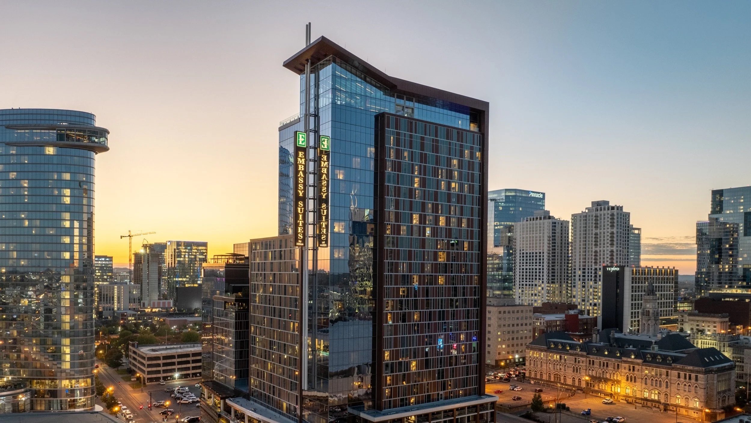
Nashville Drone Co Nashville Embassy Suits Photo
If you searched "who offers high end drone photography near me" because you need images that actually move product, close deals, or land press coverage, you already know that not every drone operator can deliver that. Anyone with a consumer drone and an app can take a photo from up high. Far fewer can walk into a 60 story luxury condo tower under construction, understand what a buyer standing at their future kitchen window will actually see, and capture that view with the precision a real estate sales team can put directly into a marketing deck. That distinction is exactly why Giarratana Development, the developer behind some of Nashville's most recognizable high-rise projects, chose Nashville Drone Co to photograph the views from every floor of Paramount Tower, one of downtown Nashville's tallest residential buildings.
What "High End" Actually Means in Drone Photography
The phrase gets used loosely. For Nashville Drone Co, high end photography is not about flying higher or owning more expensive equipment, although the gear matters. It is about the planning, the technical execution, and the editing that turns a raw aerial capture into something a luxury buyer would trust enough to put a deposit down on. Founder Keith Stancil built the company on that idea, bringing over two decades of entertainment marketing experience into a business that treats every project like a campaign asset, not a snapshot. Nashville Drone Co's marketing background is woven into every photo the team takes. Every image is intentionally captured to sell property, whether that property is a condo, a home, or a commercial development.
Nashville Drone Co’s specialty is hi-res aerial photography for luxury high rise developers, commercial real estate, and residential clients across Middle Tennessee. That focus shows up from the first conversation with a client. The question is never just what can we photograph. It is what does this image need to accomplish for the sale.
Legally Cleared to Shoot Where Others Can't
Downtown Nashville sits close to restricted and controlled airspace, and tall construction sites bring their own regulatory complications. Nashville Drone Co secures FAA flight waivers to legally shoot in restricted areas, allowing the team to fly projects that many operators would have to turn down or attempt without proper authorization. For a developer, that matters. An unauthorized flight can put a project's marketing timeline and a company's reputation at risk. Working with a fully credentialed, Part 107 certified operator who understands the waiver process removes that liability entirely.
The Paramount Tower Project: Photographing 60 Floors of Future Views
When Giarratana Development set out to build a high tech sales office for Paramount Tower, they needed something buyers could not get anywhere else: an honest, high-resolution preview of exactly what they would see from their specific floor, long before the building was finished enough to walk through.
Nashville Drone Co captured both high-resolution still images and full 360 degree panoramic views from each floor of the tower, giving the sales office a library of visuals that let a potential buyer stand in front of a screen and see, floor by floor, the skyline, the river, the hills, and the neighborhoods visible from their unit. This was not a matter of sending a drone up and hoping for a usable shot. Every floor required its own plan.
Getting the Elevation Right
Before a single photo was taken, Nashville Drone Co worked directly with Paramount's project managers and engineers to calculate the precise elevation an average height person would be viewing from on each individual floor. A view captured a few feet too high or too low can misrepresent what a buyer will actually experience once they move in, and in a luxury market, that kind of inaccuracy is not something a developer can afford. Getting this detail right meant coordinating construction data, floor plans, and finished ceiling heights, then translating all of it into exact flight elevations for dozens of separate shoots.
Timing the Light
Nashville Drone Co also consulted with the Paramount team on the best time of day to capture each set of images. Light changes everything in a skyline photo. The angle of the sun, the shadows cast by neighboring buildings, and the color of the sky all affect how a view reads to someone seeing it for the first time. Rather than shooting on a fixed schedule for convenience, the team planned capture windows around what would present each direction and floor in its best possible light.
Shooting for Precision, Not Convenience
Once conditions were right, the technical work began. Nashville Drone Co used a bracketed photography technique for every shot, capturing multiple exposures of the same view and blending them to preserve detail in both the brightest sky and the darkest shadow. This is standard practice in professional real estate and architectural photography, but it is labor intensive and easy to skip, and skipping it is often the difference between a photo that looks like a listing snapshot and one that looks like it belongs in a design magazine.
After the shoot, every image went through detailed post production. Exposure, color balance, and clarity were refined until each photo represented the view as accurately and attractively as possible. For a project of Paramount's scale, that meant editing hundreds of images across dozens of floors, all while keeping a consistent look across the entire collection so the sales office presentation felt cohesive rather than assembled from mismatched shoots.
More Than Marketing Photography
While projects like Paramount Tower highlight the sales and marketing side of the business, Nashville Drone Co also excels at architectural documentation and construction site progress and inspection work. Developers and builders use aerial photography throughout a project's timeline, not just at the marketing stage, to track progress against schedule and document site conditions for stakeholders and investors. That dual capability, marketing grade imagery paired with technical documentation, is part of why the company has become a go-to resource on multiple projects rather than a one-time vendor.
Why This Level of Detail Matters for Luxury Buyers
Buyers in the luxury condo market are not just purchasing square footage. They are purchasing a view, a lifestyle, and a level of confidence that what they are being shown is what they will actually get. That audience notices when an image looks slightly off, when the light is wrong, or when a view seems exaggerated. High-resolution accuracy is not a bonus feature for this kind of buyer. It is a baseline expectation, and it is the gap Nashville Drone Co fills by treating every floor of a building like its own individual project, with its own elevation, lighting plan, and editing pass.
From Sales Office to Nashville Business Journal
The impact of this work has extended well beyond Paramount's sales office. Nashville Drone Co's aerial photography has been featured in the Nashville Business Journal and in major marketing campaigns tied to Nashville's luxury high rise condos and hotels, putting the work in front of investors, industry professionals, and prospective buyers following Nashville's high-rise development boom. That kind of recognition happens when the photography is strong enough to stand on its own as visual storytelling about a building, not just a marketing add-on.
A Track Record Beyond Paramount
Giarratana Development is far from the only name relying on Nashville Drone Co's high end aerial work. The company is highly reviewed by leading land developers and high rise builders in Nashville, with ongoing relationships across Middle Tennessee's construction and development landscape, including McCrory Construction, Charles Hawkins Co, Axiom Builders, Redeavor Group and SomeraRoad. Each project brings its own requirements, but the approach stays the same: understand what the client needs the photography to accomplish, then build a plan around delivering exactly that, rather than a generic aerial package.
For a developer like Giarratana, working with a team that already understands the pressure of selling units in a high-rise before the building is finished makes a real difference. There is no learning curve, no explaining why elevation accuracy matters, and no need to walk a photography team through what a sales office presentation actually requires.
See the Difference for Yourself
The easiest way to understand the gap between Nashville Drone Co and other drone operators in the area is to compare galleries and portfolios directly. A big difference in Nashville drone photography and competitors can be seen quickly this way. Set a Paramount Tower panoramic view next to a typical listing photo taken from a consumer drone, and the difference in elevation accuracy, exposure detail, and overall polish becomes obvious immediately.
What to Look for When Searching "High End Drone Photography Near Me"
If you are evaluating drone photography for a project where the images need to do real work, whether that is selling condo units, marketing a commercial development, or documenting construction progress for investors and press, a few things separate high end providers from everyone else offering aerial photos in Nashville.
Look for a team that plans around your specific goals rather than offering a “one size fits all” package. Ask how they approach lighting and timing, since the difference between a flat midday shot and a photo captured under the right conditions is significant. Find out whether they use bracketed exposure techniques and detailed post production, since raw drone footage rarely looks finished straight out of the camera. Confirm they hold the proper FAA certification and waivers to fly legally in restricted airspace, and consider whether they have experience working directly with project managers, engineers, and sales teams.
Nashville Drone Co has built its reputation on exactly that kind of work. The Paramount Tower project is one example of what happens when aerial photography is treated as a strategic marketing tool rather than an afterthought, and it is why land developers and high rise builders across the Nashville area continue to turn to the team when the images need to do more than just look good. They need to sell
Contact Nashville Drone Co for your high end drone photography needs. info@nashvilledrone.co
4 Things That Set Nashville Drone Co Videos Apart
Nashville has no shortage of drone operators right now. A quick search turns up dozens of names, most offering roughly the same thing which is a licensed pilot, a decent camera, and a folder of aerial clips delivered a few days after the flight. That footage is not bad. It is usually clean and technically competent. It is also, more often than not, forgettable.
Nashville Drone Co set out to do things differently, and what sets it apart comes down to four things most drone companies either skip or never learned to do well which are composition, story, music, and color grading. Individually, each one matters. Put together, they are the reason footage from Nashville Drone Co tends to get remembered and used long after a typical drone video has been scrolled past.
1. Composition: Every Frame Has a Reason to Exist
Composition in drone videography is the deliberate framing of each shot, using angle, distance, and natural elements in a location to guide the viewer's eye rather than simply capturing whatever is visible from above. A lot of drone footage looks the same because it is shot the same way every time: fly up, hover, pan slowly across the property, land. There is nothing wrong with that as a way to document a location, but it rarely looks intentional. Composition is the difference between a shot that just shows something and one that draws the eye exactly where it needs to go. That means paying attention to leading lines, like a road or a river that pulls attention toward a building. It means framing a subject off center rather than dead in the middle, which almost always creates a more dynamic image. It means knowing when a low, close pass tells a better story than a high, distant one.
Nashville Drone Co plans every shot with composition in mind before the drone leaves the ground, studying the location ahead of time, mapping flight paths that take advantage of natural framing elements already on site, and adjusting for the time of day so shadows and light fall the right way. None of that happens if a pilot is simply flying around capturing whatever looks interesting in the moment.
2. Story: Footage Should Take a Viewer Somewhere
Story in aerial video means structuring shots in a deliberate sequence, with a clear opening, build, and conclusion, so the footage feels like a narrative rather than a random collection of clips. Most drone videos are a collection of shots, not a story. They open wide, show a few angles, and end. There is no build, no sense of movement from one idea to the next, and nothing that makes a viewer want to keep watching. A video with a story does something different. It opens with a hook, whether that is a striking wide shot or a close detail that raises a question. It builds through the middle with a mix of angles and pacing that keeps the energy moving. It closes with a shot that feels like a conclusion rather than just the last clip in the folder.
This is where Keith Stancil's background outside of drone work becomes an advantage most competitors do not have. Before founding Nashville Drone Co, Keith spent more than two decades in entertainment marketing, working with major record labels and managing artists whose careers depended on telling a story people wanted to follow. That instinct for pacing and structure did not disappear when the medium changed from music marketing to aerial video. It shows up in the way every project gets planned, shot, and edited, treating a sixty second construction update the same way a marketing team would treat a campaign asset, with a clear beginning, middle, and end.
3. Music: The Element Most Drone Companies Get Completely Wrong
Music in drone video is the soundtrack chosen and paced to match the visual rhythm of the footage, shaping how a viewer feels moment to moment rather than serving as background noise added after editing is finished. Ask most drone operators about music and the answer is usually the same. They grab something from a royalty free library, drop it under the footage, and hope it fits. Music becomes an afterthought, added at the very end of the process almost as a formality. That approach misses something important. Music is not decoration sitting on top of a video. It is one of the biggest reasons a viewer feels anything at all while watching it. The right track can turn a simple property flyover into something that feels aspirational. The right track can make a construction milestone video feel like genuine progress rather than just another update. The wrong track, even a technically fine one, can undercut footage that would otherwise be excellent.
This is the area where Keith's music industry background matters most. Two decades spent inside the music business, understanding tempo, mood, and how a track builds and releases tension, is not something most drone pilots have exposure to. Keith does not select music as a final step after editing is finished. Music selection happens early, often before the final edit is locked, because the pacing of a track directly shapes how a video gets cut. A shot lands differently on a beat drop than it does two seconds later, and knowing that instinctively comes from years working inside the music industry, not from browsing a stock audio library. This connection between music and aerial footage runs so deep that it led Keith to found Sky Hymnal, a separate project pairing original instrumental compositions with drone cinematography. It is central to how every piece of footage gets built, from a single client project to an independent creative work.
4. Color Grading: The Step Most Drone Pilots Skip Entirely
Color grading is the post production process of adjusting a video's contrast, saturation, and tone so raw drone footage takes on a polished, cinematic look instead of the flat, gray appearance it has straight off the camera. Color grading is probably the least understood part of drone video production, and it shows in a lot of the footage circulating around Nashville right now. Raw footage straight off the camera almost always looks flat and gray, lacking the depth that makes a finished video look genuinely cinematic. Many drone operators either skip this step entirely, exporting footage close to how the camera captured it, or apply a generic preset that looks the same on every project regardless of location or lighting. Neither approach produces work that stands out.
Nashville Drone Co treats color grading as a core part of production, not an optional add on. Every project gets graded individually, with attention to how the lighting conditions on that specific day and location should shape the final look. A downtown skyline shot at golden hour calls for a different grade than a construction site photographed under overcast midday light, and getting that distinction right is what separates footage that looks professionally produced from footage that simply looks like it came straight off a drone.
Why All Four Have to Work Together
None of these four elements works particularly well in isolation. Great composition without a story behind it is just a series of pretty shots. A strong story without the right music falls flat, because music does a huge amount of emotional work a viewer feels but rarely consciously notices. And even a well paced video with great music will look unfinished without proper color grading tying it together visually.
This is the real difference between Nashville Drone Co and much of the drone videography being produced across the Nashville market right now. Plenty of operators can fly well and capture clean footage. Far fewer understand how composition, story, music, and color grading work together as a single system, because most drone pilots come from an aviation background rather than a production and marketing one.
Keith Stancil's path into this business ran through two decades in entertainment marketing before it ever ran through a drone controller, and that order matters. Flying skill can be learned in weeks. Understanding how to build footage that actually moves people, using all four of these elements together, takes years of experience most drone pilots in this market have not had the chance to build. For clients across Nashville and Middle Tennessee, that difference shows up in every finished project, from a single property listing to a multi month construction documentation series. It is the reason the footage does not just document something. It makes people feel it.
FAQ
What makes drone footage look cinematic instead of amateur?
Cinematic drone footage comes from combining intentional composition, a clear narrative structure, music that matches the pacing of the visuals, and proper color grading. Most drone footage looks amateur because it skips one or more of these elements, usually music and color grading, and relies on flying skill alone.
Why does music matter in drone video production?
Music shapes how a viewer emotionally experiences footage, often more than the visuals themselves. A track chosen and paced correctly can make a property or project feel aspirational, while a mismatched or generic track can undercut even well shot footage.
What is color grading and why do drone videos need it?
Color grading is the process of adjusting a video's contrast, saturation, and tone after filming to give it a consistent, polished look. Raw drone footage straight off the camera typically looks flat and gray, and color grading is what gives it a finished, cinematic quality.
What sets Nashville Drone Co apart from other drone companies in Nashville?
Nashville Drone Co is founded and operated by Keith Stancil, who spent more than two decades in entertainment marketing before becoming a drone pilot. That background shapes how every project is planned around composition, story, music, and color grading, rather than focusing on flying skill alone.
Does music selection happen before or after editing in drone video production?
At Nashville Drone Co, music selection typically happens early in the process, often before the final edit is locked, since the pacing and rhythm of a track directly influences how footage gets cut together.
Contact us today to talk through your next project. info@nashvilledrone.co
What 20 Years in Music Marketing Taught Me About Flying a Drone For Commercial Clients
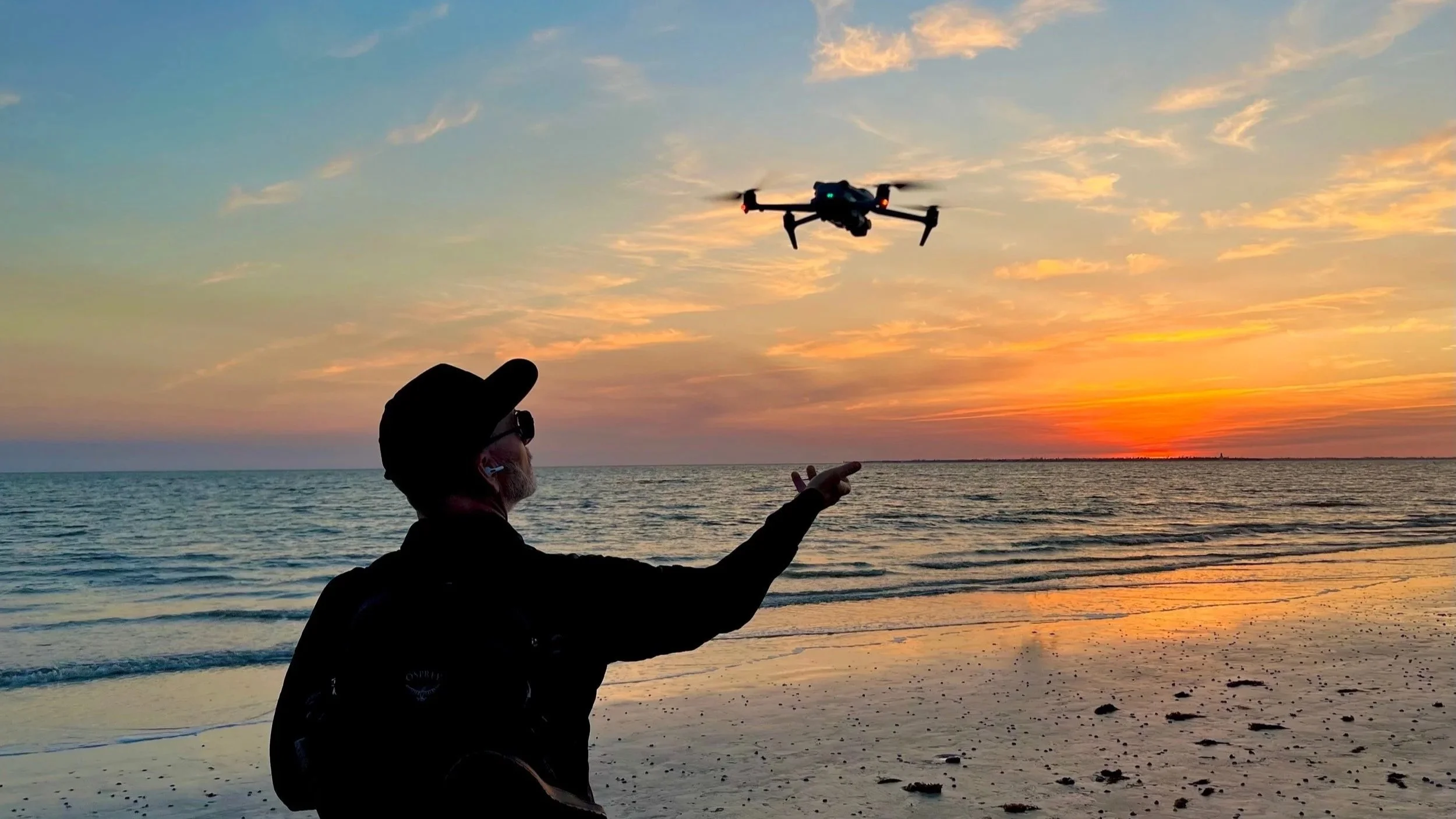
Anyone can learn to fly a drone in a weekend. The controls are not complicated, and the FAA test that comes with getting licensed is mostly a matter of studying airspace charts and weather patterns until they stick. What is much harder to learn, and what most people flying drones commercially in Nashville have never had to learn, is how to make footage that actually gets someone to feel something and then act on it.
That distinction is the entire reason Nashville Drone Co exists in its current form. Before founder Keith Stancil ever piloted a drone, he spent more than twenty years working inside the music industry, managing marketing divisions for major labels and later running his own artist management firm. That background did not just come along for the ride when he started flying drones. It became the foundation the whole business is built on.
Here is what that experience actually taught him, and why it changes the way a drone shoot gets planned from the very first phone call.
A Shot Is Not Content Until It Has a Job to Do
In the music industry, nothing gets released without a purpose behind it. A single is not just a song, it is a piece of a campaign designed to build toward an album launch, a tour announcement, or a specific moment in an artist's career. Every asset has a job. Most drone footage does not get treated that way. A pilot shows up, flies around a property or a job site, and hands over a folder of clips. There is rarely a plan for what any individual shot is supposed to accomplish once it lands in a client's hands. Keith brings the campaign mindset to every project instead. Before a drone leaves the ground, the question is not just what does this location look like from above, but what is this footage actually going to be used for. A real estate listing video needs to make a buyer picture living there within the first ten seconds. A construction milestone video needs to communicate scale and progress to investors who may never set foot on the site. A brand campaign needs a shot that stops someone mid scroll. Each of those goals calls for a completely different shot list, pacing, and edit, and none of that gets figured out by accident once the footage is already sitting on a hard drive.
Pacing Is a Skill, Not an Accident
Anyone who has worked in music marketing has sat through countless conversations about sequencing. Where does the hook land. How long before the energy shifts. What comes right before the chorus hits. That kind of thinking about rhythm and timing does not disappear just because the medium changes from a three minute song to a ninety second aerial video. A lot of drone footage feels the same because it is edited the same way every time: wide shot, slow push in, maybe a rotation around the subject, done. There is nothing wrong with that approach for simple documentation, but it rarely holds attention past the first few seconds.
Keith edits aerial footage the way a track gets sequenced. Where does the video need a big wide shot to establish scale. Where does it need a fast, close pass to create energy. Where does the pacing need to slow down so a viewer can actually absorb a detail, like the texture of a building facade or the layout of a piece of property. None of that is instinctive to someone who has only ever operated a drone. It is a skill built from years of deciding what keeps an audience engaged and what makes them tune out.
Knowing the Audience Changes the Shot List
Marketing a country album to a Nashville audience and marketing that same artist to an international market are two completely different jobs, even though the music itself does not change. The same principle applies to aerial content, and it is something most drone operators never think about because they are focused on the flight itself rather than who is going to be watching the finished product. A shot list built for a luxury real estate listing needs to sell a lifestyle. A shot list built for a construction company's investor update needs to communicate credibility and progress. A shot list built for a brand's social media campaign needs to be built for vertical video and a three second attention span. These are not small stylistic differences. They change camera angles, flight paths, editing pace, even color grading choices.
Understanding an audience before the first shot is planned is second nature to Keith Stancil after two decades of building marketing strategies around different buyers, different demographics, and different platforms. It is one of the biggest gaps between a drone operator who simply flies well and one who produces footage that actually performs.
Production Pressure Teaches Preparation
Working in the music industry means working around deadlines that do not move. An album street date does not shift because a mix is not finished. A tour announcement does not wait because a marketing asset is not ready. That kind of pressure forces a level of preparation that becomes permanent once it is learned. That same discipline carries over directly into high stakes aerial work. Filming live broadcast coverage, documentary production, or a national ad campaign leaves no room for a reshoot the next day. If a shot gets missed during a live event, it is gone. That reality demands a level of pre planning that most local drone operators, who are used to flexible timelines and forgiving clients, have never had to develop. That means studying the location in advance, planning flight paths around obstacles and airspace restrictions, checking weather windows days ahead rather than the morning of, and having a backup plan if conditions change. None of that comes from a weekend spent learning to fly. It comes from years of operating in an industry where there was never a second chance to get something right.
Storytelling Is the Real Skill, Flying Is Just the Tool
None of this is meant to downplay the technical side of drone piloting. Flying safely in dense urban airspace, around active construction sites, or in changing weather conditions is a real skill that takes real training and experience to do well. FAA Part 107 certification is the baseline for operating legally and safely, and that baseline matters. But flying a drone well and telling a story well are two entirely different skill sets, and only one of them can be learned from a certification test. The drone is a tool, the same way a camera or a mixing board is a tool. What makes footage worth watching, and worth paying for, is the thinking that happens before and after the flight itself, not just the flight. That is the biggest lesson two decades in entertainment marketing left behind. A great shot is not the goal. A shot that makes someone stop, feel something, and take an action, whether that is calling about a property, investing in a project, or remembering a brand, that is the actual job. The drone just happens to be how that job gets done today.
The Part Nobody Talks About: Managing the Client Relationship
There is another piece of this that rarely comes up when people talk about drone videography, and it has nothing to do with flying. In the music industry, managing an artist or a marketing campaign means constantly translating between people who all want something slightly different. A label wants radio friendly. An artist wants creative integrity. A promoter wants ticket sales. Learning to listen to all three and find the overlap is its own skill, separate from music itself. That same translation work happens on every drone project. A property developer wants footage that impresses investors. A real estate agent wants footage that sells a listing fast. A construction company wants footage that documents progress without making a job site look behind schedule. None of those goals get stated outright at the start of a conversation. Part of the job is figuring out what a client actually needs, sometimes before they have fully put it into words, and building a plan around that rather than just asking what shots they want. This is where a lot of technically skilled drone pilots fall short. They can execute a shot list flawlessly, but if nobody asked the right questions before the shoot, the footage ends up technically impressive and strategically useless. Two decades of sitting in rooms with people who all wanted different things builds a kind of listening that carries directly into every client conversation now.
Why This Matters More in a Crowded Market
Drone videography has become an increasingly common service, and the barrier to entry is low. A capable drone, a Part 107 certificate, and a weekend of practice is enough to start offering flights for hire. That accessibility is good for the industry overall, but it also means the market keeps filling up with operators who can produce technically clean footage without much strategic thinking behind it. That shift makes a marketing background more valuable, not less. When flying skill alone stops being a differentiator, the thing that separates useful footage from forgettable footage is exactly the part that cannot be picked up in a weekend course: knowing why a shot works, who it needs to reach, and what it needs to make that person do next. None of this is a knock against pilots with a purely technical background. Flying skill matters most when conditions get difficult, whether that is tight downtown airspace or an active job site full of moving equipment. But flying well and producing footage that performs are two different outcomes.
Bringing That Mindset to Every Project
This is not a philosophy that only applies to national campaigns or high profile productions. It applies just as much to a small business owner who needs social media content or a homeowner selling a property in Franklin. The questions stay the same regardless of budget or scale, who is this for, what should they feel, and what should they do next. That approach is what separates content that documents something from content that actually moves people to act. Two decades in marketing did not teach flying skills. It taught the part that happens before the drone ever takes off and after it lands, and that part turns out to be the one that matters most.
We would love to help you capture content that tells the story you want to tell. Contact us to get your project started. info@nashvilledrone.co
Paramount Tower Hits 20 Stories: Nashville Drone Co Captures the Rise
Nashville's skyline is in the middle of one of the most significant transformations in the city's history, and one building is about to change everything. Paramount, the 60 story residential tower rising at 1010 Church Street, has officially reached its 20 story milestone. When complete, it will stand 750 feet tall, making it the tallest building in Nashville and the entire state of Tennessee.
To document this moment, Giarratana Development, the developer behind more downtown Nashville residential high rises than any other name in the city, turned to Nashville Drone Co. Over the years, Nashville Drone Co has built a reputation among developers, contractors, and property owners across Middle Tennessee for capturing large scale construction projects with precision, creativity, and an unmistakable sense of energy. The result is a body of footage that does more than record progress. It tells the story of a city reaching new heights, one floor at a time.
A Skyscraper 30 Years in the Making
Tony Giarratana has spent more than three decades shaping the Nashville skyline. His portfolio includes landmark buildings like 505, Prime, and Alcove, each one pushing the boundaries of what downtown Nashville living could look like. Paramount represents the culmination of that vision. Designed by the Chicago based architecture firm Goettsch Partners, the tower broke ground in September 2025 after a complex financing process that Giarratana himself described as grueling. The project will eventually include 360 apartments and 140 condominiums spread across 60 floors, along with 517 parking spaces. Once finished, Paramount will rise 137 feet above the current tallest building in the city, permanently altering the skyline that Nashville residents have known for generations. Now, with the first 20 floors complete, the city is getting its first real glimpse of what that future will look like. And Nashville Drone Co has been there to capture it.
Why Aerial Footage Matters for a Project Like This
Construction milestones are easy to describe in numbers. Sixty stories. Seven hundred fifty feet. Three hundred sixty apartments. But numbers alone do not capture what it actually feels like to watch a building of this scale rise out of the ground in the heart of downtown. That is where drone footage becomes essential.
Nashville Drone Co owner Keith Stancil approached the Paramount project the way he approaches every job: not as a routine flyover, but as an opportunity to tell a visual story. Stancil has built his reputation on more than two decades of professional entertainment marketing experience, and that background shows in the way he frames a shot. Rather than simply hovering above the site and recording, he choreographs each flight to build a sense of scale, motion, and anticipation.
The footage opens with sweeping high altitude shots that place Paramount within the context of the entire Nashville skyline, showing exactly how the tower already dominates its surroundings at only a third of its final height. From there, the camera drops down into close, detailed passes along the exposed steel and concrete floors, giving viewers a rare, up close look at the construction process itself. Cranes swing overhead. Workers move across open floor plates hundreds of feet in the air. The building feels alive, not static. This mix of wide establishing shots and intimate close ups is intentional. It is a technique borrowed from cinematic storytelling, where filmmakers use varying points of view to control pacing and emotion. Applied to construction photography, it transforms what could be a simple progress update into something people actually want to watch and share.
Capturing the Energy of a Downtown Build
Filming a high rise under construction in the middle of a dense urban environment is nothing like flying over an open field or a rural property. Downtown Nashville presents a unique set of challenges that require real experience to navigate safely and effectively. Church Street sits in one of the busiest corridors in the city, surrounded by other high rises, heavy pedestrian traffic, active construction equipment, and constantly shifting wind patterns created by the surrounding buildings. Flying a drone in this kind of environment requires more than just piloting skill. It requires a deep understanding of airspace regulations, situational awareness, and a safety first mindset that never lets up, even for a single flight. Nashville Drone Co has built its reputation on exactly that kind of discipline. Every flight around the Paramount site follows strict safety protocols, including careful pre flight site assessments, coordination with the construction team on the ground, and constant monitoring of nearby air traffic and structures. Operating under FAA Part 107 certification, the team plans each flight path in advance to avoid active crane zones, worker locations, and neighboring buildings, all while still finding the angles that make the footage compelling. This combination of technical skill and cautious planning is part of what makes Nashville Drone Co one of the safer options for developers working on complex, high visibility projects in tight urban spaces. A single mistake around an active construction site is not something any developer can afford, and that reality shapes every decision the team makes before the drone ever leaves the ground.
Bringing Viewers Closer to the Build
One of the things that sets this project apart is how close the footage brings viewers to the actual construction. Rather than relying solely on distant skyline shots, Nashville Drone Co pushes in toward the exposed floors, capturing the raw texture of rebar, formwork, and concrete pours that most people never get to see up close. These details matter. They remind viewers that behind every gleaming finished skyscraper is months of labor, engineering, and precision happening hundreds of feet above the street. At the same time, the team balances those close range shots with wider perspectives that show Paramount's relationship to the rest of downtown. Viewers can see how the tower already interacts with neighboring buildings like Alcove and Prime, both of which Giarratana also developed along the same Church Street corridor. Watching the three towers together from above tells a bigger story about how one developer has methodically reshaped an entire section of the city over the course of three decades. This creative approach, mixing macro detail with sweeping context, gives the footage a documentary quality. It is not just marketing content. It is a visual record of a defining moment in Nashville's growth.
The Technical Side of Filming a Rising Skyscraper
Every ten or fifteen floors a building climbs, the filming approach has to change with it. Early in construction, when a site is still just a foundation and a few floors of steel, drone operators can fly relatively close and low, capturing the site from nearly every angle without much concern for surrounding structures. Once a tower starts climbing past 15 or 20 stories, the entire calculation shifts. At its current height, Paramount already competes for airspace with several of the buildings around it, including its own siblings, Alcove and Prime, along with the Pinnacle tower across the street and the pair of Amazon buildings butting up against the west side.
Flying safely at this stage means constantly recalculating altitude, distance, and flight paths to avoid interference while still getting shots that feel dynamic rather than distant. Wind behaves differently at 250 feet than it does at ground level, funneling and gusting unpredictably between buildings in a way that can catch an inexperienced pilot off guard. Keith Stancil and the Nashville Drone Co team account for these variables before a single rotor ever spins. Flight plans are mapped out in advance, taking into account the position of the sun for lighting, the location of active cranes and workers, and the flow of surrounding air traffic. It is a level of preparation that most people watching the final footage never think about, but it is exactly what separates a smooth, cinematic sequence from a shaky, rushed one.
As Paramount continues to rise, these challenges will only grow. Filming the top of a 750 foot tower requires an entirely different level of precision than filming the top of a 20 story one, and Nashville Drone Co is already planning for how those future flights will look.
What Comes Next
With 20 floors complete, Paramount still has 40 more to go before it claims the title of Tennessee's tallest building. Substantial completion is expected by May 2028, meaning the tower will continue climbing for the next couple of years. Each new milestone, whether it is topping out, glass installation, or the eventual grand opening, presents another opportunity to document the project from above. Nashville Drone Co plans to continue capturing Paramount's progress as construction advances, building a visual timeline that will eventually show the tower's full transformation from an empty lot on Church Street to the tallest structure in the state. For a project this ambitious, a single flyover is not enough. It takes an ongoing commitment to documentation, paired with the technical skill to keep improving the footage as the building grows taller and the shots become more complex.
A Partnership Built on Trust
Giarratana Development did not choose Nashville Drone Co by accident. High rise construction projects of this scale require a partner who understands both the creative side of storytelling and the operational realities of flying safely in a dense downtown environment. Keith Stancil and his team have spent years building that kind of trust with developers, contractors, and property owners across Middle Tennessee, and the Paramount project is a clear example of what that experience looks like in practice.
As Paramount continues its climb toward 750 feet, Nashville Drone Co will be there documenting every stage, from the ground breaking early days to the moment it officially becomes the tallest building in Tennessee.
For a city that keeps reaching higher, it takes a team that knows how to capture that ambition from above.
Nashville Drone Co provides professional aerial photography and video services for construction projects, real estate, and commercial clients throughout Middle Tennessee. Contact Nashville Drone Co to get you project scheduled. info@nashvilledrone.co
360° Panoramic Aerial Photos: A New Tool Construction Companies Are Using to Manage Projects from Anywhere
Construction management has always relied on getting eyes on a site. For decades that meant walking the property, climbing scaffolding, or flipping through a stack of printed photos from the last site visit. Drone video and aerial photography changed a lot of that, giving project managers an aerial eye view of progress without stepping foot on uneven ground. Now a newer tool is starting to show up on construction sites across Nashville, and it takes that aerial advantage a step further. It's called 360° panoramic aerial photography, and it's changing how builders, developers, and project managers stay connected to their sites, especially when they can't be there in person.
What Is a 360° Panoramic Aerial Photo?
A 360° panoramic aerial photo is exactly what it sounds like. Instead of a single flat image captured from one angle, a drone captures a series of overlapping photos from a fixed point in the air and stitches them together into one seamless, fully interactive image. The result is a photo you can click into, drag around, and zoom in on, giving you a complete view of everything surrounding that point, not just what's directly in front of the lens.
Think of it as the difference between a snapshot and a window. A regular aerial photo shows you one slice of the site. A 360° panorama puts you inside the image and lets you look wherever you want to look. Grading on the north end of the property, a materials staging area on the south side, or the framing progress on a building in the middle of the lot are all available in the same shot. You're not limited to what the photographer decided to point the camera at that day.
This technology isn't new to real estate, where it's used to create virtual walkthroughs of homes and commercial spaces. What's new is how construction companies are starting to apply it specifically to active job sites, and the results are proving useful in ways that go well beyond a nice visual.
Why Construction Companies Are Paying Attention
Construction projects generate a constant stream of decisions, and most of those decisions are made faster and more confidently when the people making them can actually see what's happening on site. A 360° panorama gives project managers, superintendents, and stakeholders that visual access without requiring another site visit.
Reviewing Grading and Site Prep
Early in a project, grading accuracy sets the tone for everything that follows. Drainage patterns, elevation changes, and pad preparation all need to be verified before foundations go in. A single aerial photo can show general shape and slope, but a 360° panorama lets a civil engineer or site supervisor examine the grading from every direction without physically walking the entire footprint. Zooming into specific areas helps confirm whether swales are cut correctly or whether a low spot needs additional attention before it becomes a drainage problem later.
Tracking Building Progress and Materials
As a project moves into vertical construction, the questions change. Has the framing crew reached the second floor? Are the roof trusses on site and staged correctly? Is there enough lumber delivered for next week's schedule? A 360° panorama captured on a regular basis, weekly or biweekly for example, creates a visual record that answers these questions without a phone call or an email chain. Project managers can zoom into a materials laydown area to do a rough visual inventory or check that deliveries match what was ordered. Developers can look at framing progress on a specific elevation to compare it against the construction schedule.
Verifying Safety Protocol
Safety compliance is one of the most valuable and often overlooked applications of this tool. A 360° panorama captured from above shows fencing placement, erosion control measures, equipment staging, and whether workers are following site safety plans in a way that's hard to fake or misrepresent. Site safety officers and insurance providers can review conditions remotely, and general contractors can document compliance at specific points in the project timeline. If a question ever comes up about site conditions on a particular date, a dated 360° panorama provides a clear, unbiased record.
A Practical Solution for Out-of-State Projects
One of the strongest use cases for 360° panoramic aerial photos is for construction companies managing projects outside their home market. Nashville's growth has attracted builders and developers from across the country, and many of them are running projects here while their leadership team sits in another state entirely.
Flying out for a site visit every time an owner or investor wants an update isn't practical. Phone calls and written reports only go so far in conveying what a site actually looks like. A 360° panorama solves this gap directly. An owner based in another state can open the image on their laptop, drag around the site, and see the same conditions they'd see if they were standing there in person. They can zoom into the retaining wall going up on the east side of the property or check whether the parking lot paving has started, all without booking a flight. This is particularly valuable for investors and lenders who need periodic proof of progress before releasing draws on a construction loan. Instead of relying on a written progress report, they get a visual document they can explore on their own terms. It builds trust and removes a layer of uncertainty that's common with remote project oversight.
Built for Civil, Commercial, and Residential Projects
The applications for 360° panoramic aerial photography aren't limited to one type of construction. Civil development projects, commercial builds, and residential projects can all put this tool to use in slightly different ways.
Civil development, including roadwork, utility installation, and large-scale land development, benefits from the wide field of view a 360° panorama provides. These projects often span acres of land where a standard photo can't capture the full context. A panorama taken from a central point on the site gives engineers and municipal reviewers a complete picture of grading, drainage infrastructure, and site access all in one interactive image.
Commercial builds, from retail centers to office parks to mixed-use developments, benefit from the marketing side of this tool just as much as the documentation side. A 360° panorama of a commercial project under construction can be embedded directly on a leasing website, giving prospective tenants a real sense of the property's scale and surroundings well before completion. It also gives ownership groups and lenders a consistent visual record throughout the build.
Residential projects, whether it's a custom home, a small subdivision, or a large master-planned community, benefit from the same transparency. Builders can share panoramas with homeowners who want to see progress on their future home without visiting a muddy job site. Developers building out subdivisions in phases can use panoramas to show buyers what a section of the neighborhood will look like once construction wraps up in that area.
Nashville Drone Co Brings This Tool to the Local Construction Market
Nashville Drone Co has started offering 360° panoramic aerial photos as part of its construction drone services, bringing a tool that's more commonly associated with luxury real estate marketing into a practical, everyday resource for builders and developers across Middle Tennessee.
This is a natural extension of the work Nashville Drone Co already does on active job sites. The company has spent years documenting construction progress for general contractors, developers, and commercial real estate teams throughout Nashville, Brentwood, Franklin, Murfreesboro, and the surrounding area. Adding 360° panoramic capture to that lineup gives clients a new way to review their sites that goes beyond a standard photo or video update.
For a construction market growing as quickly as Nashville's, introducing this kind of tool matters. New commercial towers, sprawling residential developments, and infrastructure projects are underway across the region at the same time, and many of the companies behind them are managing multiple sites at once, sometimes from outside the state entirely. A 360° panorama gives those teams a faster, more complete way to stay connected to a project without adding another flight to their calendar.
How the Process Works
Capturing a 360° panoramic aerial photo starts the same way any other drone flight does. Nashville Drone Co's FAA certified pilots handle all necessary airspace authorizations before arriving on site, then position the drone at the optimal height and location to capture the full scope of the project. From there, the drone captures a series of overlapping images in every direction from that fixed point.
Those images are then stitched together using specialized software, creating one seamless panoramic photo that can be viewed on any computer, tablet, or phone. The finished panorama can be embedded on a website, shared through a simple link, or delivered as part of a broader progress reporting package alongside standard aerial photos and video.
Because the process fits into the same site visit as other drone deliverables, construction companies don't need to schedule a separate flight to add 360° panoramic photos to their documentation routine. It's an efficient addition to an existing workflow rather than a new obligation.
A Tool Worth Adding to Your Project Workflow
As construction projects across Nashville continue to grow in scale and complexity, the tools available for managing and communicating progress need to keep pace. 360° panoramic aerial photography gives builders, developers, and project managers a level of visual access that simply wasn't available a few years ago. Whether the goal is reviewing grading before a foundation pour, tracking materials on a busy job site, verifying safety compliance, or keeping an out-of-state ownership team in the loop, this tool delivers a clear, interactive view that standard photos and video can't match on their own.
If your construction company is looking for a more complete way to document and share progress on your next project, 360° panoramic aerial photos are worth adding to your toolkit. Contact Nashville Drone Co to learn how this service can fit into your next scheduled site visit. info@nashvilledrone.co
Flying a Drone on an Active Walmart Development Construction Site
Big box retail construction is one of the more demanding environments a drone pilot can work in. There's heavy equipment moving in multiple directions, crews on tight schedules, materials staged across a shifting footprint, and a general contractor who needs usable footage without anyone slowing down for it. Nashville Drone Co flies these exact type jobs regularly and most recently kon an active Walmart development site. This recent project is a good example of what separates a drone operator who can handle real construction work from one who's only flown quiet, controlled locations. You can see the finished result in theWalmart development progress video case study, but the footage only tells half the story. The planning, safety coordination, and site knowledge behind it are what actually made the project work.
Why Active Construction Sites Are a Different Kind of Flight
Flying a drone over an empty lot or a finished property is relatively simple. An active job site is not. On a large retail development like a Walmart build, a pilot is working around tower cranes, delivery trucks entering and exiting on their own schedule, workers moving across the site on foot, and equipment that can change position hour to hour. None of that is predictable in the way a residential shoot or a static real estate listing is. That means a flight plan for an active site has to account for things that simply don't come up on quieter jobs. Crane booms swing into different airspace throughout the day. Staging areas shift as materials get delivered and used. Site access changes as fencing and equipment move around the perimeter. A pilot who hasn't worked on a live commercial construction site before can get caught off guard by how much changes between one visit and the next.
This type job is also where the FAA Part 107 certification requirement becomes more than paperwork. Certified pilots are trained to think through airspace conflicts, maintain visual line of sight, and understand how site conditions affect safe flight altitude and positioning. On an active site with cranes and moving equipment, that training isn't optional. It's the difference between a clean shoot and a serious safety problem.
What the Walmart Development Project Actually Involved
The Walmart development job gives a clear picture of what this kind of work requires. Rather than showing up and flying whatever looked interesting that day, the process started with direct coordination with the general contractor's site team to understand where cranes and equipment would be positioned, when deliveries were scheduled, and which areas of the site were active versus temporarily clear. From there, flight paths were mapped around known obstacles, with enough flexibility built in to adjust if equipment had moved since the last visit.
Because retail developments like this move through distinct phases, site grading, foundation work, structural steel, exterior build out, the footage needed to actually show that progression in a way that made sense to people who weren't on site every day. A single flyover doesn't capture that. It takes a series of weekly visits, each one framed to line up with the last so the progress is easy to follow when the footage gets compiled.
That kind of recurring, phase based documentation is exactly what you'll see reflected in the Walmart development progress video, and it's the same approach Nashville Drone Co brings to other large commercial builds across Middle Tennessee.
Why Developers and General Contractors Need This Kind of Documentation
Construction progress video isn't just a nice visual extra on a project this size. Developers use it to support investor updates and show real, verifiable progress instead of relying on written reports alone. General contractors use it internally to track how a build is moving against schedule and to flag issues before they become expensive problems. Marketing teams use the same footage later, once the project wraps, to promote the completed property to future tenants or buyers. That means the footage has to work for more than one audience. A shot that looks great for a highlight reel might not actually show the structural progress an investor needs to see. A drone operator who understands both the construction side and the marketing side of a project can deliver footage that does both jobs at once, which is a big part of what Nashville Drone Co brings to this type of work.
Safety and Coordination on a Live Job Site
Every active construction site has its own safety requirements, and a drone operator has to fit into that structure rather than work around it. That usually means checking in with the site superintendent before every flight, confirming where crews and equipment will be during the shoot window, and staying in direct communication with the general contractor's team throughout the visit.
Weather adds another layer. Wind conditions that would be fine over an open field can be riskier close to cranes, scaffolding, and partially built structures. A pilot working construction sites regularly learns to read those conditions and knows when to reschedule rather than push a flight that isn't safe. On the Walmart project, that meant building enough flexibility into the shooting schedule to shift a flight by a day or two when conditions or site activity called for it, without throwing off the overall documentation timeline.
Equipment and Technical Considerations on a Job Site
Camera settings and flight paths that work well for a finished property don't always translate to an active build. Dust from grading work, glare off exposed steel, and inconsistent lighting from partially built structures all affect how footage looks, and a pilot has to adjust for that on the fly rather than relying on the same settings used for a real estate listing.
Battery management also becomes more of a factor on a large site like a Walmart development, since covering the full footprint at a useful altitude and angle takes more flight time than a single quick pass over a smaller property.
There's also the question of what altitude actually tells the story well. Too high, and the footage loses the sense of scale and detail that makes progress video useful to a developer. Too low, and there's a real risk of getting closer to cranes or overhead lines than is safe. Finding that balance on a site that's changing week to week is part of what makes construction drone work different from most other aerial photography jobs, and it's something that only comes with having actually done it before.
What Sets Nashville Drone Co Apart on Construction Jobs
Founder Keith Stancil brings over two decades of professional entertainment marketing experience into every project, which shapes how Nashville Drone Co approaches construction documentation differently than a typical local drone operator. Rather than treating a job site visit as a quick flyover, each flight is planned with the final use of the footage in mind, whether that's an investor update, a leasing package, or a case study like the Walmart project. That background, paired with FAA Part 107 certification and hands on experience navigating live job sites, is why general contractors and developers across the Nashville area keep coming back for recurring progress video. It's one thing to fly a drone safely. It's another to understand how a construction timeline works, what a superintendent needs from a site visit, and how to turn a series of flights into a coherent record of a project's progress.
What to Expect When You Bring in Nashville Drone Co for a Construction Project
Most construction video projects start with a site visit before the first flight, walking the property with the site team to identify obstacles, confirm access points, and set a shooting schedule that fits around the project's timeline. From there, flights typically happen on a recurring basis, weekly monthly or quarterly depending on the pace of the build, with each visit framed to match the ones before it so the footage tells a consistent story as the project moves forward.
Turnaround matters here more than on a lot of other drone projects. If footage is meant to support an investor update or a leasing timeline, it needs to be delivered fast enough to actually be useful, not sitting in an editing queue for weeks. That responsiveness, along with the safety planning and site coordination described above, is what a general contractor or developer should expect from a drone team that's actually built for construction work, not just general aerial photography.
Serving Active Construction Sites Across Middle Tennessee
Nashville Drone Co works on active construction sites throughout Nashville and the surrounding area, including Brentwood, Franklin, Murfreesboro, Spring Hill, and communities across Middle Tennessee where commercial and residential development continues to grow. The same planning process used on the Walmart development, site coordination, phase based documentation, and safety first flight planning, applies to every construction project the company takes on, regardless of size or location.
For developers and general contractors looking for a drone team that understands what an active job site actually requires, the Walmart development progress video is a good place to see that experience in action. It's the kind of project that shows what's possible when a drone operator treats a construction site with the same seriousness the people building on it do every day.
Contact Nashville Drone Co to get your project captured with drone video. info@nashvilledrone.co
Where Can I Find Professional Drone Video and Drone Photography Services in Nashville?
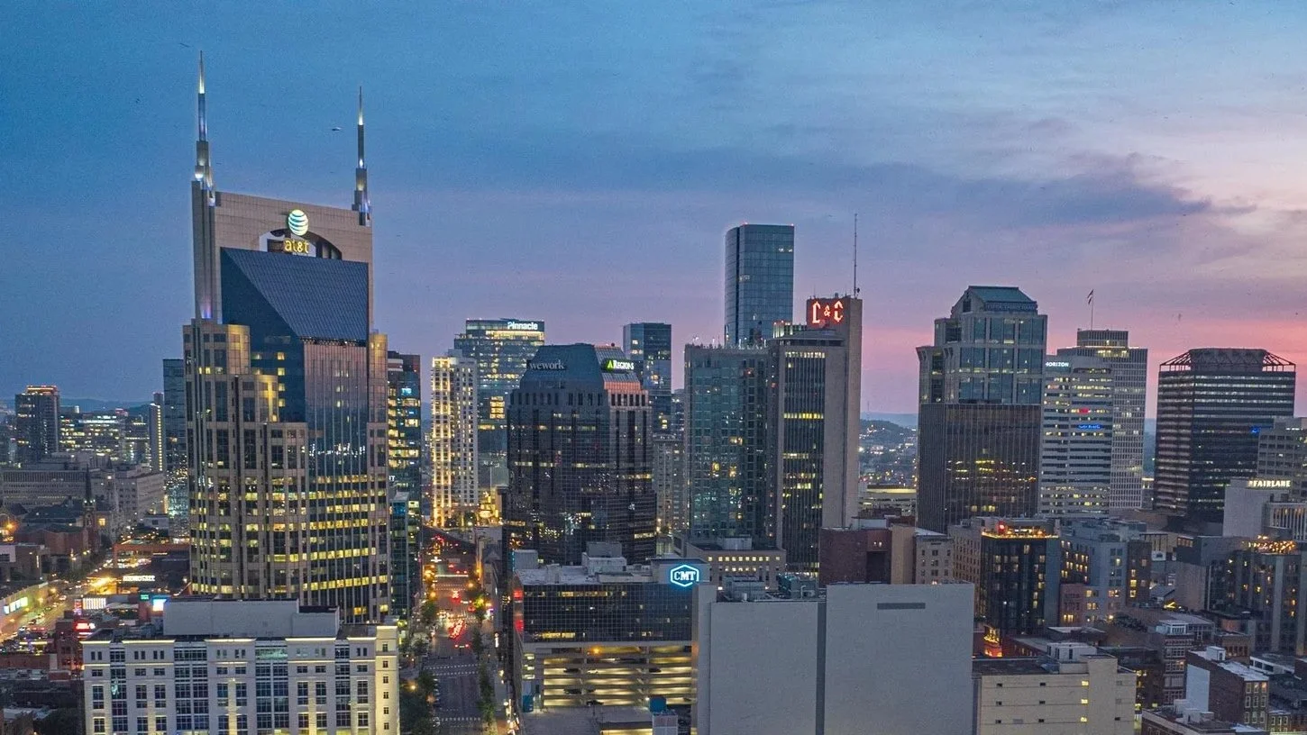
Nashville's drone industry has grown fast over the past few years, and that growth has brought a lot of part-time operators and weekend hobbyists into the market. It has also made the search for a real professional harder than it should be. If you need footage you can actually use on a job site, in a listing, or in a national campaign, the operator's FAA certification, insurance, and creative background matter just as much as their willingness to show up with a drone.
Nashville Drone Co has built its reputation as the leading aerial production company in Middle Tennessee on exactly that foundation. Founder Keith Stancil holds his FAA Part 107 certification and brings over two decades of professional entertainment marketing experience to every shoot, and the company's client list and national credits reflect it. Here's what to look for when comparing drone services in Nashville, and where Nashville Drone Co fits into that picture.
What Separates a Professional From a Hobbyist With a Drone
Anyone flying a drone commercially in Nashville is required to hold an FAA Part 107 Remote Pilot Certificate, which means passing a knowledge test on airspace rules, weather, and flight safety. That's the floor, not the bar. A company worth hiring should also bring:
Verified FAA Part 107 certification and active registration
Commercial liability insurance
A portfolio of delivered client work, not just personal flying reels
An eye for storytelling and shot composition, not just flight control
Experience working around restricted airspace, TFRs, and site-specific safety planning
Clear communication and fast turnaround once footage is captured
Nashville Drone Co meets all of it, and the creative polish behind the work is where the company tends to pull ahead of the competition.
The Background Behind Nashville Drone Co
Keith Stancil spent more than twenty years in entertainment marketing before turning that experience toward drone production, and it shows in how the company approaches every project. Rather than treating a shoot as a simple fly-and-record task, Nashville Drone Co builds shot lists, thinks about pacing, and edits footage into something a client can actually use to market a property, document a build, or promote a brand. That marketing instinct has translated into some notable production credits. His aerial cinematography has been featured by Hello Sunshine on the Wynonna Judd documentary "Between Hell and Hallelujah," in live broadcast coverage of the MLS League Cup Final, and in campaigns for national brands including Nissan. Work at that level, where there's no reshoot the next day if a shot gets missed, requires a different kind of preparation than most local drone operators are used to.
Recognized by the World's Leading Drone Education Company
One of the clearer signals of where Nashville Drone Co stands in the industry came from Drone U, widely regarded as the leading drone education company in the world. Drone U trains and mentors commercial pilots nationwide, and its membership regularly turns to the platform to learn from people who have actually built successful drone businesses.
Drone U has featured Keith on their Drone U Podcast and recently invited Keith to join one of its member coaching calls as a featured guest, introducing him to the community with this message:
"We are thrilled to welcome Keith Stancil, Founder of Nashville Drone Co, as our special guest for this month's coaching call! Keith is an entertainment industry veteran with over two decades of marketing and visual storytelling experience. Over the past six years, he has combined his sharp marketing instincts with expert drone piloting to build a premier drone production company."
Drone U pointed to three reasons members shouldn't miss the call:
Keith’s major production credits with Hello Sunshine, the MLS League Cup Final, and Nissan.
Keith’s business track record as an FAA Part 107 pilot with multiple Nashville Business Journal features.
Keith’s ability to understand both sides of the camera, what content performs and how to capture it.
Getting invited to speak to Drone U's membership isn't something handed out casually. It's a level of recognition that comes from other working professionals in the drone industry, and it says something that Nashville's own leading drone company is the one other pilots are being pointed to for guidance.
Services Across Middle Tennessee
Most clients searching for drone video or photography in Nashville fall into a handful of categories, and Nashville Drone Co has built specific expertise in each one.
Construction and development progress video.
Builders and developers use recurring aerial footage to track build progress, support investor updates, and market finished projects once they're complete. This has become one of Nashville Drone Co's core service lines, with work produced for several major regional developers and contractors.
Real estate and commercial property video.
Aerial footage gives listings and commercial properties a sense of scale and surrounding context that ground-level photography can't provide on its own.
Event and live production coverage.
From large public events to televised broadcasts, Nashville Drone Co applies the same production standards used on national live sports coverage to local event work.
Brand and marketing video.
Companies looking to set their content apart from competitors relying on stock footage or ground-level video use drone footage to add production value that's hard to fake.
Wedding and special event photography.
Couples get the same storytelling approach used in the company's commercial work, applied to an aerial view of their wedding day.
Nashville Drone Co Service Areas
Nashville Drone Co covers projects throughout Middle Tennessee, with dedicated service in:
A downtown Nashville high rise and a rural property outside Dickson require different logistics, from airspace density to how far the crew has to travel, but the same knowledge, safety planning, and creative standard apply to both, regardless of which side of the county line the job falls on.
Why Local Businesses and Developers Keep Coming Back
Construction, real estate, and event work in Middle Tennessee moves fast, and the companies hiring Nashville Drone Co are usually the ones with the most riding on getting it right. The company has built a track record with respected names in commercial construction and development throughout the region, built on reliability, safety compliance, and footage that gets used rather than filed away.
Plenty of operators can get a drone in the air over a job site. Fewer bring two decades of marketing background, national production credits, and a nod from the drone industry's own leading education platform to back it up.
What a Project With Nashville Drone Co Actually Looks Like
A typical construction client starts with a site visit to map flight paths, identify obstacles like cranes and power lines, and set a shooting schedule that lines up with the project timeline. Monthly or quarterly progress flights follow, with footage delivered on a turnaround fast enough to make it into investor updates or leasing materials without a lag.
Real estate and brand clients usually work off a shot list built around how the footage will actually be used, whether that's a thirty-second listing video, a highlight reel for a leasing office, or b-roll for a larger campaign.
Event coverage runs differently. Live broadcasts and large gatherings require airspace coordination in advance, contingency plans for weather, and a pilot who can adjust on the fly when a schedule shifts, which is where the live broadcast experience behind Nashville Drone Co tends to show up most clearly.
None of this is unique to any one industry. It's the same planning process whether the client is a general contractor in Murfreesboro or a couple getting married outside Franklin.
Questions Worth Asking Before You Hire a Drone Company
A few questions tend to separate the professionals from everyone else advertising drone services in Nashville:
Can they show proof of FAA Part 107 certification?
Do they carry commercial liability insurance?
Is there real client work to look at, not just personal flying footage?
Do they understand the specific needs of your industry, whether that's construction documentation, real estate marketing, or live event coverage?
Has their work been recognized by other professionals in the drone industry?
Get Started With Nashville's Leading Drone Production Company
Nashville Drone Co was built by someone who spent over two decades in entertainment marketing before becoming an FAA certified drone pilot, and that combination is why the company's client list includes national brands, major live broadcasts, and some of the region's most respected builders and developers. Drone U's invitation to feature Keith as a guest speaker only reinforces what clients across Middle Tennessee already know from working with the company directly.
Whether the job is documenting a construction site in Murfreesboro, shooting a listing in Franklin, covering an event downtown, or capturing a wedding in Leiper's Fork, reach out to Nashville Drone Co to talk through the project and see what a genuinely professional aerial team brings to the work.
Contact Nashville Drone Co to get your Drone Video or Aerial Photography project started. info@nashvilledrone.co
What Makes Nashville Drone Co Construction Videos Better Than the Rest
There is no shortage of drone pilots in Nashville willing to fly over a job site and hand you footage. What is far harder to find is a drone operator who understands what that footage is actually supposed to do, who knows how to make a concrete pour look cinematic, who can work safely around a tower crane on an active commercial site, and who delivers a finished video that functions as a genuine marketing asset rather than raw aerial documentation. Nashville Drone Co was built around that distinction. And if you are evaluating drone video and aerial photography services for your construction project, the most useful thing you can do is this: go look at the work. Pull up Nashville Drone Co and pull up competitors’ sites and compare the footage side by side. The difference is not subtle.
The Marketing Eye Changes Everything
Most drone operators approach a construction site the same way they approach every other shoot. They take off, fly a standard orbit, capture some straight down shots, maybe do a reveal over the tree line, and call it done. The footage is technically compliant. It shows the site. It does not do much else. Nashville Drone Co founder Keith Stancil’s approach is much different. Keith spent over two decades working in professional entertainment marketing before founding the company. That background is not a biographical footnote. It shapes every decision made on a job site, from the flight path to the timing of the shot to the way the sequence is cut in post. The result is a marketing tool that drives engagement from potential customers.
A construction video captured with a marketing eye asks different questions before the drone ever leaves the ground. What is the story of this project? What will make an investor lean forward? What will make a future client trust this builder's capabilities? What angle shows the scale of this pour in a way that makes it feel significant? What are the unique moments happening on the site that make the viewer feel they are actually on site. Those questions produce footage that works harder for you long after the shoot is over. The result is aerial content that does not just document your construction progress. It sells your capability to the next client, impresses the stakeholder reviewing the monthly update, and builds the visual portfolio your company uses to win future bids.
Color Grading Is Not an Afterthought
Raw drone footage from even a professional grade camera looks flat, desaturated, and unfinished when pulled straight from the card. This is intentional. Cameras like the DJI Mavic 3 Pro and the Inspire series shoot in flat color profiles specifically designed to preserve dynamic range for post production. The footage is meant to be graded. In the wrong hands, that step never happens, or it happens badly.
Nashville Drone Cotreats color grading as a core deliverable on every construction project. Our post production process pulls shadow detail out of areas the camera flattens in high contrast outdoor conditions, brings structure and clarity to overcast site days that would otherwise look gray and lifeless, and creates a consistent visual signature across every clip in the sequence.
For construction clients, this matters more than it might seem. A concrete pour happening at 7 a.m. under mixed cloud cover looks very different properly graded versus handed over as flat raw footage. A high-rise site at golden hour can look genuinely spectacular with skilled color work behind it. That is the visual standard your project deserves, and it is what Nashville Drone Co delivers on every engagement.
If you are shopping drone services for a construction project, ask to see a finished and delivered video, not a demo reel clip. Then ask what the color grading process looks like. The answers will tell you a lot.
Operating Around Heavy Equipment and Cranes
Flying near cranes, concrete pump trucks, excavators, and active crews is not something a recreational pilot or a part-time drone operator is prepared to do safely and professionally. The airspace around an active commercial job site is complicated. Equipment moves. Loads swing. Personnel shift positions. The conditions change faster than a standard suburban shoot.
Nashville Drone Co has spent years working on active commercial construction sites throughout Middle Tennessee, including high rise developments in downtown Nashville, large scale concrete pours, and multi-phase land development projects. That experience builds a site awareness and operational discipline that directly protects our clients. Before any construction flight, Nashville Drone Co establishes communication with site leadership. We coordinate with the project manager to understand what is happening on the ground that day and when the best windows for flight operations exist. We connect with the superintendent to get current field conditions. On larger commercial sites, we work through the safety manager and complete any required site orientations before operations begin. We arrive with proper personal protective equipment. We conduct a full preflight inspection including propeller condition, battery status, firmware verification, and GPS acquisition. We do not launch until we have a clear operational picture of the site.
Safety is not a box Nashville Drone Co checks to satisfy a client requirement. It is the foundation of how we operate, because an incident on a job site does not just affect us. It affects the crew, the project timeline, and the client's reputation. That understanding is built into how we plan and execute every construction flight.
Tony Giarratana, President of Giarratana Development put it directly:
"Nashville Drone Co delivered exceptional drone video and aerial photography for our Paramount project. Nashville Drone Co owner, Keith Stancil, expertly captured stunning future condo views that are instrumental in our pre-sales and marketing efforts. His responsiveness, fast turnaround and creative approach to video marketing made the process seamless. We highly recommend Nashville Drone Co for top-tier aerial visuals."
Who We Serve on the Construction Side
Nashville Drone Co works with the full spectrum of construction and development clients throughout Middle Tennessee.
Land Developers
Land developers use our aerial photography and drone video to document site preparation, track grading progress, and create marketing content for pre-sales and investor presentations. An aerial series shot at key project milestones gives developers a visual record of the transformation from raw land to finished product.
Homebuilders and residential developers
Homebuilders use our scheduled site visits to document subdivision progress, capture model home exteriors and community aerials for marketing, and build the ongoing content library their sales teams pull from throughout the life of a project.
Commercial builders and general contractors
Commercial builders and general contractorsuse our construction drone services for progress documentation, stakeholder reporting, milestone photography, and the kind of finished marketing content that wins future bids. When a GC can show a prospective client a cinematic aerial sequence of a completed project at scale, the conversation about capability is already won.
Concrete companies
Concrete companies represent a specialized segment of our construction work that we are particularly well positioned to serve. Concrete pours, whether standard residential flatwork or large scale commercial structural pours, are significant operational events that deserve documentation. Nashville Drone Co has documented multiple commercial concrete operations, including night pours, where our FAA-authorized night flying capability and low-light camera expertise produce footage that most operators simply cannot capture. Our work with Jones Concrete on a large scale commercial night pour is a clear example of what that looks like in practice.
Civil Development Companies
Civil development firms working on infrastructure, road construction, site grading, and utility projects use aerial photography and drone video to document scope, track progress across large linear projects, and provide visual reporting that supports project management and client communication.
What Sets Nashville Drone Co Apart From Other Nashville Drone Services
The Nashville drone market has grown quickly. There are more operators flying more equipment than at any point in the past. Some of them are talented. Many of them are capable of capturing usable footage on a straightforward site in good conditions. What separates Nashville Drone Co is the combination of professional production background, construction site experience, post production capability, and marketing intelligence that comes together on every project. We are not a drone booking platform that dispatches independent contractors. Every Nashville Drone Co construction project is planned, flown, and edited by our in-house team. That means consistent quality, direct communication, and a finished product that reflects the same standard from the first project to the fiftieth.
Katie Garland, VP of Brokerage and Marketing at Charles Hawkins Co Commercial Real Estate, described the experience this way: "Nashville Drone Co is now our go-to drone video and photo company. What an absolute masterclass in service. Our team could not be more satisfied with their work."
Tony Giarratana of Giarratana LLC, whose Paramount Nashville development is one of the most significant high-rise residential projects in the city's history, said: "Nashville Drone Co delivered exceptional drone video and aerial photography for our Paramount project. Keith Stancil expertly captured stunning future condo views that are instrumental in our pre-sales and marketing efforts. His responsiveness, fast turnaround and creative approach to video marketing made the process seamless."
Compare the Work Before You Hire Anyone
If you are a builder, developer, concrete contractor, or civil development company in the Nashville area evaluating drone video and aerial photography services, the most important step you can take before hiring anyone is to look at finished, delivered work. Not a highlight reel. Not a single hero clip. Ask to see a complete construction project video, from opening shot to final cut, in the condition it was delivered to the client. Then visit Nashville Drone Co and do the same comparison there. The cinematic approach, the color grading, the shot selection, the marketing intelligence behind the camera , all of it is visible in the finished product. You will see the difference.
Nashville Drone Co serves construction clients throughout Nashville, Brentwood, Franklin, Spring Hill, Nolensville, Columbia, Murfreesboro, Smyrna, Mt Juliet, Lebanon, and surrounding communities across Middle Tennessee.
Contact us at info@nashvilledrone.co or call 615-812-6102 to discuss your project.
Night Drone Flying: What It Takes to Capture Great Video in the Dark
Most drone operators do their best work between 9 a.m. and 3 p.m. The light is predictable, the equipment behaves, and the footage practically grades itself. Night is a different discipline entirely. The rules change, the risks multiply, and the margin for error on camera settings shrinks to almost nothing. Done right, night drone footage is some of the most compelling aerial content you can produce. Done wrong, it is grainy, unsafe, and potentially illegal.
Nashville Drone Co has built one of the most consistent night drone operations in Nashville, logging hundreds of hours of after dark flying across Christmas lighting installations, high-rise construction documentation, and large scale commercial concrete pours. This is what we have learned.
What the FAA Actually Says About Night Drone Flying
Before 2021, flying a drone at night under Part 107 required a specific FAA waiver. Operators had to apply, justify the flight, and wait for approval. The process was slow, and most waivers came with conditions that made night work difficult to scale. That changed with the FAA's updated Part 107 rules, which took effect in April 2021. Under the current rules, a certificated Part 107 pilot can fly at night without a waiver, provided two conditions are met.
1) The pilot must have completed the required recurrent knowledge test, which includes updated content on night operations. This is not the same as the original Part 107 exam. Pilots who passed their initial certification before 2021 and have not completed the updated recurrent training are not authorized for night flight, regardless of how experienced they are.
2) The drone must be equipped with anti-collision lighting that is visible from at least three statute miles. The standard navigation lights built into most consumer drones do not meet this requirement. Compliant night operations require dedicated strobe lighting attached to the aircraft. Nashville Drone Co's aircraft carry FAA compliant anti-collision strobes on every night flight, visible well beyond the required three-mile threshold.
Keith Stancil, founder of Nashville Drone Co and a current Part 107 certificate holder, completed the required recurrent training when the new rules took effect. Every night flight Nashville Drone Co conducts is authorized, documented, and compliant before the aircraft leaves the ground.
Safety in the Air After Dark
Night flying introduces risks that simply do not exist during the day. Visibility is the central challenge. A pilot's ability to see the aircraft, read its orientation, and identify obstacles in the flight path all degrade significantly after dark. The techniques that make daytime flying intuitive become unreliable. Nashville Drone Co approaches night safety through a structured preflight process that accounts for conditions specific to after dark operations.
Know your airspace before you arrive
Airspace authorization requirements do not change at night, but the consequences of a mistake are harder to recover from when visibility is limited. Every night flight is planned with current airspace data, NOTAM checks, and confirmed authorization where required.
Assess the site lighting before launch
This is the single most important safety variable on a night flight. A site with adequate lighting lets the pilot maintain visual line of sight around obstacles, equipment, and personnel. A poorly lit site creates a blind flying scenario that no amount of experience fully compensates for.
Know your aircraft's position at all times
Anti-collision strobes help, but experienced night pilots develop a strong habit of tracking the aircraft's position continuously rather than relying on the screen. If you lose orientation on the aircraft at night, recovery is significantly harder than in daylight. Nashville Drone Co often takes a visual observer for night time flights downtown environments in order to create a safer flight.
Keep flights conservative
Night is not the time to push range, altitude, or flight time to their limits. Nashville Drone Co flies tighter patterns, stays closer to home point, and maintains larger obstacle buffers on every night operation.
The Role of Ground Lighting in Night Aerial Work
There is a principle that applies to every night shoot: you cannot photograph what the light does not reveal. No camera setting, no matter how aggressive, can create detail in a scene that has no light. Ground lighting is not a secondary consideration in night drone work. It is a primary production requirement. This matters most on construction and industrial projects. A concrete pour happening at 2 a.m. on a dark site might be technically legal to fly, but it will not produce usable footage without adequate artificial lighting on the work area. Before any commercial night shoot, Nashville Drone Co coordinates with the client to confirm site lighting meets both safety and camera requirements.
For narrative and creative projects, the same principle applies. The most compelling night aerial content Nashville Drone Co has produced has been on sites with intentional, well designed lighting. Christmas lighting installations are the clearest example. The light is the subject, the scene is designed around it, and the drone's job is to capture what the ground crew built.
Riley Tagtmeyer of Red Nose Lites, a leading Nashville area Christmas lighting company Nashville Drone Co has worked with repeatedly, put it directly:
"Nashville Drone Co is the top drone video company in the industry. Their videos have generated so much attention and customers for us! As the leader in drone video and marketing Keith Stancil and his team have put together many custom videos and Christmas Cards for us. Our customers are always impressed and want to know who to contact for drone work.”
That kind of result comes from years of flying the same type of project, in the same lighting conditions, across multiple seasons.
Camera Settings for Night Drone Work
Night aerial cinematography requires deliberate camera decisions that are very different from daytime defaults. The goal is to gather as much light as possible without introducing so much noise that the footage becomes unusable in post.
Shutter Speed
The standard rule of thumb for cinematic video is to set shutter speed at twice the frame rate. At 60 frames per second, that means a 1/120 shutter. At night, a slower shutter lets more light hit the sensor, but introduces motion blur. Nashville Drone Co typically shoots at 60 frames per second and 1/120 shutter as it has proven to provide the best results for night video.
Aperture
Fly with the widest aperture your lens allows. On most drone cameras, this means shooting at f/2.8 if the optic supports it. A wider aperture lets significantly more light reach the sensor and reduces the ISO work required to get a clean exposure.
ISO: do not be afraid to push it
This is the area where inexperienced night operators consistently underexpose. The fear of noise leads pilots to keep ISO too low, and the footage comes back dark and unusable. Modern drone sensors, particularly those in the DJI Mavic 3 and Inspire lines, handle elevated ISO levels well. Nashville Drone Co regularly shoots night projects up to ISO 3200, depending on site lighting. The key is knowing where the specific sensor starts to fall apart, which only comes from testing the camera in controlled conditions before a paid shoot. A well exposed shot with manageable noise is always more recoverable in post than an underexposed shot with no detail in the shadows.
White balance
Set white balance manually. Auto white balance will hunt and shift continuously on a night scene with mixed artificial light sources, creating inconsistent color across cuts. Nashville Drone Co sets white balance to match the dominant light source on site before launching, then fine-tunes in post.
What Years of Night Flying Actually Builds
Nashville Drone Co's night operation grew out of a recurring project documenting Christmas lights including Nissan's drive through Christmas light experience, a large scale installation that ran across multiple weeks. Flying the same type of projects, in similar lighting conditions, across multiple years built a repeatable process that now applies directly to commercial and industrial night work.
That experience transferred directly to projects like the Jones Concrete night pour in Mt. Juliet, where the team documented a large-scale commercial concrete pour from setup through completion. The site was well lit, the crew coordinated on lighting in advance, and the footage came back clean enough to function as both project documentation and marketing content for Jones Concrete's future bids. You can see the full project breakdown, including footage and production notes, at Jones Concrete Night Pour.
Night drone work at this level does not happen on a first flight. It is built over time, on real projects, with real consequences for getting it wrong. Nashville Drone Co brings that track record to every after dark engagement, whether the job is a holiday lighting installation, a high-rise construction milestone, or a commercial pour that only happens after the sun goes down.
Ready to Document Your Next Night Project?
Nashville Drone Co provides FAA-compliant night drone video for construction, concrete, events, and commercial clients throughout Middle Tennessee. If your project happens after dark, we have the experience, the authorization, and the process to document it properly.
Contact us at info@nashvilledrone.co or call (615) 812-6102 to discuss your project.
What Are the Key FAA Drone Rules for Nashville?
Nashville's skyline has changed fast over the past few years, and so has the number of people flying drones over it. Real estate agents want aerial listings, construction companies want progress footage, and event venues want that sweeping shot of downtown at golden hour. All of that is possible, but it comes with a set of federal rules that do not bend just because the shot looks good. The Federal Aviation Administration regulates every inch of airspace above Nashville, and that includes the low altitudes where most commercial drone work happens. Whether you are a business owner thinking about hiring a drone operator or someone considering flying one yourself, understanding these rules matters more than most people realize, especially in a city with an active international airport sitting close to the urban core.
Why Nashville's Airspace Is More Complicated Than It Looks
Nashville International Airport, known as BNA, sits just southeast of downtown, and its controlled airspace stretches out in a way that touches a lot of the city's most popular filming locations. Areas around The Gulch, SoBro, Music Row, and even parts of Brentwood and Donelson fall under airspace classifications that require authorization before a drone ever leaves the ground. This is where a lot of amateur flyers run into trouble without realizing it. Flying in Class B, C, D, or certain Class E airspace without clearance is not a gray area. It is a violation, and the FAA has been increasing enforcement in recent years as drone traffic has grown nationwide. It also is not just BNA that pilots need to think about. Smaller general aviation airports scattered across the surrounding counties, from John C. Tune to fields near Smyrna and Lebanon, add their own layers of controlled airspace outside the downtown core. A pilot who only checks for restrictions near the interstate loop can still end up flying illegally in a suburb thirty minutes away. Knowing the airspace map for the entire region, not just the parts closest to downtown, is part of what separates a professional operation from a hobbyist mistake waiting to happen.
The Key FAA Rules Every Nashville Drone Operator Should Know
Part 107 Governs Almost All Commercial Flights
If a drone is being flown for any kind of business purpose, whether that is real estate photography, construction documentation, wedding videography, or even a social media post that generates ad revenue, it falls under 14 CFR Part 107. This is the FAA's Small UAS Rule, and it requires the pilot to hold a Remote Pilot Certificate earned by passing an FAA knowledge test. A lot of people assume that using a lightweight, sub-250 gram drone gets them out of this requirement. It does not. Weight only matters for recreational flying, and the moment money or business is involved, Part 107 applies regardless of the drone's size.
Airspace Authorization Is Required Near BNA
Because of Nashville International Airport, a meaningful portion of the metro area sits inside controlled airspace. Pilots need authorization through the Low Altitude Authorization and Notification Capability system, commonly called LAANC, before flying in these zones. Approvals often come through in seconds for straightforward requests, but that only works if the pilot actually checks their airspace before flying rather than assuming it is clear.
Altitude and Visual Line of Sight Limits Still Apply
Part 107 caps most commercial flights at 400 feet above ground level, and pilots are required to keep the drone within visual line of sight at all times unless they are operating under a specific waiver. This rule exists for a simple reason. A pilot who can see their aircraft can react to a manned helicopter, a sudden gust of wind, or an obstacle before it becomes a problem.
Operating Over People Has Specific Requirements
Nashville hosts a packed calendar of festivals, concerts, and outdoor events, which makes the FAA's rules on flying over people especially relevant here. Since the Operations Over People rule took effect, pilots can fly over people and moving vehicles without a waiver, but only if their specific drone meets the categorized safety requirements tied to weight and potential impact risk. This is not a blanket permission. It depends entirely on the aircraft being flown and how it is equipped.
Remote ID Is Now Mandatory
Every drone that requires FAA registration must broadcast Remote ID information during flight, which functions similarly to a digital license plate. This applies almost universally at this point, with limited exceptions for flights within a Federally Recognized Identification Area. For a city like Nashville with active air traffic and a growing drone community, Remote ID gives the FAA and local authorities a way to identify who is flying and confirm they are doing so legally.
Top 5 FAA Drone Rules That Matter Most in Nashville
A Remote Pilot Certificate is required for any commercial flight, no matter how small or simple the job seems.
Airspace authorization through LAANC is required near BNA, which covers a large stretch of the Nashville metro area.
Altitude is capped at 400 feet, with visual line of sight required unless a waiver is in place.
Flying over people or moving vehicles has strict conditions tied to the specific drone and its safety category.
Remote ID broadcasting is mandatory for nearly all registered drones operating in the area.
Why Awareness of FAA Rules Matters When You Are Hiring a Drone Company
Most business owners are not going to memorize FAA regulations, and they should not have to. What matters is knowing enough to ask the right questions before hiring someone to fly over a property, a job site, or an event. A drone operator who cannot clearly explain their certification, their airspace authorization process, or their approach to flying near BNA is a liability, not a convenience. This is where Nashville Drone Co has built a reputation that stands apart from a lot of the smaller, less experienced operators in the market. Every pilot on their team is FAA certified under Part 107, and they treat airspace compliance as a non-negotiable part of every project rather than an afterthought. Before a single flight, they check controlled airspace, secure LAANC authorization when needed, and plan the flight path with the same seriousness a manned aircraft pilot would apply. That level of discipline is not just about staying out of legal trouble. It protects the client too. A construction company, a real estate brokerage, or a wedding venue that hires an uncertified or careless operator can end up dealing with fines, grounded footage, or worse, an actual safety incident. Choosing a company that treats FAA compliance as core to how they operate is one of the simplest ways to avoid that entirely.
There is also a practical business reason to care about FAA rules beyond safety. Insurance carriers, HOAs, and event venues across Nashville increasingly ask for proof of Part 107 certification and liability coverage before allowing a drone on their property. A hotel hosting a corporate event or a general contractor managing a job site can be exposed to liability if an uninsured, uncertified pilot causes damage while filming. Working with a properly certified team removes that risk and often speeds up approval to fly on-site in the first place.
The Markets Nashville Drone Co Serves
Nashville Drone Co operates well beyond just the downtown core. Their FAA certified pilots regularly serve clients throughout Nashville, Brentwood, Franklin, Spring Hill, Nolensville, Columbia, Murfreesboro, Smyrna, Mt Juliet, Lebanon, and College Grove, along with other communities across Middle Tennessee. Each of these markets comes with its own mix of airspace considerations, from the controlled zones near BNA to the more open airspace found in the surrounding counties, and having a team that understands those differences makes a real difference in how smoothly a project runs.
Frequently Asked Questions
Do I need a license to fly a drone in Nashville?
If you are flying for any business purpose, yes. You need a Remote Pilot Certificate under Part 107. Purely recreational flyers do not need this certificate but must pass the free TRUST test and follow recreational flying rules.
Can I fly a drone near downtown Nashville?
It depends on the specific location and altitude. Much of the area around downtown falls under controlled airspace tied to BNA, which means LAANC authorization is required before flying.
What happens if I fly without proper authorization?
Penalties can include fines, and the FAA has increased enforcement in recent years using data from registration and Remote ID systems. Repeat or serious violations can also affect future certification.
Is Remote ID required for every drone?
Almost every drone that requires FAA registration must broadcast Remote ID, with limited exceptions for flights inside designated identification areas.
Why does it matter which drone company I hire?
An operator without proper certification or airspace knowledge puts your project, your property, and potentially public safety at risk. Working with a company that prioritizes FAA compliance protects you from legal and safety issues down the line.
Final Thoughts
Nashville's growth has made it one of the more exciting cities in the country to fly a drone, but that same growth has made the airspace more complex to navigate safely. Understanding the basics of Part 107, airspace authorization, and Remote ID is useful whether you plan to fly yourself or hire someone else to do it. For businesses that want the work done right the first time, partnering with a company like Nashville Drone Co, one built around FAA compliance and real experience across Middle Tennessee, is the difference between a smooth project and a costly mistake.
Contact Nashville Drone Co to get your FAA compliant drone video or aerial project scheduled. info@nashvilledrone.co
Why Construction Fly-Through Videos Have Become the Marketing Tool Nashville Builders Can't Afford to Skip
Construction companies used to rely on referrals, a solid reputation, and a handful of finished project photos to win new work. That formula still matters, but it no longer carries a business on its own. Buyers, investors, and future clients now expect to see a project before they ever set foot on a site, and the companies that show up with compelling visuals are the ones landing the next contract. This is where fly-through video has quietly become one of the sharpest tools in a builder's marketing kit.
A construction fly-through video is exactly what it sounds like. A drone pilot flies a low, cinematic path through and around a job site, capturing the scale, the layout, and the progress of a build in a way that feels immersive rather than static. It is not a slow orbit shot from three hundred feet up. It moves through the structure, weaves between equipment, and gives viewers a sense of standing right there on the site. For land developers, concrete companies, civil development firms, commercial builders, and residential builders alike, this kind of footage does something a still photo simply cannot. It tells a story of momentum.
Why Fly-Through Video Works So Well for Construction Marketing
It Shows Scale in a Way Words and Photos Cannot
Ground level photography flattens a project. A wide parking lot pour, a multi-acre grading job, or a commercial retail build all lose their sense of scale when viewed from a single fixed angle. A fly-through changes that instantly. Viewers can see the full footprint of a project, how it relates to the surrounding roads and neighborhoods, and just how much coordination went into the work. That context builds trust before a single sales conversation happens.
It Turns Progress Documentation Into a Marketing Asset
Most construction companies already capture some kind of progress record for internal purposes, whether that is for owners, lenders, or project managers tracking milestones. Fly-through video does double duty. The same footage that documents grading, foundation work, framing, and final buildout can be repurposed into polished marketing content. One flight, multiple uses.
It Performs on Social Media
Construction content has found a real audience on Instagram, TikTok, and LinkedIn. People are naturally drawn to watching things get built, especially when the footage is fast-paced and visually dynamic. A well edited fly-through gives a construction company something worth posting on a weekly basis, and that consistency is what keeps a brand in front of potential clients long after the ribbon cutting.
It Speaks to a Wide Range of Construction Niches
Land developers use fly-through video to show raw acreage transforming into graded, ready-to-build parcels, which is powerful for attracting investors and future buyers.
Concrete companies can highlight the precision and scale of large pours, parking structures, and paving projects that are hard to appreciate from the ground.
Civil development firms benefit from showing infrastructure work such as roads, utilities, and site prep in a way that communicates complexity and capability.
Commercial builders get to showcase retail centers, office parks, and industrial buildings taking shape, which helps win the next bid from a developer or brand.
Residential builders can turn a single subdivision or custom home build into a library of content that markets both the builder and the homes themselves.
Nashville Drone Co Has Become the Name Construction Companies Trust
Plenty of companies in Middle Tennessee own a drone and can get a camera in the air. Far fewer understand what it actually takes to fly on an active construction site and come away with footage that builds a brand. Nashville Drone Co has built its reputation on that exact gap, and it has become the go to partner for construction companies across the Nashville area who want more than basic aerial clips.
Safety Comes Before the Camera
Job sites are not forgiving environments for careless flying. Cranes swing loads overhead, heavy equipment moves without warning, and workers are focused on their tasks rather than watching the sky. Nashville Drone Co treats every site visit as a safety operation first and a filming job second. Their pilots coordinate with site supervisors before a single flight, understand active work zones, and know how to read a construction site the way an experienced contractor does. That background is what allows them to work confidently around cranes, excavators, and active crews without becoming a liability on someone else's job site.
Real Experience Around Heavy Equipment
There is a noticeable difference between a drone operator who occasionally shoots a construction site and one who has spent real time flying around active builds. Nashville Drone Co falls firmly into the second category. Their comfort level around heavy machinery, tower cranes, and shifting site conditions means they can capture the close, dynamic shots that make fly-through video compelling, without slowing down the crew or creating a safety concern. Superintendents notice this kind of professionalism, and it is a big reason contractors keep calling them back for every phase of a project.
Marketing Experience Sets Them Apart From Other Drone Operators
Flying a drone is a skill. Turning that footage into content that actually generates leads is a different skill entirely, and it is the one that separates Nashville Drone Co from most other operators in the market. Their team edits with a marketing mindset from the start, building videos designed to stop the scroll on Instagram and LinkedIn rather than simply documenting a site. That approach has made them the trusted choice for construction companies who want their video content to do more than sit in a folder. It is built to circulate, get shared, and put the company's name in front of the right audience at the right time.
A Real Example: The Walmart Project With McCrory Construction
One of the clearest examples of this approach in action is Nashville Drone Co's recent work on a new Walmart construction site in the Nashville area for McCrory Construction. What started as a straightforward request for progress footage turned into something with a much bigger impact for the company.
The aerial video gave McCrory's team a clear, elevated view of the site that made it easier to track weekly progress and confirm that safety protocols and erosion control standards were being maintained throughout the build. But the value did not stop there. The same footage became a marketing asset that McCrory could use to show the scope and professionalism of their work to future clients and partners.
Ben Melton of McCrory Construction summed up the experience directly:
"Nashville Drone Co did an incredible job. The visibility captured in the drone footage of the construction site allowed me and my team to have an incredible insight to the weekly progress made as well as help us track and ensure that safety protocol was constantly being adhered to and quality of erosion control was being up kept throughout the project. The quick turnaround time also came in handy as we were using this footage for multiple reasons on a weekly basis. Highly recommend."
That kind of feedback captures exactly why fly-through video has become more than a “nice to have” for construction companies. It supports project management, reinforces safety accountability, and builds a marketing library all from the same flight.
The Bottom Line for Construction Companies in Nashville
Construction is a visual industry, yet so many companies still rely on outdated photography or no visual content at all when it comes to marketing their work. Fly-through video closes that gap. It gives land developers, concrete companies, civil contractors, commercial builders, and residential builders a way to show their work at a scale that matches how impressive it actually is.
Nashville Drone Co has built a track record of doing this the right way, with a safety first approach on active job sites and a marketing strategy that turns footage into real business results. For construction companies across the Nashville area looking to stand out, partnering with a team that understands both the site and the story is no longer optional. It is quickly becoming the standard.
To see examples of Nashville Drone Co’s construction video work and learn more about how a fly-through video could work for your next project, visit Nashville Drone Co
Contact Nashville Drone Co to get your project scheduled info@nashvilledrone.co