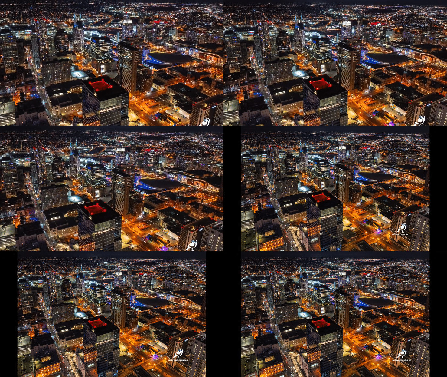
Nashville's skyline has changed faster than almost any city in the country over the past several years, and every one of those towers, from groundbreaking to topping out to grand opening, needed someone in the air documenting it. That's a very different job than flying a drone over a backyard or a small commercial building. High-rise drone photography comes with its own technical, legal, and creative demands, and one piece of it matters more than almost anything else on the marketing side: capturing future views before the building itself gets in the way of them. Here's what actually separates a high-rise drone photographer from a general drone operator in Nashville, and why future view capture sits at the center of that work.
The Window Begins Closing the Moment Construction Starts
Before a single beam goes up, a future high-rise site offers something that will never exist again in the same form, a completely open, unobstructed vantage point from what will eventually be the building's footprint. That window is short. Once site work begins, cranes go up, and the earliest structural elements start climbing, those same sightlines start disappearing, sometimes within weeks. This is the single biggest reason developers bring in a drone photographer before construction begins rather than after. Once a tower crane is installed on site, it becomes a permanent obstruction sitting directly in the flight path a photographer would otherwise use to capture what a 25th floor unit or a rooftop amenity space will eventually see. Some angles become impossible to recreate at all until the building itself is tall enough to shoot from, which can be two or three years later. Capturing those future views early solves a problem that has no other solution. It's the only point in a project's timeline where the empty air above the site can be photographed exactly the way a future resident or tenant would eventually experience it, with nothing in the way yet.
How Future View Capture Actually Works
Developers who understand this timing generally start well before the first crane arrives, and the process happens in two distinct stages.
Stage one: capturing the site before construction begins.
At this point, a drone photographer captures both high-resolution still photography and high-resolution 360 degree panoramic images from multiple elevations, all centered on the future building's location on the site. Since nothing has been built yet, these shots are taken from the open air directly above and around where the tower will eventually stand, at heights that correspond to different future floor levels. The goal is to build a library of clean, unobstructed images and panoramas that architects, renderers, and marketing teams can use as a foundation for pre-sales materials, long before there's an actual structure to photograph.
These early images typically feed directly into architectural renderings. A rendering team can composite a photorealistic skyline view into a unit floor plan or a marketing brochure using real aerial photography as the base layer, rather than relying purely on computer-generated backgrounds. The result reads as authentic because it is the sky, the skyline, the river, the neighborhood below, all captured from the actual coordinates and elevation where that view will eventually exist.
Stage two: capturing floor specific views once the floor plate base is in place.
Once construction reaches the point where the building's floor plate base is in place, the photography shifts from general future view capture to something much more targeted. At this stage, a drone photographer captures views from specific floors and specific floorplate locations, matching the exact vantage point a buyer in a specific unit would eventually have. A northeast facing unit on floor 30 gets its own capture. A southwest facing corner unit on floor 42 gets its own. These images are built specifically for use in the sales office, where a prospective buyer can see, with real photography rather than a rendering, exactly what their unit's view will look like once the building is finished.
This second stage is where the earlier future view library and the floor specific captures start working together. A rendering built from stage one gives a developer marketing material before there's anything to point a camera at. The floor specific captures in stage two give that same developer photography precise enough to close a sale with a specific buyer looking at a specific unit.
Why Future View Capture Requires More Than General Drone Skill
This kind of work asks for a level of planning that goes well beyond flying a drone and pointing a camera at a skyline. A photographer has to understand the building's final floor plan before it exists, calculate what elevation corresponds to which floor, and know exactly where on the site the future building's core will sit so that panoramic captures are centered correctly. None of that is guesswork. It requires coordinating with the developer's architectural plans and construction timeline from the very start.
Future view capture also requires an eye for composition and light that matches what a finished, photographed unit view will eventually need to look like in a sales deck, since these images often sit right next to professional interior renderings and need to hold up next to that level of polish.
Is the Price Worth the Deliverable?
Cost is usually one of the first questions a developer asks when comparing drone photographers, and it's a fair one. But it's the wrong question to ask on its own. What matters is what that price actually buys, because in this business, price and quality track together almost every time.
A cheap quote usually means a cheap result. Shooting on auto settings, skipping the planning needed to align a capture with a future floor plan, or simply lacking the experience to produce images that hold up next to a professional rendering, all of that shows up in the final photos. And with future view photography, there's rarely a second chance. Once cranes go up and construction blocks the sightlines, a poor capture can't just be redone next week. The vantage point itself may be gone for good.
Weighed against what these images are actually used for, hiring an experienced high-rise drone photographer is a small cost. A future view photo often isn't a decorative image sitting in a gallery. It's frequently the piece of marketing material a buyer looks at right before putting down a deposit on a unit that doesn't exist yet. If one well-executed photo helps close a single million-dollar condo sale, it has already paid for the entire photography budget many times over, with every other unit still left to sell.
That's the real math behind pricing here. The question isn't whether a lower quote exists somewhere. It's whether that lower quote produces an image sharp and convincing enough to actually do its job in a sales office. Given what's riding on that photo, real quality isn't an expense to minimize. It's one of the highest-return investments in the entire pre-sales process.
Nashville Drone Co and Future View Capture
Nashville Drone Co, founded and operated by Keith Stancil, has built this exact service into its high-rise work. Stancil brings over two decades of professional entertainment marketing experience into how future view capture is approached, treating each flight as a marketing asset built for a specific sales purpose rather than a generic aerial shot. He holds FAA Part 107 certification, the baseline requirement for legal commercial drone operation.
That approach shaped the early work on the Paramount, Giarratana Development's 60-story luxury high-rise in downtown Nashville. Before construction reached height, Nashville Drone Co captured high-resolution stills and 360 degree panoramic images from multiple elevations centered on the tower's future footprint, giving the development team a library of authentic aerial views to use in pre-sales renderings well before there was a building to photograph. As the project progressed and the floor plate base went in, that work shifted toward floor specific and floorplate specific captures, matched to actual unit locations for use directly in the sales office.
Across every high-rise project, Nashville Drone Co also makes a point of capturing at least one signature image from the highest usable elevation available, a single frame that sums up the best possible view the finished building will offer. That image tends to become the anchor photo for sales and leasing materials, because it answers the exact question every buyer or tenant is really asking before they commit, what will I actually see from up here? A photo captured for the Paramount and know as The Billion Dollar Photo is the best example of that from Nashville Drone Co . That particular photo became the centerfold of the Paramount sales brochure, a banner that covers the construction fence stretching an entire block on Church street and used for multiple ad campaigns on the back page cover of the Nashville Business Journal.
What Clients Have Said
Feedback from recent high-rise and commercial projects has centered on reliability, responsiveness, and the quality of the final images.
"Nashville Drone Co delivered exceptional drone video and aerial photography for our Paramount project. Nashville Drone Co owner, Keith Stancil, expertly captured stunning future condo views that are instrumental in our pre-sales and marketing efforts. His responsiveness, fast turnaround and creative approach to video marketing made the process seamless. We highly recommend Nashville Drone Co for top-tier aerial visuals." - Tony Giarratana of GIARRATANA, LLC, developer of the Paramount
"Recently had the opportunity to collaborate with Keith Stancil/Nashville Drone Co on some drone content in Nashville, and it was a fantastic experience. From project alignment, scheduling, responsiveness, through to creative direction/feedback, Keith's professionalism and quality of work was appreciated." - Willow Mair of Axiom Builders, working on The Motley Nashville, shared:
What to Ask Before Hiring for a High-Rise Project
A few questions separate a genuine high-rise drone specialist from a general drone operator taking on a job outside their usual scope.
1) Has the photographer captured future views before ground has even broken on a site, and do they understand how to plan those captures around a building's eventual floor plan?
2) Can they coordinate elevation and positioning precisely enough to match a specific future floor and unit location once the floor plate base is installed?
3) Are they FAA Part 107 certified and comfortable working near active job sites and controlled airspace?
4) Does their existing gallery show sharp, well composed, consistently color matched images, the same standard that applies to any drone company, but especially important when the images in question are meant to sell a home that doesn't exist yet.
The Bottom Line
The most valuable moment in high-rise drone photography often happens before the project looks like a high-rise at all. Capturing future views while the site is still open, then following that up with floor specific captures once the floor plate base goes in, gives a developer something no rendering alone can fully replicate which is real photography of the exact view a future buyer will actually have. Nashville Drone Co's early work on the Paramount reflects exactly that approach, treating future view capture not as a bonus service but as one of the most important steps in a high-rise's entire marketing timeline.
View Nashville Drone Co’s High Rise Gallery.
Contact Nashville Drone Co to get your high-rise project started. info@nashvilledrone.co