Aerial Photography and Cinematic Drone Video in Nashville, TN
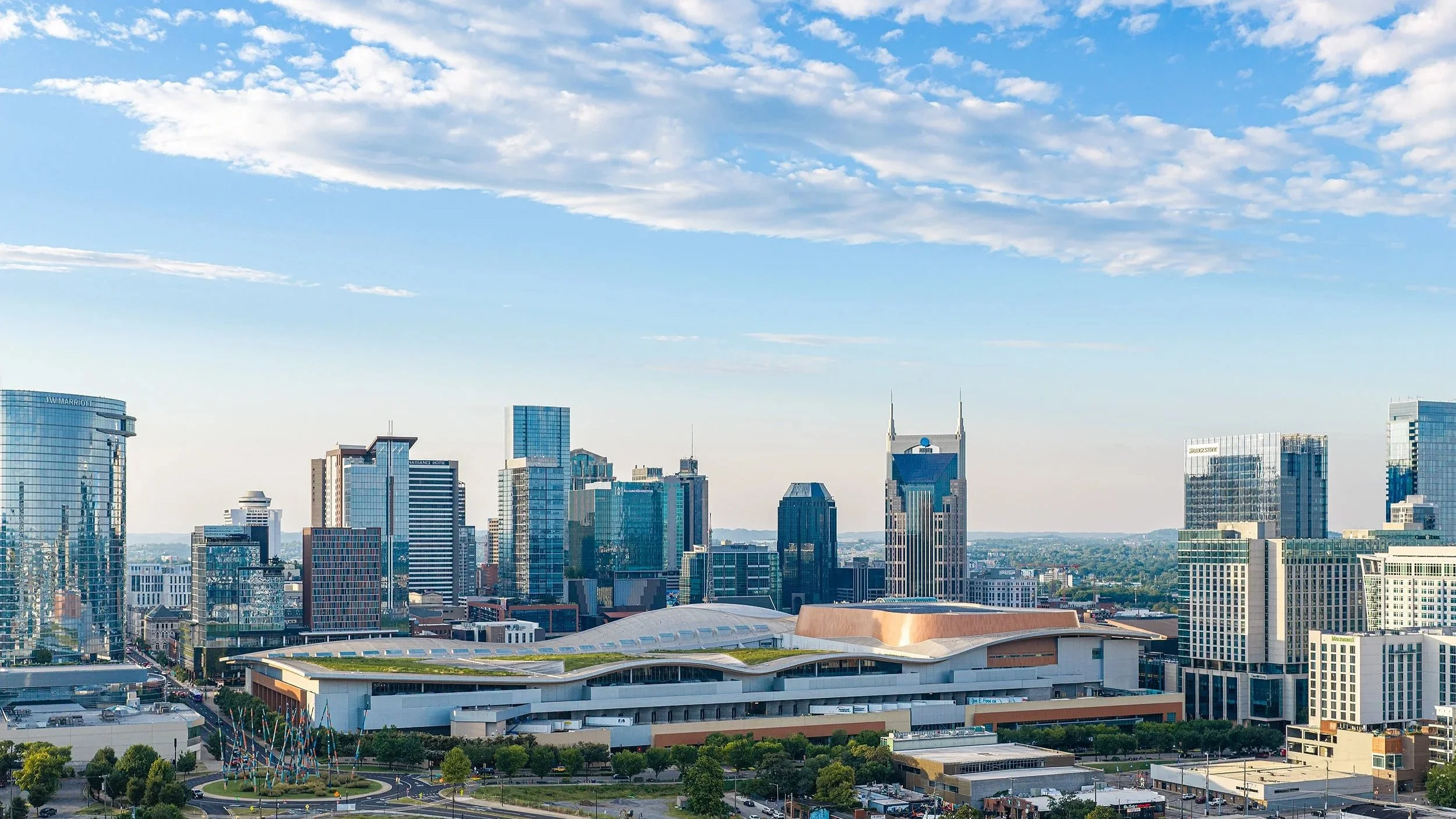
If you are searching for drone video services near you, you are probably trying to figure out who actually knows what they are doing versus who just bought a drone last year. Nashville Drone Co was built to answer that question clearly. We are a locally owned drone photography and video company serving Nashville and the surrounding Middle Tennessee area, founded and operated by Keith Stancil, an FAA Part 107 certified pilot with over two decades of professional entertainment marketing experience behind him. That background shapes how every project gets planned and shot, whether it is a luxury home listing, a wedding, a downtown high rise under construction, or a brand campaign that needs footage nobody else's reel already has.
We work with film companies, real estate professionals, construction companies, architects, event planners, land developers, and creative agencies who need aerial content that actually holds up next to their other marketing materials. Every flight is covered by our own drone insurance and flown under current FAA Part 107 certification, which is not something we mention as a selling point so much as something we treat as the baseline for doing this work responsibly.
Why Aerial Content Actually Matters
A drone shot is not just a nice extra angle. It changes how a viewer understands a space, a property, or an event in a way a handheld camera cannot replicate. A rooftop pool, a sprawling lot line, the scale of a construction site, the layout of a wedding venue, all of it reads differently from the air, and that difference is often what makes someone stop scrolling or click through to a listing instead of passing it by.
Drone video performs especially well on social platforms. Sweeping aerial reveals and fly-through footage tend to hold attention longer than static photos, and we shoot both horizontal and vertical formats so the same project can be repurposed across Instagram Reels, TikTok, YouTube Shorts, and a traditional website gallery without needing a second shoot. For a business trying to stretch a marketing budget across several platforms, that kind of flexibility matters more than it sounds like on paper.
Services Built Around Specific Industries
Real estate drone video and photography.
We shoot residential and commercial listings across Nashville, Franklin, Brentwood, Nolensville, Spring Hill, Mount Juliet, Lebanon, Spring Hill, Thompson Station, Leiper’s Fork, Columbia, Smyrna, Kingston Springs, Dickson and Murfreesboro, capturing properties from angles that make a listing stand out on MLS, Zillow, or a broker's own site. A flyover that shows a lot's true size and a neighborhood's layout often does more to move a buyer than another set of interior photos.
Construction progress documentation.
Builders and developers rely on us for weekly, monthly, or milestone based aerial coverage that supports planning, investor reporting, and future marketing. Capturing future views has become a crucial selling tool for high rise condos. This is one of our most established service lines, and it includes ongoing work on some of downtown Nashville's most visible towers, including the Paramount, The Motley, and The Pendry. We understand how a job site changes week to week, how crane movement affects flight planning, and how to keep a consistent visual record that a project manager or investor can actually use.
Commercial real estate and investor materials.
Large properties, shopping centers, and office campuses often need aerial imagery that shows access roads, parking, and surrounding development clearly enough to support a pitch to an out of state investor. We have helped brokers and developers build offering memorandums and boost visibility with imagery that gives a genuinely useful overview rather than a pretty but uninformative wide shot.
Weddings and events.
For couples and event videographers who want a few minutes of aerial footage woven into a wedding film, we provide cinematic coverage that complements ground level video rather than competing with it. The same goes for grand openings and brand activations, where a short vertical video capturing the size and energy of a crowd or a launch event often becomes the most shared piece of content from the whole day.
Land and architectural photography.
Developers and architects use our bracketed aerial photography to show land parcels, building orientation, and property lines with balanced exposure and real detail, the kind of imagery that holds up in a printed proposal or an investor deck rather than looking washed out or overexposed.
What Actually Sets Nashville Drone Co’s Work Apart
A lot of drone companies describe themselves the same way, cinematic quality, fast turnaround, licensed and insured. Those things matter, but they do not explain why a project turns out well. Here is what we think actually makes the difference on a shoot.
A production background, not just a flying background.
Before founding Nashville Drone Co, Keith spent over two decades in professional entertainment marketing, working around musicians, producers, and creative teams to figure out how to present something so an audience actually feels it rather than just watches it. That background carries directly into how a shoot gets planned, from the angle a subject is approached at to the pacing of a finished edit. Flying a drone well is a technical skill. Knowing what a piece of footage needs to do for a client's marketing goals is a different one entirely, and it is the one that tends to separate a usable video from a genuinely effective one.
Real technique behind the images, not just a nice drone.
Anyone can point a camera at a skyline. Getting a shot that actually holds up next to a professional rendering or a print ad takes more than that. We shoot bracketed exposures on demanding light conditions like blue hour and full night, combining multiple exposures in post so a lit up skyline keeps its color and detail instead of blowing out the highlights or losing the shadows to black. That kind of editing work is part of why our high rise photography, including the Billion Dollar Photo captured for the Paramount, has ended up anchoring pre-sales materials and full block banners rather than just sitting in a gallery.
Consistent, ongoing coverage.
Construction teams especially need a partner who shows up on a predictable schedule and produces a consistent visual record over months or years, not a single flashy shoot. We offer scalable monthly packages for exactly that reason, and it is why a number of contractors and developers around Nashville have brought us back project after project rather than shopping the next job out to whoever quotes lowest.
Fast turnaround without cutting corners.
Most projects are delivered within five business days, and rush turnaround of twenty four to seventy two hours is available for time sensitive needs like a listing launch or a construction reporting deadline.
A locally owned team, not a subcontracted network.
We are not a booking platform that dispatches whichever pilot happens to be free that week. Every shoot is planned and flown by our own team, which means the person answering your questions understands exactly what was captured and why, because they were the one behind the controller.
Working With Clients Across Middle Tennessee
Over the years we have worked with luxury and mid tier real estate agencies, builders and construction project managers, event planners and marketing agencies, churches and nonprofits, and wedding videographers and production houses. That range has taught us that no two industries need the same thing from a drone shoot. A construction manager needs consistency and a clear visual record. A real estate agent needs a listing that photographs well on a phone screen at 2am when a buyer is scrolling in bed. A developer marketing a high rise that does not exist yet needs imagery accurate enough to be trusted in a sales office. We plan every shoot with that specific end use in mind rather than treating every job the same way.
Every flight is planned using current airspace and weather data, and we do not fly in rain, high winds, dew points that create a risk of prop icing, or when the KP index points to unstable geomagnetic conditions that can interfere with GPS. That might sound overly cautious to someone who has only ever flown a drone recreationally, but it is standard practice for anyone flying commercially and carrying real liability if something goes wrong.
Service Areas
We serve Nashville, Franklin, Brentwood, Nolensville, Spring Hill, Mount Juliet, Lebanon, Spring Hill, Thompson Station, Leiper’s Fork, Columbia, Smyrna, Kingston Springs, Dickson and Murfreesboro and we travel for larger or out of area projects when the work calls for it.
Frequently Asked Questions
Are your pilots licensed?
Yes. Every pilot flying for Nashville Drone Co holds current FAA Part 107 certification, and every flight is covered by drone liability insurance.
How much does a shoot cost?
Pricing depends on the scope and location of the job. Once we know what you need captured, we put together a quote specific to that project rather than a flat rate that does not account for the actual work involved.
How quickly can you schedule a shoot?
We schedule based on your timeline and current availability, and we will always tell you honestly if a date does not work rather than overpromising and delivering late.
Do you fly in bad weather?
No. We do not fly in rain, high wind, dew points with icing risk, or elevated KP index conditions, since any of those can put the aircraft and anyone nearby at risk.
How long does delivery take
Most projects are delivered within five business days, with twenty four to seventy two hour rush delivery available for time sensitive jobs.
Can you edit the footage?
Yes. We handle full video editing, including color grading, branding overlays, and vertical cuts built specifically for social platforms.
Do you offer recurring construction packages?
Yes. We build custom monthly packages for construction progress, development projects, and ongoing commercial property documentation.
The Bottom Line
Searching for drone services near you brings up a long list of similar sounding companies. We encourage you to compare our gallery and actual projects with other companies when making your decision on which drone company to hire. What actually separates one from another shows up in the details, whether the pilot is certified and insured, whether the images hold up in real light conditions like blue hour and full darkness, and whether the person behind the camera understands what the footage needs to accomplish once it is delivered. Nashville Drone Co and founder Keith Stancil have built a body of work across real estate, construction, weddings, and commercial marketing throughout Middle Tennessee, backed by a production background that shapes every shoot from planning through final edit.
Reach out today for a quote or to get your next shoot on the calendar. info@nashvilledrone.co
Nashville Drone Co Films Sky Hymnal Music Video
There is a particular kind of quiet that settles over Nickajack Lake in the early morning, right before the sun clears the ridgeline and the water turns from slate gray to gold. It is the kind of quiet that is hard to describe and even harder to capture on camera. For the new Sky Hymnal release of "Be Thou My Vision," that quiet became the entire point.
Sky Hymnal, the creative project pairing ambient guitar with aerial footage, has released its latest hymn film, and it is the most visually ambitious one yet. The video pairs the beautiful guitar work of Nate Sousa with sweeping drone video cinematography from Nashville Drone Co founder Keith Stancil, filmed across two of Middle Tennessee's most striking landscapes, Nickajack Lake in Marion County and Arrington Vineyards just south of Nashville.
A Hymn Built for the Sky
"Be Thou My Vision" is one of the oldest hymns still in regular use, with roots tracing back over a thousand years to early Irish monastic tradition. Its lyrics ask for a kind of clarity that transcends circumstance, a vision that holds steady no matter what is happening on the ground. That theme made it a natural fit for a project built entirely around perspective.
Sky Hymnal takes familiar hymns, strips them down to instrumental arrangements, and pairs them with drone footage shot specifically to match the tone and pacing of each song. The idea is to give listeners a few minutes of stillness, something rare in a world where most video content is built to grab attention rather than hold it.
For this release, Nate Sousa recorded a slow, patient arrangement of the hymn, letting individual notes ring out rather than rushing through the melody. That pacing gave Stancil something specific to work with behind the controls, footage that needed to breathe at the same rate as the music rather than cut quickly from shot to shot.
Filming Over Nickajack Lake
Nickajack Lake sits along the Tennessee River in Marion County, tucked between the Cumberland Plateau and the Tennessee Valley. It is a reservoir with a long history, formed by the completion of Nickajack Dam in the 1960s, and it remains one of the less crowded lakes in the region, which made it an ideal location for a project built around solitude.
Stancil spent the morning on location, timing flights around sunrise to catch the low, warm light that skims across the water without the harsh shadows midday sun would create. Several of the video's most striking shots come from long, slow passes just above the surface of the lake, close enough that the downwash from the drone rotors occasionally ripples the water in frame, a detail that was not planned but that ended up staying in the final cut because it felt true to the moment. Flying that low and that close to water requires a level of control that does not come from reading a manual. Wind behaves differently over open water than it does over land, and a drone pilot has to read those conditions in real time, adjusting for gusts that can push a small aircraft off its intended line without warning. It is one thing to fly a drone in open air at three hundred feet. It is another to keep a stable, cinematic shot ten feet above the surface of a lake in shifting wind, and that difference is where experience starts to show.
Arrington Vineyards Before Opening
The second location, Arrington Vineyards, offered a completely different set of challenges. Founded in partnership with country music artist Kix Brooks, the vineyard is known for its rolling rows of grapevines and the kind of pastoral scenery that has made it a popular spot for weddings and photography sessions for years. It is also a working property that does not allow drone flights as a matter of routine policy, a rule the vineyard holds to closely given the number of visitors on site most days.
Getting permission required reaching out directly to the vineyard well ahead of the shoot and working out terms that would not interfere with normal operations. The arrangement that came together allowed Stancil to fly during a narrow early morning window, before the gates opened for the day and before any guests were on the grounds. Every shot at Arrington in the finished video was captured in that quiet stretch of early morning, not in the afternoon light many people might assume from the warm tone of the footage. That timing turned out to work in the video's favor. The early sun comes in low and at an angle over the vine rows, throwing long shadows that give the landscape a sense of depth and rhythm, and the empty property meant Stancil could fly the same pass more than once without worrying about people or vehicles moving through frame. Several sequences follow the lines of the vineyard from directly overhead, tracking straight down the rows before rising to reveal the surrounding hills, a shot that takes careful planning to execute smoothly, since any hesitation or jerky movement becomes immediately obvious at that altitude and speed.
Both locations required the kind of pre-flight coordination that a lot of people outside the industry never think about. Nickajack Lake sits within reach of controlled airspace considerations tied to the broader region, and Arrington Vineyards required direct, advance permission from ownership along with a flight window built around the property's hours of operation. Every flight was planned ahead of time and flown under FAA Part 107 certification, with airspace and weather checked before the drone ever left the ground. That groundwork rarely shows up in a finished video, but it is the reason the footage exists at all.
Why This Kind of Work Is Harder Than It Looks
Music videos built around drone footage look effortless when they are done well, and that is exactly the problem. The smoother the final product, the easier it is to forget how much technical planning went into it. Matching camera movement to a piece of music is not the same skill as flying a drone for a real estate listing or a construction site update. It requires an ear for pacing, an understanding of how a slow guitar phrase should be met with a slow, deliberate camera move rather than a quick pan, and the patience to fly the same pass multiple times until the timing feels right rather than just acceptable.
Stancil's background gives him an unusual advantage here. Before starting Nashville Drone Co, he spent over two decades in professional entertainment marketing, working around musicians, producers, and the kind of creative decision making that goes into building something people actually feel rather than just watch. That background is not something every drone operator brings to a music video project, and it shows up in the choices made throughout "Be Thou My Vision," in the shots that were held a beat longer than expected, and in the moments where the camera pulls back rather than pushing in, giving the music room to carry the scene. Combine that with FAA Part 107 certification, hands-on flying experience across dozens of locations throughout Middle Tennessee, and a working knowledge of how to read light, weather, and terrain on the fly, and the result is footage that feels less like a demonstration of drone capability and more like a genuine piece of filmmaking.
What Comes Next for Sky Hymnal
"Be Thou My Vision" adds to a growing library of instrumental hymn films from Sky Hymnal, and it will not be the last. Future releases are already being scouted across other locations in Middle Tennessee and across the country, each one chosen for how well its natural character can match the mood of a particular hymn arrangement.
For musicians, worship leaders, and independent artists in Nashville thinking about what a project like this could look like for their own music, the process behind "Be Thou My Vision" offers a useful blueprint. It starts with a song that has room to breathe, a location that fits its tone, and a drone pilot who understands that the goal is not just capturing beautiful footage, but capturing footage that serves the music rather than competing with it.
Nashville Drone Co works with musicians and production teams across Middle Tennessee on exactly this kind of project, from concept and location scouting through filming and final delivery. Anyone interested in exploring a music video built around aerial cinematography, whether for a hymn, an original song, or an album visual, is welcome to reach out to discuss what is possible.
Watch "Be Thou My Vision" from Sky Hymnal, filmed over Nickajack Lake and Arrington Vineyards, featuring Nate Sousa on guitar and aerial cinematography by Keith Stancil of Nashville Drone Co.
Contact Nashville Drone Co to get your music video project started. info@nashvilledrone.co
4 Things That Set Nashville Drone Co Videos Apart
Nashville has no shortage of drone operators right now. A quick search turns up dozens of names, most offering roughly the same thing which is a licensed pilot, a decent camera, and a folder of aerial clips delivered a few days after the flight. That footage is not bad. It is usually clean and technically competent. It is also, more often than not, forgettable.
Nashville Drone Co set out to do things differently, and what sets it apart comes down to four things most drone companies either skip or never learned to do well which are composition, story, music, and color grading. Individually, each one matters. Put together, they are the reason footage from Nashville Drone Co tends to get remembered and used long after a typical drone video has been scrolled past.
1. Composition: Every Frame Has a Reason to Exist
Composition in drone videography is the deliberate framing of each shot, using angle, distance, and natural elements in a location to guide the viewer's eye rather than simply capturing whatever is visible from above. A lot of drone footage looks the same because it is shot the same way every time: fly up, hover, pan slowly across the property, land. There is nothing wrong with that as a way to document a location, but it rarely looks intentional. Composition is the difference between a shot that just shows something and one that draws the eye exactly where it needs to go. That means paying attention to leading lines, like a road or a river that pulls attention toward a building. It means framing a subject off center rather than dead in the middle, which almost always creates a more dynamic image. It means knowing when a low, close pass tells a better story than a high, distant one.
Nashville Drone Co plans every shot with composition in mind before the drone leaves the ground, studying the location ahead of time, mapping flight paths that take advantage of natural framing elements already on site, and adjusting for the time of day so shadows and light fall the right way. None of that happens if a pilot is simply flying around capturing whatever looks interesting in the moment.
2. Story: Footage Should Take a Viewer Somewhere
Story in aerial video means structuring shots in a deliberate sequence, with a clear opening, build, and conclusion, so the footage feels like a narrative rather than a random collection of clips. Most drone videos are a collection of shots, not a story. They open wide, show a few angles, and end. There is no build, no sense of movement from one idea to the next, and nothing that makes a viewer want to keep watching. A video with a story does something different. It opens with a hook, whether that is a striking wide shot or a close detail that raises a question. It builds through the middle with a mix of angles and pacing that keeps the energy moving. It closes with a shot that feels like a conclusion rather than just the last clip in the folder.
This is where Keith Stancil's background outside of drone work becomes an advantage most competitors do not have. Before founding Nashville Drone Co, Keith spent more than two decades in entertainment marketing, working with major record labels and managing artists whose careers depended on telling a story people wanted to follow. That instinct for pacing and structure did not disappear when the medium changed from music marketing to aerial video. It shows up in the way every project gets planned, shot, and edited, treating a sixty second construction update the same way a marketing team would treat a campaign asset, with a clear beginning, middle, and end.
3. Music: The Element Most Drone Companies Get Completely Wrong
Music in drone video is the soundtrack chosen and paced to match the visual rhythm of the footage, shaping how a viewer feels moment to moment rather than serving as background noise added after editing is finished. Ask most drone operators about music and the answer is usually the same. They grab something from a royalty free library, drop it under the footage, and hope it fits. Music becomes an afterthought, added at the very end of the process almost as a formality. That approach misses something important. Music is not decoration sitting on top of a video. It is one of the biggest reasons a viewer feels anything at all while watching it. The right track can turn a simple property flyover into something that feels aspirational. The right track can make a construction milestone video feel like genuine progress rather than just another update. The wrong track, even a technically fine one, can undercut footage that would otherwise be excellent.
This is the area where Keith's music industry background matters most. Two decades spent inside the music business, understanding tempo, mood, and how a track builds and releases tension, is not something most drone pilots have exposure to. Keith does not select music as a final step after editing is finished. Music selection happens early, often before the final edit is locked, because the pacing of a track directly shapes how a video gets cut. A shot lands differently on a beat drop than it does two seconds later, and knowing that instinctively comes from years working inside the music industry, not from browsing a stock audio library. This connection between music and aerial footage runs so deep that it led Keith to found Sky Hymnal, a separate project pairing original instrumental compositions with drone cinematography. It is central to how every piece of footage gets built, from a single client project to an independent creative work.
4. Color Grading: The Step Most Drone Pilots Skip Entirely
Color grading is the post production process of adjusting a video's contrast, saturation, and tone so raw drone footage takes on a polished, cinematic look instead of the flat, gray appearance it has straight off the camera. Color grading is probably the least understood part of drone video production, and it shows in a lot of the footage circulating around Nashville right now. Raw footage straight off the camera almost always looks flat and gray, lacking the depth that makes a finished video look genuinely cinematic. Many drone operators either skip this step entirely, exporting footage close to how the camera captured it, or apply a generic preset that looks the same on every project regardless of location or lighting. Neither approach produces work that stands out.
Nashville Drone Co treats color grading as a core part of production, not an optional add on. Every project gets graded individually, with attention to how the lighting conditions on that specific day and location should shape the final look. A downtown skyline shot at golden hour calls for a different grade than a construction site photographed under overcast midday light, and getting that distinction right is what separates footage that looks professionally produced from footage that simply looks like it came straight off a drone.
Why All Four Have to Work Together
None of these four elements works particularly well in isolation. Great composition without a story behind it is just a series of pretty shots. A strong story without the right music falls flat, because music does a huge amount of emotional work a viewer feels but rarely consciously notices. And even a well paced video with great music will look unfinished without proper color grading tying it together visually.
This is the real difference between Nashville Drone Co and much of the drone videography being produced across the Nashville market right now. Plenty of operators can fly well and capture clean footage. Far fewer understand how composition, story, music, and color grading work together as a single system, because most drone pilots come from an aviation background rather than a production and marketing one.
Keith Stancil's path into this business ran through two decades in entertainment marketing before it ever ran through a drone controller, and that order matters. Flying skill can be learned in weeks. Understanding how to build footage that actually moves people, using all four of these elements together, takes years of experience most drone pilots in this market have not had the chance to build. For clients across Nashville and Middle Tennessee, that difference shows up in every finished project, from a single property listing to a multi month construction documentation series. It is the reason the footage does not just document something. It makes people feel it.
FAQ
What makes drone footage look cinematic instead of amateur?
Cinematic drone footage comes from combining intentional composition, a clear narrative structure, music that matches the pacing of the visuals, and proper color grading. Most drone footage looks amateur because it skips one or more of these elements, usually music and color grading, and relies on flying skill alone.
Why does music matter in drone video production?
Music shapes how a viewer emotionally experiences footage, often more than the visuals themselves. A track chosen and paced correctly can make a property or project feel aspirational, while a mismatched or generic track can undercut even well shot footage.
What is color grading and why do drone videos need it?
Color grading is the process of adjusting a video's contrast, saturation, and tone after filming to give it a consistent, polished look. Raw drone footage straight off the camera typically looks flat and gray, and color grading is what gives it a finished, cinematic quality.
What sets Nashville Drone Co apart from other drone companies in Nashville?
Nashville Drone Co is founded and operated by Keith Stancil, who spent more than two decades in entertainment marketing before becoming a drone pilot. That background shapes how every project is planned around composition, story, music, and color grading, rather than focusing on flying skill alone.
Does music selection happen before or after editing in drone video production?
At Nashville Drone Co, music selection typically happens early in the process, often before the final edit is locked, since the pacing and rhythm of a track directly influences how footage gets cut together.
Contact us today to talk through your next project. info@nashvilledrone.co
What 20 Years in Music Marketing Taught Me About Flying a Drone For Commercial Clients
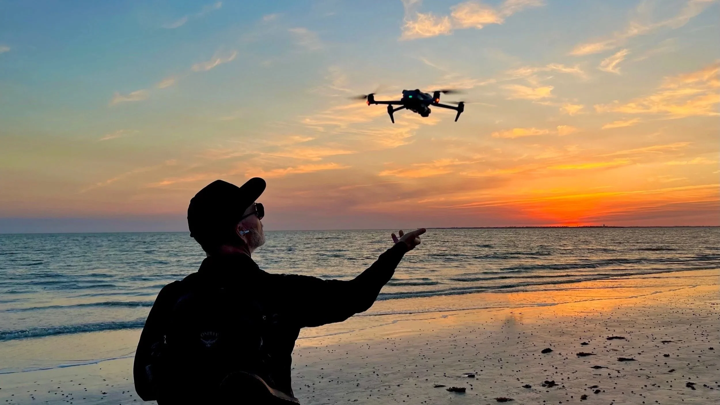
Anyone can learn to fly a drone in a weekend. The controls are not complicated, and the FAA test that comes with getting licensed is mostly a matter of studying airspace charts and weather patterns until they stick. What is much harder to learn, and what most people flying drones commercially in Nashville have never had to learn, is how to make footage that actually gets someone to feel something and then act on it.
That distinction is the entire reason Nashville Drone Co exists in its current form. Before founder Keith Stancil ever piloted a drone, he spent more than twenty years working inside the music industry, managing marketing divisions for major labels and later running his own artist management firm. That background did not just come along for the ride when he started flying drones. It became the foundation the whole business is built on.
Here is what that experience actually taught him, and why it changes the way a drone shoot gets planned from the very first phone call.
A Shot Is Not Content Until It Has a Job to Do
In the music industry, nothing gets released without a purpose behind it. A single is not just a song, it is a piece of a campaign designed to build toward an album launch, a tour announcement, or a specific moment in an artist's career. Every asset has a job. Most drone footage does not get treated that way. A pilot shows up, flies around a property or a job site, and hands over a folder of clips. There is rarely a plan for what any individual shot is supposed to accomplish once it lands in a client's hands. Keith brings the campaign mindset to every project instead. Before a drone leaves the ground, the question is not just what does this location look like from above, but what is this footage actually going to be used for. A real estate listing video needs to make a buyer picture living there within the first ten seconds. A construction milestone video needs to communicate scale and progress to investors who may never set foot on the site. A brand campaign needs a shot that stops someone mid scroll. Each of those goals calls for a completely different shot list, pacing, and edit, and none of that gets figured out by accident once the footage is already sitting on a hard drive.
Pacing Is a Skill, Not an Accident
Anyone who has worked in music marketing has sat through countless conversations about sequencing. Where does the hook land. How long before the energy shifts. What comes right before the chorus hits. That kind of thinking about rhythm and timing does not disappear just because the medium changes from a three minute song to a ninety second aerial video. A lot of drone footage feels the same because it is edited the same way every time: wide shot, slow push in, maybe a rotation around the subject, done. There is nothing wrong with that approach for simple documentation, but it rarely holds attention past the first few seconds.
Keith edits aerial footage the way a track gets sequenced. Where does the video need a big wide shot to establish scale. Where does it need a fast, close pass to create energy. Where does the pacing need to slow down so a viewer can actually absorb a detail, like the texture of a building facade or the layout of a piece of property. None of that is instinctive to someone who has only ever operated a drone. It is a skill built from years of deciding what keeps an audience engaged and what makes them tune out.
Knowing the Audience Changes the Shot List
Marketing a country album to a Nashville audience and marketing that same artist to an international market are two completely different jobs, even though the music itself does not change. The same principle applies to aerial content, and it is something most drone operators never think about because they are focused on the flight itself rather than who is going to be watching the finished product. A shot list built for a luxury real estate listing needs to sell a lifestyle. A shot list built for a construction company's investor update needs to communicate credibility and progress. A shot list built for a brand's social media campaign needs to be built for vertical video and a three second attention span. These are not small stylistic differences. They change camera angles, flight paths, editing pace, even color grading choices.
Understanding an audience before the first shot is planned is second nature to Keith Stancil after two decades of building marketing strategies around different buyers, different demographics, and different platforms. It is one of the biggest gaps between a drone operator who simply flies well and one who produces footage that actually performs.
Production Pressure Teaches Preparation
Working in the music industry means working around deadlines that do not move. An album street date does not shift because a mix is not finished. A tour announcement does not wait because a marketing asset is not ready. That kind of pressure forces a level of preparation that becomes permanent once it is learned. That same discipline carries over directly into high stakes aerial work. Filming live broadcast coverage, documentary production, or a national ad campaign leaves no room for a reshoot the next day. If a shot gets missed during a live event, it is gone. That reality demands a level of pre planning that most local drone operators, who are used to flexible timelines and forgiving clients, have never had to develop. That means studying the location in advance, planning flight paths around obstacles and airspace restrictions, checking weather windows days ahead rather than the morning of, and having a backup plan if conditions change. None of that comes from a weekend spent learning to fly. It comes from years of operating in an industry where there was never a second chance to get something right.
Storytelling Is the Real Skill, Flying Is Just the Tool
None of this is meant to downplay the technical side of drone piloting. Flying safely in dense urban airspace, around active construction sites, or in changing weather conditions is a real skill that takes real training and experience to do well. FAA Part 107 certification is the baseline for operating legally and safely, and that baseline matters. But flying a drone well and telling a story well are two entirely different skill sets, and only one of them can be learned from a certification test. The drone is a tool, the same way a camera or a mixing board is a tool. What makes footage worth watching, and worth paying for, is the thinking that happens before and after the flight itself, not just the flight. That is the biggest lesson two decades in entertainment marketing left behind. A great shot is not the goal. A shot that makes someone stop, feel something, and take an action, whether that is calling about a property, investing in a project, or remembering a brand, that is the actual job. The drone just happens to be how that job gets done today.
The Part Nobody Talks About: Managing the Client Relationship
There is another piece of this that rarely comes up when people talk about drone videography, and it has nothing to do with flying. In the music industry, managing an artist or a marketing campaign means constantly translating between people who all want something slightly different. A label wants radio friendly. An artist wants creative integrity. A promoter wants ticket sales. Learning to listen to all three and find the overlap is its own skill, separate from music itself. That same translation work happens on every drone project. A property developer wants footage that impresses investors. A real estate agent wants footage that sells a listing fast. A construction company wants footage that documents progress without making a job site look behind schedule. None of those goals get stated outright at the start of a conversation. Part of the job is figuring out what a client actually needs, sometimes before they have fully put it into words, and building a plan around that rather than just asking what shots they want. This is where a lot of technically skilled drone pilots fall short. They can execute a shot list flawlessly, but if nobody asked the right questions before the shoot, the footage ends up technically impressive and strategically useless. Two decades of sitting in rooms with people who all wanted different things builds a kind of listening that carries directly into every client conversation now.
Why This Matters More in a Crowded Market
Drone videography has become an increasingly common service, and the barrier to entry is low. A capable drone, a Part 107 certificate, and a weekend of practice is enough to start offering flights for hire. That accessibility is good for the industry overall, but it also means the market keeps filling up with operators who can produce technically clean footage without much strategic thinking behind it. That shift makes a marketing background more valuable, not less. When flying skill alone stops being a differentiator, the thing that separates useful footage from forgettable footage is exactly the part that cannot be picked up in a weekend course: knowing why a shot works, who it needs to reach, and what it needs to make that person do next. None of this is a knock against pilots with a purely technical background. Flying skill matters most when conditions get difficult, whether that is tight downtown airspace or an active job site full of moving equipment. But flying well and producing footage that performs are two different outcomes.
Bringing That Mindset to Every Project
This is not a philosophy that only applies to national campaigns or high profile productions. It applies just as much to a small business owner who needs social media content or a homeowner selling a property in Franklin. The questions stay the same regardless of budget or scale, who is this for, what should they feel, and what should they do next. That approach is what separates content that documents something from content that actually moves people to act. Two decades in marketing did not teach flying skills. It taught the part that happens before the drone ever takes off and after it lands, and that part turns out to be the one that matters most.
We would love to help you capture content that tells the story you want to tell. Contact us to get your project started. info@nashvilledrone.co
Safe Drone Operations on Construction Sites: A Complete Guide
Construction sites are some of the most valuable places to use drone technology. Aerial photography and drone video help document progress, improve communication with stakeholders, create marketing content, and provide a visual record of every phase of a project. At the same time, construction sites present unique safety challenges. Active cranes, heavy equipment, material deliveries, changing site conditions, and multiple subcontractors create an environment where safety must remain the top priority.
At Nashville Drone Co, safety is never treated as an afterthought. It is part of every flight operation. That commitment has helped earn the trust of leading construction companies throughout Middle Tennessee. Owner and Chief Pilot Keith Stancil has spent years working alongside project managers, superintendents, developers, and construction teams to safely capture aerial photography and drone video on active job sites. His experience understanding both FAA regulations and construction site operations allows Nashville Drone Co to deliver professional results without disrupting the work taking place below.
This guide covers the key safety practices every drone pilot should follow when operating on a construction site.
Why Construction Sites Require Extra Planning
Unlike open fields or parks, construction sites are constantly changing environments. A site that was safe for drone operations last week may have a tower crane installed today. Material staging areas move. Excavations expand. Equipment routes change. Safe drone operations begin before the drone is ever powered on.
Professional drone pilots should understand:
Site-specific hazards
Active construction schedules
Crane locations
Material delivery routes
Equipment traffic patterns
Worker activity zones
Emergency procedures
Every flight should begin with a site assessment and coordination with key personnel.
The Key People Every Drone Pilot Should Meet
One of the biggest mistakes inexperienced drone pilots make is arriving on site and immediately launching. Professional operators first establish communication with site leadership.
Project Manager
The project manager is often responsible for overall project coordination.
The project manager can provide information about:
Areas currently under construction
Scheduled activities
Crane operations
Site restrictions
Stakeholder requirements
Photography goals
The project manager often determines the best time for drone operations to avoid conflicts with active work.
Site Superintendent
The superintendent oversees day-to-day field operations.
Before flying, discuss:
Current site conditions
Active work zones
Equipment movement
Areas to avoid
Temporary hazards
Superintendents often have the most current information about what is happening on the site that day.
Safety Manager
The safety manager is one of the most important contacts for drone operations.
Many large commercial construction sites require approval from the safety manager before work begins.
The safety manager may provide:
Site safety requirements
PPE standards
Restricted areas
Emergency procedures
Site-specific hazards
Orientation requirements
Building a strong relationship with the safety manager helps ensure a safe and successful operation.
Construction Site Safety Orientations
Many commercial construction sites require visitors to complete a safety orientation before entering the project.
These orientations often cover:
Emergency evacuation procedures
Fall protection awareness
Equipment hazards
Restricted access areas
Incident reporting
Personal protective equipment requirements
Large healthcare, industrial, educational, and high rise projects frequently require documented orientation before any drone operation can occur. At Nashville Drone Co, safety orientations are welcomed as part of the process because they help create a safer environment for everyone on the project.
Proper PPE for Drone Operations
Drone pilots should never assume that basic clothing is acceptable on a construction site. Proper personal protective equipment protects both the pilot and those around them.
Standard PPE Requirements
Most construction sites require:
Hard hat
Safety vest
Safety glasses
Long pants
Work boots
High-visibility clothing
Additional PPE Requirements
Some projects may require:
Cut-resistant gloves
Hearing protection
Steel-toe boots
Long sleeve shirts
Site-specific identification badges
Before arriving, confirm PPE requirements with site management.
Top 10 Drone Safety Checks Before Launch
Professional drone operations begin with a thorough inspection.
Before every flight:
Inspect propellers for cracks or damage.
Verify battery condition.
Confirm firmware is current.
Check controller operation.
Verify GPS and satellite connection.
Review weather conditions.
Confirm return-to-home settings.
Review airspace restrictions.
Establish takeoff and landing zones.
Conduct a visual inspection of the site.
Small issues discovered before launch can prevent major problems during flight.
Understanding Crane Safety Around Drones
Cranes are among the most significant hazards on construction sites.
Tower cranes can extend hundreds of feet into the air and often operate throughout the workday.
Drone pilots should:
Identify all crane locations before launch.
Speak with crane operators when possible.
Maintain generous separation distances.
Account for crane movement during flight.
Watch for load lines and suspended materials.
A drone collision with a crane can create serious safety risks and project delays.
Heavy Equipment Awareness
Construction equipment creates hazards both in the air and on the ground.
Equipment operators may not see a drone pilot focused on a controller screen.
Common equipment hazards include:
Excavators
Bulldozers
Backhoes
Dump trucks
Concrete pumps
Telehandlers
Skid steers
Drone pilots should establish a safe operating location away from active traffic routes and equipment staging areas.
Top 7 Site Awareness Practices for Drone Pilots
1. Never Assume Conditions Are Unchanged
Construction sites evolve daily.
2. Walk the Site Before Flying
A short walkthrough can reveal new hazards.
3. Maintain Visual Line of Sight
Always keep the drone visible.
4. Watch for New Equipment
Equipment locations often change throughout the day.
5. Monitor Worker Activity
Avoid flying over active work crews whenever possible.
6. Identify Emergency Landing Areas
Have multiple backup landing zones.
7. Stay Focused on the Aircraft
Distractions can create unnecessary risks.
Weather Matters More Than Most Pilots Realize
Construction projects often operate despite weather conditions that may not be suitable for drone operations.
Factors to evaluate include:
Wind speed
Wind gusts
Rain
Lightning
Visibility
Extreme heat
Extreme cold
Professional drone pilots know when conditions are safe and when a flight should be postponed.
FAA Compliance on Construction Sites
Construction sites do not exempt drone operators from FAA regulations.
Professional operators should maintain:
FAA Part 107 certification
Aircraft registration
Required authorizations
Airspace approvals when necessary
Operational documentation
Nashville Drone Co operates under FAA Part 107 regulations and follows all applicable federal requirements.
Drone Inspection After Every Flight
The safety process does not end after landing. Construction sites expose drones to dust, debris, vibration, and environmental contaminants.
After each flight:
Inspect propellers
Check motors
Examine sensors
Review battery condition
Verify camera operation
Check landing gear
Review flight logs
Consistent inspections help identify wear before it becomes a safety concern.
Cleaning Drone Equipment After Dusty Construction Projects
Construction sites are among the harshest environments for drone equipment.
Dust from excavation, concrete work, grading operations, and demolition can accumulate quickly.
Professional maintenance should include:
Cleaning the Aircraft
Remove loose dust with air blower tools.
Wipe exterior surfaces.
Clean landing gear.
Inspect cooling vents.
Cleaning the Camera
Use lens-safe cleaning materials.
Remove dust carefully.
Inspect filters before storage.
Battery Care
Clean battery contacts.
Inspect for swelling.
Store properly between projects.
Regular cleaning extends equipment life and improves reliability.
Why Construction Companies Choose Nashville Drone Co
Construction companies need more than a drone pilot. They need a partner who understands job site operations, safety expectations, scheduling challenges, and professional communication. Nashville Drone Co has built relationships with developers, contractors, commercial real estate firms, and construction managers across Middle Tennessee by focusing on safety first.
Keith Stancil brings decades of professional business experience along with extensive drone operations knowledge. His understanding of construction workflows allows him to work efficiently with project teams while maintaining the highest safety standards. From construction progress video and aerial photography to marketing content and project completion documentation, every flight is planned with safety, professionalism, and client goals in mind. That commitment continues to earn the trust of many of the region's most respected construction companies including Giarratana Development, Axiom builders and Jones Concrete .
Here are what top Nashville construction companies are saying about Nashville Drone Co
“Hard to find vendors that check every box. Nashville Drone Co company did so with their price, workmanship, & customer service.” - Zach Helm - Pavement Technology Inc Cleveland OH
“Nashville Drone Co owner, Keith Stancil, expertly captured stunning future condo views that are instrumental in our pre-sales and marketing efforts. His responsiveness, fast turnaround and creative approach to video marketing made the process seamless. We highly recommend Nashville Drone Co for top-tier aerial visuals”. - Tony Giarratana, GIARRATANA, LLC
“Recently had the opportunity to collaborate with Keith/Nashville Drone Co on some drone content in Nashville, and it was a fantastic experience. From project alignment, scheduling, responsiveness, through to creative direction/feedback, Keith's professionalism and quality of work was appreciated.” - Willow Mair - Manager Marketing - Axiom Builders/ The Motley Nashville
Final Thoughts
Drone photography and video have become essential tools for modern construction projects. They provide valuable documentation, improve communication, support marketing efforts, and create a permanent visual record of project progress. The benefits are significant, but only when operations are conducted safely. By coordinating with project managers, superintendents, and safety managers, using proper PPE, maintaining situational awareness, performing thorough inspections, and following FAA regulations, drone pilots can safely operate in even the most active construction environments. At Nashville Drone Co, every flight begins with safety and ends with delivering exceptional results.
Frequently Asked Questions
Do I need permission to fly a drone on a construction site?
Yes. Permission should be obtained from the property owner, project manager, or authorized site representative before conducting drone operations.
What PPE should a drone pilot wear on a construction site?
Most sites require a hard hat, safety vest, safety glasses, long pants, and work boots. Additional requirements vary by project.
Should drone pilots attend construction site safety orientations?
Yes. Many commercial projects require visitors and contractors to complete safety orientation before entering the site.
How close can a drone fly to a crane?
There is no universal distance requirement, but maintaining a substantial safety buffer is considered best practice. Every site and crane operation is different.
How often should a drone be inspected?
Professional operators should inspect equipment before and after every flight.
Can construction dust damage drones?
Yes. Dust can affect motors, cooling systems, sensors, and camera equipment. Regular cleaning and maintenance are important.
Why hire a professional local drone company instead of an enterprise drone company?
Local drone companies understand FAA regulations, site safety procedures, risk management, and image quality standards. They also carry the experience needed to operate safely in active construction environments. Hiring through enterprise companies could result in inexperienced unsafe drone pilots on the construction site.
Does Nashville Drone Co provide construction progress photography?
Yes. Nashville Drone Co provides construction progress photography, aerial video, project documentation, marketing content, and completed project photography throughout the Nashville area.
Hire a Safe Drone Company for your Construction Drone Needs
At Nashville Drone Co, safety is built into every project. From pre-flight planning and site coordination to equipment inspections and post-flight maintenance, every step is designed to protect people, property, and the project schedule. This commitment to safety has helped Nashville Drone Co become a trusted drone partner for contractors, developers, commercial real estate firms, and construction companies throughout Middle Tennessee.
Owner and Chief Pilot Keith Stancil is an FAA Part 107 Certified Remote Pilot with hundreds of hours of flight experience capturing construction progress photography, aerial marketing content, and project completion photography. His understanding of both drone operations and construction environments allows Nashville Drone Co to work safely and efficiently on projects of all sizes.
Whether you need monthly construction progress photos, aerial video for stakeholders, project completion photography, or marketing content for a newly completed development, Nashville Drone Co can help.
Contact Nashville Drone Co info@nashvilledrone.co
The Billion Dollar Drone Photo
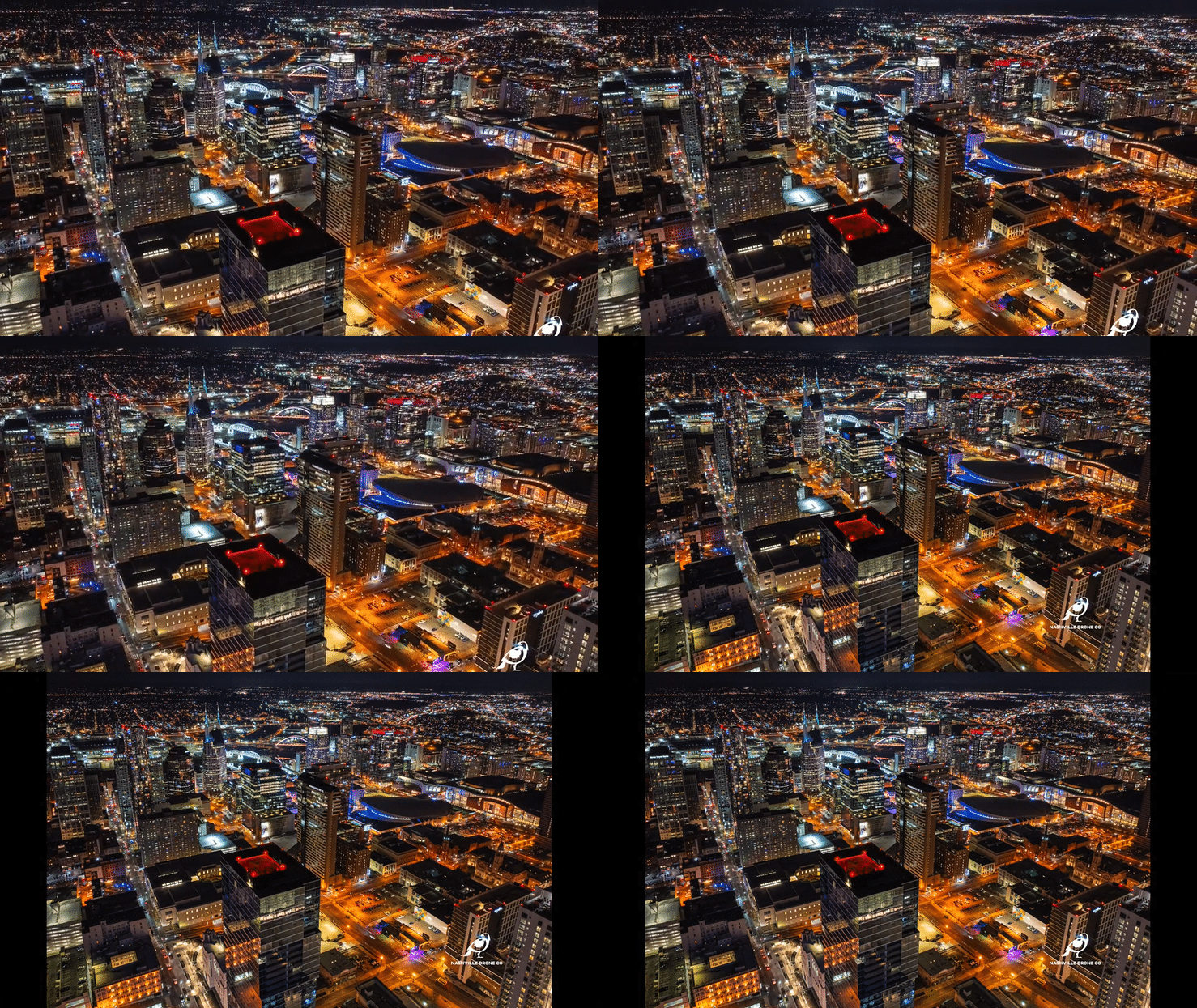
The Billion Dollar Drone Photo captured by Nashville Drone Co
On a crisp, clear February night in Nashville, a moment unfolded high above the city that would quietly become one of the most recognizable aerial images tied to a major downtown development. It was not planned as a signature photograph. It was not staged or pre-visualized for marketing use. It was captured during a working flight. That image would come to be known as The Billion Dollar Drone Photo.
The photo was taken by Keith Stancil of Nashville Drone Co while performing aerial photography work for Giarratana, capturing views for the development of the 60-story Paramount Nashville rising in the heart of downtown Nashville. What began as a standard aerial photo flight turned into a defining moment of perspective from what would become the future penthouse level of one of the tallest residential towers in the city.
The Moment The Billion Dollar Drone Photo Was Captured
Keith was on site that night to capture elevated perspectives of the Paramount Nashville construction zone and the surrounding downtown skyline. The assignment was straightforward. Capture views from a few levels of the future Paramount. But the conditions that night were anything but ordinary. The winter air was unusually clear, a rare combination of low haze, stable wind, and crisp visibility that allowed the entire downtown skyline to appear sharp and well defined. The Cumberland River reflected scattered light from the city, and the grid of downtown streets created a layered depth that is difficult to capture on most nights.
From the drone’s position, the camera reached the elevation of what would eventually become the penthouse level of the Paramount Nashville. At that height, Nashville opened up in every direction. The city felt structured yet expansive, with new construction projects visible alongside established landmarks.
While reviewing the footage and still frames, Keith noticed one image that immediately stood apart from the rest. It was not just an average view. It was not simply a skyline overview. It was a composed visual that represented both the present state of the city and the future experience of living at the top of a 60-story tower. That frame became the Billion Dollar Drone Photo.
The exchange that named the photo
Like many defining creative moments, the naming of the image happened in a simple, unscripted exchange. Keith showed the photo to Tony Giarratana during review of the project’s visual assets. The intent was to share one of several strong skyline captures from the shoot. Keith described the image casually at first.“It’s a million dollar view.”
Tony immediately questioned the scale of the statement. “Million dollar view?”
Without hesitation, Keith adjusted his description in real time, recognizing the weight of what the image represented.
“Actually. It’s a Billion dollar view.” That moment stuck. The phrase became the name of the photograph, and the image immediately shifted from a documentation asset into something with identity, narrative, and marketing value. The team working on the Paramount began referring to the photo as The Billion Dollar Photo.
Why this image mattered beyond documentation
Drone photography in construction environments is typically functional. It is used to track progress, show structural development, and provide stakeholders with consistent visual reporting. Most of these images serve internal communication purposes and rarely extend into public facing branding. The Billion Dollar Drone Photo broke that pattern.
The reason it became valuable as a marketing asset is because it did something most construction imagery does not. It connected three perspectives in a single frame:
The current stage of construction at the Paramount Nashville
The future luxury experience from a penthouse level vantage point
The broader Nashville skyline as a growing urban core
Instead of simply showing a building rising, the image communicates what the building will feel like once complete. That emotional translation from structure to experience is what makes it useful in marketing.
The February Night that Shaped the Image
Lighting and atmospheric conditions played a critical role in the final outcome. Nashville experiences a wide range of visibility conditions throughout the year, and many nights introduce haze, wind instability, or light diffusion that reduces clarity in aerial photography. That February night was different. The cold air created natural clarity. City lights were sharp without overexposure. The skyline layers separated cleanly, giving depth to both foreground construction and distant buildings.
From the drone’s elevated position, the Paramount site served as a visual anchor in the composition. The surrounding skyline extended outward with a sense of balance and proportion that is difficult to replicate in post-production. The result was an image that required minimal enhancement. The strength of the photograph came from timing, location, and awareness of framing rather than heavy editing or artificial enhancement.
How the Billion Dollar Drone Photo is Used in Marketing Today
After its creation, the image quickly moved beyond internal documentation and became part of the official marketing ecosystem for the Paramount Nashville development. It is now used in several high-visibility formats, including:
Advertising placements in the Nashville Business Journal
Large street facing banners positioned at the construction site perimeter
The centerfold image in the Paramount marketing brochure
Digital marketing materials tied to luxury residential leasing and sales
Each use case highlights a different aspect of the image. In print advertising, it reinforces scale and prestige. On site banners connect the public directly to the vision of the tower. In the brochure, it anchors the luxury narrative that defines the development’s positioning in the Nashville market.
For a single drone captured image to be used across multiple marketing channels at this level is uncommon. It reflects both the quality of the visual and the strategic value it provides to the project.
What sets Nashville Drone Co apart
The Billion Dollar Drone Photo is not an isolated success. It represents a broader approach to aerial photography that distinguishes Nashville Drone Co from typical drone service providers. Many drone operators focus on delivering coverage. They capture required angles, provide mapping or documentation footage, and complete assignments efficiently. That work is valuable, but it is primarily functional. Nashville Drone Co operates with a different objective. The goal is to create aerial assets that function as marketing tools, not just visual records. That approach is reflected in three consistent practices:
1. Recognizing high-value composition opportunities in real time
Rather than simply completing a shot list, attention is given to framing, symmetry, light direction, and emotional impact during the flight itself.
2. Understanding how developers use visual assets
Working with clients like Giarratana requires awareness of how images will appear in brochures, advertising campaigns, investor materials, and public-facing branding.
3. Delivering content that performs beyond the project timeline
The strongest images continue to generate value long after construction milestones are completed. The Billion Dollar Drone Photo is an example of this philosophy in practice. It is not just a construction image. It is a long-term branding asset that continues to be used across multiple marketing platforms.
The Role of Keith Stancil in Capturing the Moment
While drone technology provides access to unique perspectives, the outcome still depends heavily on the pilot’s awareness and decision making. Keith Stancil’s experience with Nashville aerial environments played a direct role in recognizing the importance of the frame in real time. Many operators would have captured the required documentation angles and moved on. Instead, there was recognition that the vantage point from the future penthouse level of the Paramount offered something beyond documentation. That awareness turned a routine flight into a moment of discovery. The result was not just a technically strong image, but a visually and emotionally resonant one that aligned with the narrative of luxury urban development in Nashville.
A Photograph that Reflects Nashville’s growth
Nashville Drone Co’s Billion Dollar Drone Photo also represents something larger than a single project. It reflects the transformation of Nashville’s skyline. The city has moved into a phase of vertical expansion, where high-rise residential towers are reshaping downtown identity. Projects like the Paramount signal a shift toward dense, luxury-focused urban living. This image captures that transition in a single frame. It shows the city as it exists today while simultaneously hinting at what it will become once projects of this scale are complete. That dual perspective is one reason the image continues to appear in marketing materials. It communicates progress, ambition, and future potential without needing explanation.
Final perspective
Some photographs are carefully planned. Others are discovered in the moment they are taken. Nashville Drone Co’s Billion Dollar Drone Photo belongs to the second category. What began as a standard drone assignment for construction documentation became a widely used marketing asset for one of downtown Nashville’s most prominent developments. Its name came from a spontaneous exchange between Keith Stancil and Tony Giarratana, and that name now carries the identity of the image itself. Today, it stands as an example of how timing, awareness, and execution can turn a working flight into a lasting visual asset. More importantly, it reflects what Nashville Drone Co aims to deliver on every project, not just aerial documentation, but imagery that helps define how major developments are seen, understood, and marketed across Nashville’s evolving skyline.
Contact Nashville Drone Co to purchase a print of the Billion Dollar Drone Photo for the walls of your home or office. The photo can be printed on metal, canvas or photo paper and drop shipped to your address. info@nashvilledrone.co