From Downtown High-Rises to Hail Nets in Spring Hill: Drone Photography Across Middle Tennessee
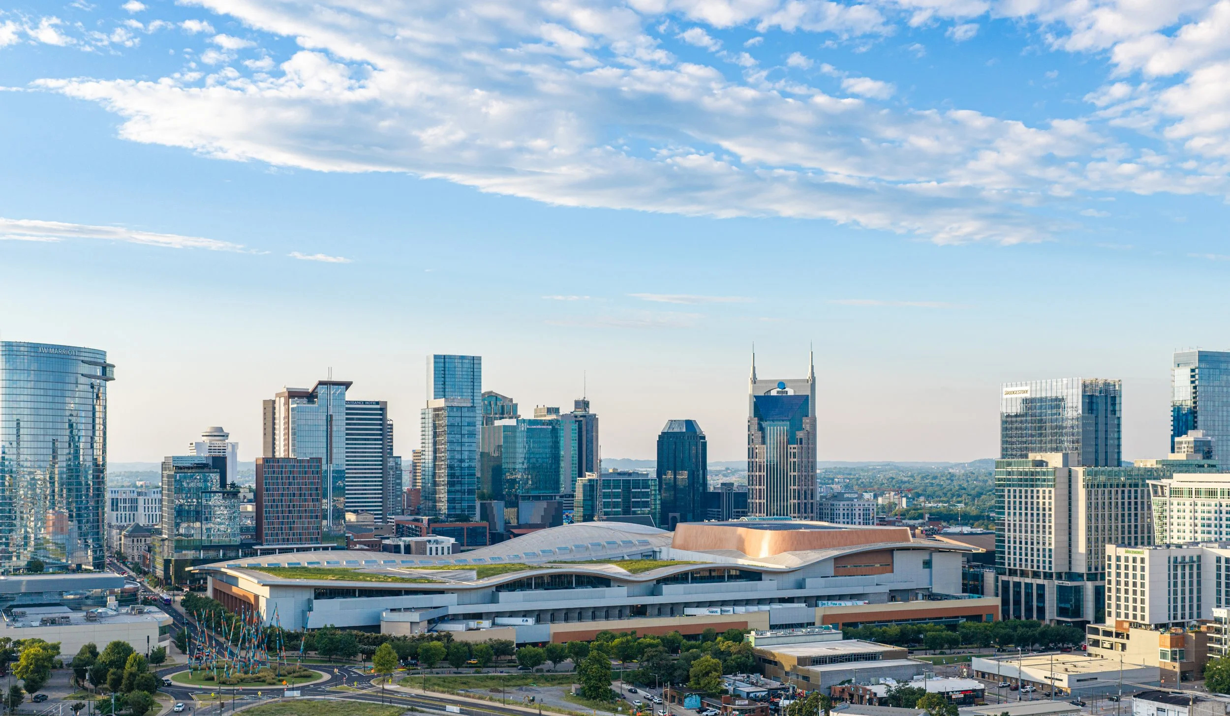
Nashville Drone Co is a commercial drone photography and video company based in Nashville, Tennessee. We work with developers, general contractors, real estate professionals, manufacturers and landowners who need aerial images that are sharp enough to print, accurate enough to document a project, and polished enough to carry a marketing campaign. Our founder, Keith Stancil, is an FAA Part 107 certified pilot with over two decades of professional entertainment marketing experience, and that background shapes how we plan every shoot. We understand the footage has to work as a business asset, not just look good.
This article explains what we do, where we do it, and what the work looks like in practice. That includes high-rise towers in downtown Nashville, commercial real estate, land and residential development, working farms, and a recent project for Vehicle Protection Structures at the GM plant in Spring Hill.
What Nashville Drone Co Does
We provide professional drone photography, drone video and related deliverables across Middle Tennessee. Most projects fall into a few categories.
Construction Progress Documentation
Regular flights that record a project from site work through completion, shot from consistent vantage points so changes are easy to compare.
Marketing Photography and Video
Cinematic aerial video and high resolution stills for websites, sales galleries, brochures, social media and advertising.
Real estate and Property Imagery
Aerial views that show a property in context, including boundaries, access, neighboring uses and surrounding landmarks.
Land and Development Visuals
Site overviews, lot and phase photography, and before and after records for developers and civil contractors.
Night and Twilight Work
Skyline, lighting and event imagery captured after sunset under FAA night operating rules.
Equipment We Use
We shoot with the DJI Mavic 4 Pro, which captures 100 megapixel photos and up to 6K video and the DJI Mavic 3 Pro when flying over people and moving vehicles. We also shoot FPV video with a DJI Avata 2.
High Rise Drone Photography in Nashville
Downtown Nashville is a demanding place to fly a camera. Towers rise hundreds of feet, the airspace is controlled, and the best vantage points are often at altitudes that require careful planning. We have built a large share of our reputation on this work.
Our high rise experience includes progress photography and video at The Pendry and The Motley, and marketing imagery for Giarratana Development's Paramount, the 60-story luxury residential tower in downtown Nashville. One image from the Paramount work became known as the Billion Dollar Photo, and it has been featured multiple times in the Nashville Business Journal and in marketing materials for the project.
Flying around tall structures means working inside a strict set of rules. Under 14 CFR 107.51, the general altitude limit for small drones is 400 feet above ground level, with an allowance to fly higher only while staying within 400 feet of a structure and no more than 400 feet above its uppermost limit. Much of downtown also sits in controlled airspace tied to Nashville International Airport, so we secure FAA authorization before flights. We also calculate above ground level altitudes for specific vantage points ahead of time, so a shot planned at a certain floor height is a shot we can capture safely.
The payoff for developers is images that do real work. High resolution aerials sell units before they exist, show lenders and investors what is happening on site, and give press and partners something worth publishing.
Commercial Real Estate Photography
Commercial buyers and tenants want context. A ground level photo of a building tells them very little about parking, access, traffic flow or the neighborhood around it. A drone image tells most things in a single glance. We photograph office buildings, retail centers, industrial properties, mixed-use projects and development sites for brokers, owners and builders.
A good commercial aerial shows the whole parcel, the roads that serve it, and the features that matter to a decision, such as nearby interstates, rail lines, rivers or neighboring developments. When a client needs more than stills, we add a short video that moves from the street into the property, which works well on listing pages and in pitch decks.
Our work with Giarratana Development and McCrory Construction reflects this kind of commercial and construction-focused work in the Nashville area, from marketing visuals to progress records.
Land Development and Residential Development
Land development moves quickly and changes shape from month to month. Clearing, grading, utilities, roads and foundations each look completely different from the air, and a record of each phase is valuable to the developer, the civil contractor and the lender.
We document development sites for builders and civil contractors, including a large commercial site at the new Walmart development in Lebanon, Tennessee, and civil development work for Bell Construction Inc. For residential communities, we capture phase overviews, lot layouts and amenity areas that sales teams use to show buyers what a neighborhood will become. Consistent flights over a subdivision from the first clearing to the final landscaping create a visual history that no set of ground photos can match.
Several habits make development photography more useful. We return to the same camera positions on each visit, we fly at similar times of day so light stays consistent, and we organize the files by date and location so the archive stays usable when team members change.
Farms, Ranches and Rural Property
Middle Tennessee has a lot of land that is better understood from above. Farms, horse properties and rural estates in places like Leiper's Fork, College Grove, Dickson and Columbia show their real character in an aerial view: the pasture, the tree lines, the barns and outbuildings, the creek, the long drive up to the house.
For landowners, brokers and event venues, drone photography and video makes a property easier to market and easier to understand. It shows boundaries and acreage in context, highlights features a buyer would otherwise miss, and gives a farm or event space a visual identity that works on a website and in print. We shoot at golden hour when the light is soft and the landscape reads at its best, and we adjust the plan for the season, since a property in spring looks very different from the same ground in late fall.
Case study: hail nets at the GM plant in Spring Hill
One of our recent projects was for Vehicle Protection Structures, a company that installs hail nets designed to protect vehicles. We captured drone photography and drone video of VPS's hail nets installed at the GM plant in Spring Hill, Tennessee. The photos and video will be used in VPS's marketing campaigns and on its website.
Industrial projects like this one present a different set of challenges than a downtown tower or a farm. The scale is large, so a single frame has to communicate how much ground the structures cover. Everything is built from repeating geometry, which looks striking from above when the camera angle and light are right, and flat when they are not. And the site is a working manufacturing campus, which means access, safety and timing all have to be coordinated in advance with the client and the people responsible for the property. The goal on a project like this is to give a marketing team a complete library. That means wide establishing photos that show the full installation in context, closer images that show how the nets are built and anchored, and video that moves across the structure so a viewer understands its size. It also means delivering files that are ready for use, with high resolution stills for print and web, and edited video cut for the website and social media.
Keith Busam, Vice President at Vehicle Protection Structures, described their experience with Nashville Drone Co
“Keith at Nashville Drone was outstanding from start to finish. His communication and professionalism were top-notch, and the photos and video he captured exceeded our expectations. We’ve hired many drone photographers, and Keith is easily the best we’ve worked with. Nashville Drone gets our highest recommendation.”
Where We Fly Across Middle Tennessee
Nashville Drone Co serves a 15-city area across Middle Tennessee. Our service area includes Nashville, Brentwood, Franklin, Nolensville, Spring Hill, Columbia, Lebanon, Mt. Juliet, Murfreesboro, College Grove, Hendersonville, Smyrna, Leiper's Fork, Dickson and Kingston Springs.
Each part of the region brings its own kind of work. We will also travel further for work that makes sense. In Nashville, it is high rise construction and commercial development. Franklin, Brentwood and Nolensville combine commercial projects with growing residential communities. Spring Hill and Columbia bring industrial and manufacturing sites along with new neighborhoods, which is where the GM plant project fits. Lebanon and Mt. Juliet are seeing major commercial and residential growth to the east. Murfreesboro and Smyrna add industrial, retail and housing projects to the south and southeast. Hendersonville sits on Old Hickory Lake and brings waterfront property and residential work. Leiper's Fork, College Grove, Dickson and Kingston Springs lean toward farms, estates and rural land.
Because we are based locally, we know the airspace, the terrain and the traffic patterns in each of these communities, and we can usually fly on short notice when the schedule demands it.
Safety, Licensing and How We Work
Professional drone work depends on discipline. Every flight we conduct is operated by an FAA Part 107 certified pilot, and we carry liability insurance. We obtain airspace authorization where it is required, plan altitude limits ahead of time, and brief site contacts before takeoff so everyone knows when the aircraft is in the air.
We also hold an FAA long-term waiver for sustained flight over open-air assemblies and over moving vehicles, and we fly aircraft fitted with an ASTM-compliant ParaZero SafeAir parachute system under that waiver.
If weather forces a reschedule, there is no additional charge.
Our process is simple. We talk through the goals of the project, plan the shots and the schedule, handle the authorizations, fly the job, and deliver edited files quickly. Clients communicate directly with the pilot who is making the images, which keeps the work focused and the feedback loop short.
Frequently asked questions
Does Nashville Drone Co serve areas outside Nashville?
Yes. We serve 15 cities across Middle Tennessee, including Brentwood, Franklin, Nolensville, Spring Hill, Columbia, Lebanon, Mt. Juliet, Murfreesboro, College Grove, Hendersonville, Smyrna, Leiper's Fork, Dickson and Kingston Springs. We will also travel further and even out of state for specific jobs.
What kinds of projects do you photograph?
High rise construction, commercial real estate, land development, residential development, farms and rural property, industrial sites and events.
How fast will I receive my photos and video?
Most projects are delivered within 5 days with 24-48 hour rush delivery available.
Are you licensed and insured?
Yes. Our pilots hold FAA Part 107 certification and we carry liability insurance.
Can you fly at night or over people and vehicles?
Yes, within FAA rules. We conduct night operations under Part 107 and hold a long-term FAA waiver for sustained flight over open-air assemblies and moving vehicles.
Do you offer ongoing construction progress photography?
Yes. Many of our clients schedule regular flights through the life of a project so they have a consistent visual record.
Work with Nashville Drone Co
If you need professional drone photography or video for a tower, a development, a property or an industrial site, we would like to hear about your project. Email us to request a quote info@nashvilledrone.co