Aerial Photography and Cinematic Drone Video in Nashville, TN
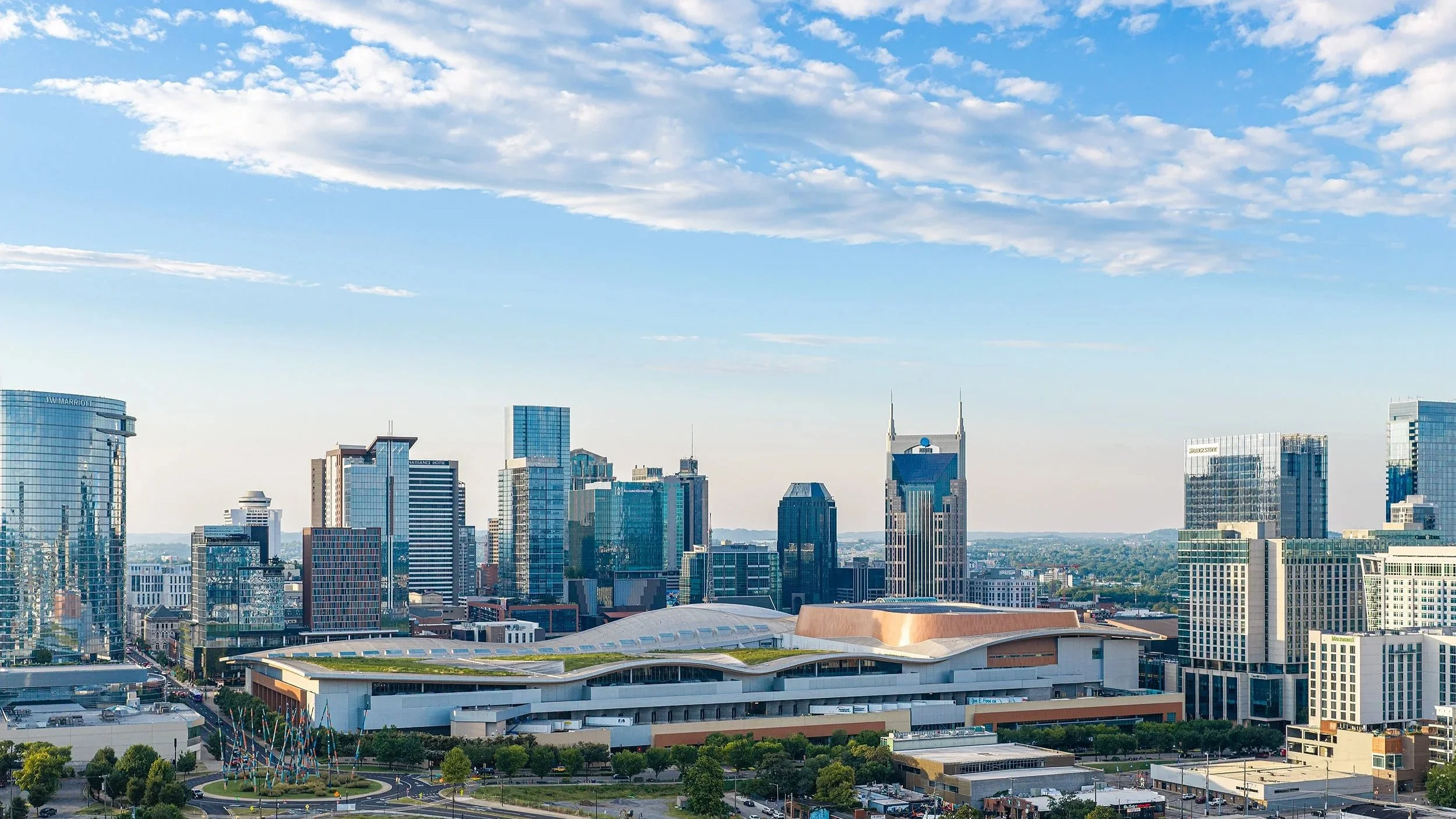
If you are searching for drone video services near you, you are probably trying to figure out who actually knows what they are doing versus who just bought a drone last year. Nashville Drone Co was built to answer that question clearly. We are a locally owned drone photography and video company serving Nashville and the surrounding Middle Tennessee area, founded and operated by Keith Stancil, an FAA Part 107 certified pilot with over two decades of professional entertainment marketing experience behind him. That background shapes how every project gets planned and shot, whether it is a luxury home listing, a wedding, a downtown high rise under construction, or a brand campaign that needs footage nobody else's reel already has.
We work with film companies, real estate professionals, construction companies, architects, event planners, land developers, and creative agencies who need aerial content that actually holds up next to their other marketing materials. Every flight is covered by our own drone insurance and flown under current FAA Part 107 certification, which is not something we mention as a selling point so much as something we treat as the baseline for doing this work responsibly.
Why Aerial Content Actually Matters
A drone shot is not just a nice extra angle. It changes how a viewer understands a space, a property, or an event in a way a handheld camera cannot replicate. A rooftop pool, a sprawling lot line, the scale of a construction site, the layout of a wedding venue, all of it reads differently from the air, and that difference is often what makes someone stop scrolling or click through to a listing instead of passing it by.
Drone video performs especially well on social platforms. Sweeping aerial reveals and fly-through footage tend to hold attention longer than static photos, and we shoot both horizontal and vertical formats so the same project can be repurposed across Instagram Reels, TikTok, YouTube Shorts, and a traditional website gallery without needing a second shoot. For a business trying to stretch a marketing budget across several platforms, that kind of flexibility matters more than it sounds like on paper.
Services Built Around Specific Industries
Real estate drone video and photography.
We shoot residential and commercial listings across Nashville, Franklin, Brentwood, Nolensville, Spring Hill, Mount Juliet, Lebanon, Spring Hill, Thompson Station, Leiper’s Fork, Columbia, Smyrna, Kingston Springs, Dickson and Murfreesboro, capturing properties from angles that make a listing stand out on MLS, Zillow, or a broker's own site. A flyover that shows a lot's true size and a neighborhood's layout often does more to move a buyer than another set of interior photos.
Construction progress documentation.
Builders and developers rely on us for weekly, monthly, or milestone based aerial coverage that supports planning, investor reporting, and future marketing. Capturing future views has become a crucial selling tool for high rise condos. This is one of our most established service lines, and it includes ongoing work on some of downtown Nashville's most visible towers, including the Paramount, The Motley, and The Pendry. We understand how a job site changes week to week, how crane movement affects flight planning, and how to keep a consistent visual record that a project manager or investor can actually use.
Commercial real estate and investor materials.
Large properties, shopping centers, and office campuses often need aerial imagery that shows access roads, parking, and surrounding development clearly enough to support a pitch to an out of state investor. We have helped brokers and developers build offering memorandums and boost visibility with imagery that gives a genuinely useful overview rather than a pretty but uninformative wide shot.
Weddings and events.
For couples and event videographers who want a few minutes of aerial footage woven into a wedding film, we provide cinematic coverage that complements ground level video rather than competing with it. The same goes for grand openings and brand activations, where a short vertical video capturing the size and energy of a crowd or a launch event often becomes the most shared piece of content from the whole day.
Land and architectural photography.
Developers and architects use our bracketed aerial photography to show land parcels, building orientation, and property lines with balanced exposure and real detail, the kind of imagery that holds up in a printed proposal or an investor deck rather than looking washed out or overexposed.
What Actually Sets Nashville Drone Co’s Work Apart
A lot of drone companies describe themselves the same way, cinematic quality, fast turnaround, licensed and insured. Those things matter, but they do not explain why a project turns out well. Here is what we think actually makes the difference on a shoot.
A production background, not just a flying background.
Before founding Nashville Drone Co, Keith spent over two decades in professional entertainment marketing, working around musicians, producers, and creative teams to figure out how to present something so an audience actually feels it rather than just watches it. That background carries directly into how a shoot gets planned, from the angle a subject is approached at to the pacing of a finished edit. Flying a drone well is a technical skill. Knowing what a piece of footage needs to do for a client's marketing goals is a different one entirely, and it is the one that tends to separate a usable video from a genuinely effective one.
Real technique behind the images, not just a nice drone.
Anyone can point a camera at a skyline. Getting a shot that actually holds up next to a professional rendering or a print ad takes more than that. We shoot bracketed exposures on demanding light conditions like blue hour and full night, combining multiple exposures in post so a lit up skyline keeps its color and detail instead of blowing out the highlights or losing the shadows to black. That kind of editing work is part of why our high rise photography, including the Billion Dollar Photo captured for the Paramount, has ended up anchoring pre-sales materials and full block banners rather than just sitting in a gallery.
Consistent, ongoing coverage.
Construction teams especially need a partner who shows up on a predictable schedule and produces a consistent visual record over months or years, not a single flashy shoot. We offer scalable monthly packages for exactly that reason, and it is why a number of contractors and developers around Nashville have brought us back project after project rather than shopping the next job out to whoever quotes lowest.
Fast turnaround without cutting corners.
Most projects are delivered within five business days, and rush turnaround of twenty four to seventy two hours is available for time sensitive needs like a listing launch or a construction reporting deadline.
A locally owned team, not a subcontracted network.
We are not a booking platform that dispatches whichever pilot happens to be free that week. Every shoot is planned and flown by our own team, which means the person answering your questions understands exactly what was captured and why, because they were the one behind the controller.
Working With Clients Across Middle Tennessee
Over the years we have worked with luxury and mid tier real estate agencies, builders and construction project managers, event planners and marketing agencies, churches and nonprofits, and wedding videographers and production houses. That range has taught us that no two industries need the same thing from a drone shoot. A construction manager needs consistency and a clear visual record. A real estate agent needs a listing that photographs well on a phone screen at 2am when a buyer is scrolling in bed. A developer marketing a high rise that does not exist yet needs imagery accurate enough to be trusted in a sales office. We plan every shoot with that specific end use in mind rather than treating every job the same way.
Every flight is planned using current airspace and weather data, and we do not fly in rain, high winds, dew points that create a risk of prop icing, or when the KP index points to unstable geomagnetic conditions that can interfere with GPS. That might sound overly cautious to someone who has only ever flown a drone recreationally, but it is standard practice for anyone flying commercially and carrying real liability if something goes wrong.
Service Areas
We serve Nashville, Franklin, Brentwood, Nolensville, Spring Hill, Mount Juliet, Lebanon, Spring Hill, Thompson Station, Leiper’s Fork, Columbia, Smyrna, Kingston Springs, Dickson and Murfreesboro and we travel for larger or out of area projects when the work calls for it.
Frequently Asked Questions
Are your pilots licensed?
Yes. Every pilot flying for Nashville Drone Co holds current FAA Part 107 certification, and every flight is covered by drone liability insurance.
How much does a shoot cost?
Pricing depends on the scope and location of the job. Once we know what you need captured, we put together a quote specific to that project rather than a flat rate that does not account for the actual work involved.
How quickly can you schedule a shoot?
We schedule based on your timeline and current availability, and we will always tell you honestly if a date does not work rather than overpromising and delivering late.
Do you fly in bad weather?
No. We do not fly in rain, high wind, dew points with icing risk, or elevated KP index conditions, since any of those can put the aircraft and anyone nearby at risk.
How long does delivery take
Most projects are delivered within five business days, with twenty four to seventy two hour rush delivery available for time sensitive jobs.
Can you edit the footage?
Yes. We handle full video editing, including color grading, branding overlays, and vertical cuts built specifically for social platforms.
Do you offer recurring construction packages?
Yes. We build custom monthly packages for construction progress, development projects, and ongoing commercial property documentation.
The Bottom Line
Searching for drone services near you brings up a long list of similar sounding companies. We encourage you to compare our gallery and actual projects with other companies when making your decision on which drone company to hire. What actually separates one from another shows up in the details, whether the pilot is certified and insured, whether the images hold up in real light conditions like blue hour and full darkness, and whether the person behind the camera understands what the footage needs to accomplish once it is delivered. Nashville Drone Co and founder Keith Stancil have built a body of work across real estate, construction, weddings, and commercial marketing throughout Middle Tennessee, backed by a production background that shapes every shoot from planning through final edit.
Reach out today for a quote or to get your next shoot on the calendar. info@nashvilledrone.co
How to Compare Drone Photography and Video Companies in Nashville
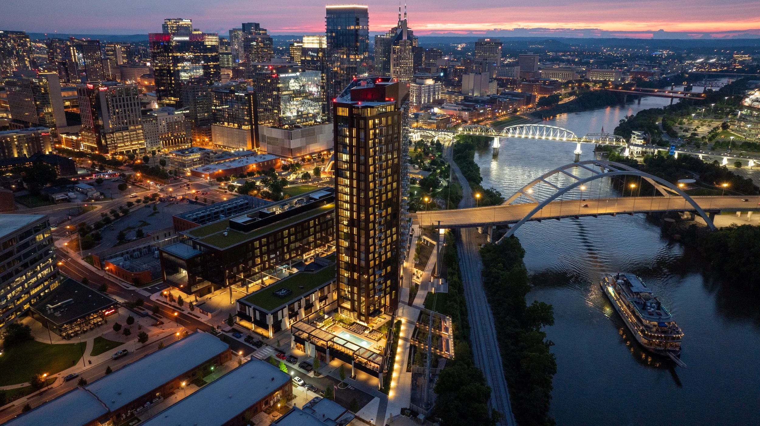
Anyone searching for a drone company in Nashville right now is looking at a page full of nearly identical service lists. Aerial photography. Construction documentation. Real estate video. Every site says roughly the same thing, in roughly the same order, using roughly the same language. None of that tells you what you actually need to know. Here's the one simple comparison that matters. Pull up each company's gallery and reel, side by side, and look at the work itself.
Forget the Service List. View the Reel and Gallery
A drone company's marketing page is written to be found. However, its gallery is where you find out if the company is any good. That's the part that can't be faked or filtered around, and it's the part most people skip past on their way to the contact form. Before hiring anyone, spend ten minutes actually watching the reel and scrolling the gallery.
5 questions to ask yourself About the Reel and Gallery
1) Are the photos sharp, high resolution, and genuinely clear?
Not "good enough for social media." Sharp enough to print on a banner in a sales office or a leasing lobby, because that's often exactly where these images end up.
2) What do the skies look like?
This is one of the fastest tells in the entire industry. A blown-out, flat white sky means the operator didn't manage exposure or didn't know how to correct it in post. A rich blue sky, or a well-shaded golden hour sky, means someone understood light before they ever launched the drone.
3) Does the video move like a film, or like a toy?
Cinematic drone footage has smooth, deliberate motion. Jerky stops, sudden direction changes, or footage that feels like someone is just flying a hobby drone around a building are signs of an operator without real production experience.
4) What does the color grading look like?
Flat, washed-out color or oversaturated, cartoonish color are both red flags. Good drone video has a color profile that looks intentional, consistent from shot to shot, and true to how the location actually looks.
5) Is exposure consistent, or all over the place?
Dark, muddy shadows in one shot and blown-out highlights in the next usually mean the operator is shooting on auto settings and hoping for the best, rather than dialing in exposure for each specific shot. None of this requires any technical background to spot. It just requires actually looking at the work instead of the words describing the work. What's sitting in a company's gallery right now is what will show up when the drone is over your project.
A Recent Example: The Paramount Photos
This exact scenario played out recently with a luxury high-rise client in Nashville. Early in the construction process, the developer's team hired a drone photography company to capture future views. The photos came back usable, in the sense that they were photos of the views. That was about the extent of it.
The client visited the sales office for the Paramount, the 60-story luxury high-rise from Giarratana Development in downtown Nashville, and saw Nashville Drone Co's photography project for Paramount on display. The difference in what they saw with the Paramount’s photos verses their photos was immediate. Sharper detail. Better composition. Skies that actually looked like skies. Color that was consistent from one image to the next instead of shifting depending on the time of day the photo happened to be taken. The client made the call to Nashville Drone Co not long after that visit to schedule new photos to be captured.
What separated the two sets of images wasn't luck. It came down to a handful of specific things: shooting at the right time of day for the light instead of whenever happened to be convenient, framing each shot with actual composition in mind rather than just centering the building in the frame, correcting exposure so skies stayed blue and shadows stayed detailed, and keeping color consistent across an entire batch of photos so a gallery or sales deck doesn't look like it was assembled from five different shoots. That consistency matters more than people expect going in. A single great photo is easy. A full set of consistently great photos, shot across different angles and times, is what separates a company that happens to own a drone from one that actually knows how to use it for marketing purposes.
Why Reel and Gallery Comparison Matters More for High-Rises and Commercial Projects
For a high-rise, construction site, or commercial real estate project, drone photography isn't decoration. It's often the primary sales and leasing tool before a building is even finished. Sales offices and leasing centers lean on these images to sell units and space that don't exist yet in any walkable form. If the photography is mediocre, it's not just an aesthetic problem, it's a sales problem.
In addition to the planned photos, Nashville Drone Co makes a point of capturing a standout image from a key elevation and view on every high-rise project, a single frame that sums up the prime view a resident or tenant could actually have. That one photo tends to become the anchor image for pre-sales materials, leasing brochures, or marketing decks, because it answers the exact question a buyer or tenant is asking: what will I actually see from up here?
Nashville Drone Co works across high-resolution stills, high-resolution 360 degree panoramic photography, construction progress documentation for towers still under construction, and architectural photography of finished buildings. The through line across all of it is the same standard: images clean and consistent enough to hand directly to a sales team without needing a disclaimer about lighting or quality.
What Clients Have Said About Nashville Drone Co
Feedback from recent projects has centered on a similar set of themes: reliability, quality, and speed of turnaround.
"Nashville Drone Co delivered exceptional drone video and aerial photography for our Paramount project. Nashville Drone Co owner, Keith Stancil, expertly captured stunning future condo views that are instrumental in our pre-sales and marketing efforts. His responsiveness, fast turnaround and creative approach to video marketing made the process seamless. We highly recommend Nashville Drone Co for top-tier aerial visuals." - Tony Giarratana of GIARRATANA, LLC, developer of the Paramount
"Nashville Drone Co is now our go-to drone video and photo company. What an absolute masterclass in service. Our team could not be more satisfied with their work." - Katie Garland, VP of Brokerage & Marketing at Charles Hawkins Co Commercial Real Estate
"Recently had the opportunity to collaborate with Keith Stancil/Nashville Drone Co on some drone content in Nashville, and it was a fantastic experience. From project alignment, scheduling, responsiveness, through to creative direction/feedback, Keith's professionalism and quality of work was appreciated." - Willow Mair of Axiom Builders, working on The Motley Nashville
"Nashville Drone Co did an incredible job. The visibility captured in the drone footage of the construction site allowed me and my team to have an incredible insight to the weekly progress made as well as help us track and ensure that safety protocol was constantly being adhered to and quality of erosion control was being up kept throughout the project. The quick turnaround time also came in handy as were using this footage for multiple reasons on a weekly basis. Highly recommend." - Ben Melton of McCrory Construction
Beyond the Gallery: Four Follow-Up Questions
Once a gallery has passed the eye test, there are a few practical questions worth asking before signing off on a drone company for a construction or real estate project.
1) How fast is turnaround?
Construction documentation is often needed on a weekly basis to track progress, monitor safety compliance, and keep erosion control and site conditions on record. A company that takes two weeks to deliver files isn't useful for a weekly reporting cycle, no matter how good the images look once they finally arrive.
2) Are they actually certified to fly commercially?
FAA Part 107 certification is the baseline requirement for any commercial drone operation in the United States, and it matters even more near a downtown corridor or an active job site with cranes and other aircraft in the airspace. Any company doing this work professionally should be able to speak to their certification and their understanding of airspace restrictions without hesitation.
3) Do they understand the marketing side, not just the flying side?
There's a real difference between someone who can pilot a drone competently and someone who understands how a photo is going to be used in a sales deck or a leasing brochure. The best work in this space tends to come from people who think about composition and story the same way a photographer or marketer would, not just a pilot checking boxes on a flight log.
4) Is their portfolio specific to the type of project involved?
A company with a strong gallery of wedding or landscape drone shots isn't necessarily the right fit for a 60-story high-rise or an active concrete pour. Look for a track record with the kind of project actually being planned, whether that's a residential tower, a commercial retail space, or a construction site under a tight documentation schedule.
None of these questions replace the gallery test. They're a second layer, useful once a company's actual work has already earned a closer look.
The Bottom Line
Skip the service descriptions and go straight to the gallery. Look at the skies. Look at the color. Watch whether the video moves smoothly or jerks around. Check whether the photos look consistent from one to the next, or like they were shot on five different settings across five different days. Whatever quality is sitting in that gallery today is exactly what will show up on-site. The Paramount comparison made that obvious to one client already. It tends to become obvious to anyone else who takes the time to actually look before they hire.
Contact Nashville Drone Co to view actual top level drone video and photography. info@nashvilledrone.co
When Is the Right Time to Capture Drone Photography of a High Rise Build?
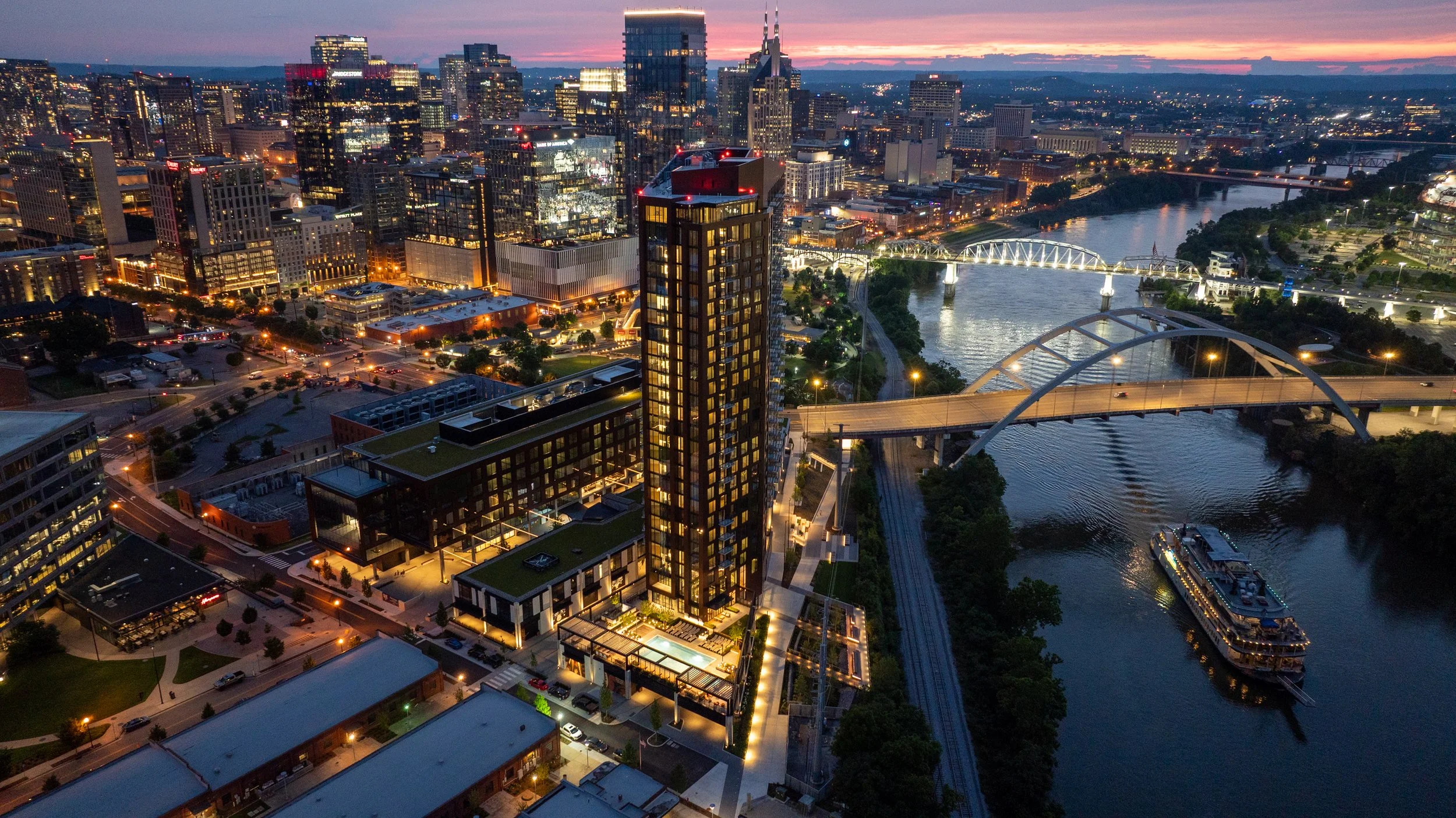
Nashville Drone Co South Bank Aerial Photo
Anyone who has watched a high rise climb out of the ground in Nashville knows the process moves fast. Steel and concrete stack floor by floor, and within months a skyline changes shape. What most developers do not realize until it is too late is that the same speed working in their favor on the construction schedule is working against them when it comes to capturing the views their future residents, tenants, and buyers will one day pay a premium for.
The honest answer to "when is the right time" is simple: earlier than you think, and before a crane goes up.
The Closing Window Nobody Talks About
Every high rise construction site has a brief period where the building's future sightlines are still fully accessible from the air. This window opens once the site is cleared and foundation work is underway, and it starts closing the moment the first tower crane is erected.
Cranes are a practical necessity on any vertical build, but they are also one of the biggest obstacles to clean aerial photography. A crane boom parked in front of a skyline view, a jib swinging through a shot, or a counterweight blocking the exact angle a future twelfth floor balcony will have; these are not problems a drone pilot can edit around later. Once the crane is in place, certain angles are simply gone for the duration of construction.
Floor height creates a second closing window. As soon as a floor is topped out and enclosed, the specific vantage point that floor would have offered is no longer accessible by drone. A drone cannot fly through a poured slab or a framed wall to capture what the view would have looked like from inside a unit that no longer has open air where the camera needs to be. That view existed for a matter of weeks during construction and then it was gone.
This is why timing is not a minor scheduling detail. It is the difference between having authentic, sellable imagery for every floor of a building and having none at all for the upper levels once the structure tops out.
The smartest developers treat drone photography as part of the construction schedule itself, not an afterthought that gets penciled in once the building is finished. That means checking in with the project's general contractor or site superintendent early, understanding the crane placement plan before it happens, and mapping out which floors need to be captured and on what timeline. A shoot planned around the framing schedule, floor by floor, can document sightlines that would otherwise be lost the moment steel or concrete closes them off. Waiting until the building is farther along almost always means losing access to the lower and middle floors, since those views close first while upper floors are still under construction.
What Happens After the Window Closes
Once the ideal aerial window has passed, developers are left with far more limited and far more expensive options.
Some developers turn to architectural renderings to fill the gap. Renderings have their place in a marketing package, particularly in the very early stages before a single beam goes up, but buyers and tenants have grown far more discerning. A rendering is understood to be an artist's interpretation. It shows what a view is supposed to look like under ideal conditions, not what it actually looks like on a hazy Tuesday afternoon or during a golden hour sunset over the Cumberland River. Real photography closes that credibility gap in a way no rendering ever will.
Is the Cost of Aerial Photography Worth It?
For a high rise development, this question almost always comes down to the value of the sale or lease being made. A single unit view can influence a buyer's decision on a six or seven figure purchase. A retail space view can determine whether a national tenant sees enough foot traffic and skyline exposure to sign a lease. The cost of a properly planned drone photography campaign is a small fraction of the value that a single strong sale or lease adds to a project's bottom line. Compare that against the alternative. Once a building is complete, capturing those same views again requires expensive still phoyography, coordination with the property, and in many cases limited access to floors that are already occupied. What would have taken a single flight during construction now requires a logistics plan, permissions, and a budget that dwarfs the original cost. There genuinely is one real opportunity to capture every floor's view efficiently, and it exists only during the build.
Why High Resolution Views Sell Space
Photography plays a different role at every stage of a project's sales and leasing cycle, but its impact on the closing decision is consistent. Buyers touring a condo before it is finished want to see, not imagine, what their morning coffee view will look like. Prospective retail tenants want to see their signage sightline from the street. Office leasing teams want to show a boardroom's skyline backdrop before the glass is even installed. High resolution aerial photography answers all of these questions with evidence instead of promises. A crisp, well composed image taken from the exact elevation and orientation of a specific unit does more to close a sale than pages of specifications ever could. These images end up on listing pages, in leasing brochures, in investor decks, and across social media campaigns that build anticipation months before a single unit is move in ready. A strong aerial photo library becomes one of the most reused assets in an entire marketing campaign, showing up again and again across channels long after the shoot itself is finished.
Giarratana Development has seen this play out firsthand with the future condos of their 60 story Paramount tower. One image in particular, captured by Nashville Drone Co from what will become the building's penthouse level, has taken on a life of its own inside the project's marketing efforts. The team has come to call it the Billion Dollar Photo, and it has since appeared across multiple ad campaigns tied to the building. It is the kind of shot that only exists because it was captured early, well before the floor it represents was fully enclosed. Giarratana also relies on the high resolution stills and 360 degree panoramic images taken during those early construction phases inside its sales presentation office, giving prospective condo buyers a way to stand in the room and see the actual view from any floor in the building, not a rendering of what that view is supposed to look like.
Sales teams often underestimate how long a single well timed photo shoot will keep paying off. A gallery captured during construction can carry a project from its earliest pre sale phase all the way through grand opening, then continue to serve as content for anniversary posts, press features, and case studies long after every unit is sold. Compare that to the cost of a single rendering package, which typically covers only a handful of predetermined angles and cannot be updated once the building's actual lighting, landscaping, and surrounding skyline are in place. Real photography adapts to whatever the marketing team needs next, whereas a rendering is locked the day it is delivered.
Nashville Drone Co's Approach to High Rise Timing
Nashville Drone Co has worked with high rise developers across Middle Tennessee who understand this timing challenge firsthand. The team plans shoots around construction milestones rather than waiting for a project to reach a convenient stopping point, coordinating directly with general contractors and development teams to capture each floor's unique vantage point before it becomes inaccessible. That kind of planning takes more than a drone and a clear sky. It requires an understanding of sun position and time of day for each specific compass direction a building faces, camera settings that hold detail in both the sky and the shaded building facade, and a precise method for calculating elevation so that a photo taken from what will become the twentieth floor is actually captured from the twentieth floor's true height above sea level, not an approximation. Nashville Drone Co built its process around exactly this kind of accuracy, treating every shoot as a technical exercise in matching a future floor plan to a real world elevation before that floor exists. This attention to detail has made Nashville Drone Co a familiar name to developers working on condo towers, mixed use projects, and commercial high rises throughout the region.
Beyond still photography, the team produces marketing video that walks viewers through a property's story, from the construction process itself to the finished views a resident or tenant will wake up to every day. These videos and photo galleries are frequently the centerpiece of a project's sales center presentation and digital marketing rollout.
Not Limited to Nashville
While the name reflects the company's home base, Nashville Drone Co regularly travels beyond Middle Tennessee for developers who need this same level of construction phase planning and accuracy in other markets. High rise timing challenges are not unique to any one city, and developers working in secondary and tertiary markets across the Southeast face the exact same closing windows once cranes go up and floors get enclosed. A development team with a project outside Nashville can bring the same construction schedule coordination, FAA certified flight operations, and elevation accuracy to their own market.
The Bottom Line
The right time to schedule drone photography for a high rise build is not after the ribbon cutting. It is during the earliest phases of construction, before cranes obstruct the skyline and before floors close off the exact vantage points future buyers and tenants will one day call home. Developers who plan for this window end up with a complete photo and video library that supports every stage of sales and leasing, from the first rendering shown to an investor to the final unit sold to a resident. Those who wait are left choosing between expensive workarounds and marketing materials that simply cannot compete with the real thing.
View Nashville Drone Co’s Gallery
Contact Nashville Drone Co to capture your future high rise views. info@nashvilledrone.co
360° Panoramic Aerial Photos: A New Tool Construction Companies Are Using to Manage Projects from Anywhere
Construction management has always relied on getting eyes on a site. For decades that meant walking the property, climbing scaffolding, or flipping through a stack of printed photos from the last site visit. Drone video and aerial photography changed a lot of that, giving project managers an aerial eye view of progress without stepping foot on uneven ground. Now a newer tool is starting to show up on construction sites across Nashville, and it takes that aerial advantage a step further. It's called 360° panoramic aerial photography, and it's changing how builders, developers, and project managers stay connected to their sites, especially when they can't be there in person.
What Is a 360° Panoramic Aerial Photo?
A 360° panoramic aerial photo is exactly what it sounds like. Instead of a single flat image captured from one angle, a drone captures a series of overlapping photos from a fixed point in the air and stitches them together into one seamless, fully interactive image. The result is a photo you can click into, drag around, and zoom in on, giving you a complete view of everything surrounding that point, not just what's directly in front of the lens.
Think of it as the difference between a snapshot and a window. A regular aerial photo shows you one slice of the site. A 360° panorama puts you inside the image and lets you look wherever you want to look. Grading on the north end of the property, a materials staging area on the south side, or the framing progress on a building in the middle of the lot are all available in the same shot. You're not limited to what the photographer decided to point the camera at that day.
This technology isn't new to real estate, where it's used to create virtual walkthroughs of homes and commercial spaces. What's new is how construction companies are starting to apply it specifically to active job sites, and the results are proving useful in ways that go well beyond a nice visual.
Why Construction Companies Are Paying Attention
Construction projects generate a constant stream of decisions, and most of those decisions are made faster and more confidently when the people making them can actually see what's happening on site. A 360° panorama gives project managers, superintendents, and stakeholders that visual access without requiring another site visit.
Reviewing Grading and Site Prep
Early in a project, grading accuracy sets the tone for everything that follows. Drainage patterns, elevation changes, and pad preparation all need to be verified before foundations go in. A single aerial photo can show general shape and slope, but a 360° panorama lets a civil engineer or site supervisor examine the grading from every direction without physically walking the entire footprint. Zooming into specific areas helps confirm whether swales are cut correctly or whether a low spot needs additional attention before it becomes a drainage problem later.
Tracking Building Progress and Materials
As a project moves into vertical construction, the questions change. Has the framing crew reached the second floor? Are the roof trusses on site and staged correctly? Is there enough lumber delivered for next week's schedule? A 360° panorama captured on a regular basis, weekly or biweekly for example, creates a visual record that answers these questions without a phone call or an email chain. Project managers can zoom into a materials laydown area to do a rough visual inventory or check that deliveries match what was ordered. Developers can look at framing progress on a specific elevation to compare it against the construction schedule.
Verifying Safety Protocol
Safety compliance is one of the most valuable and often overlooked applications of this tool. A 360° panorama captured from above shows fencing placement, erosion control measures, equipment staging, and whether workers are following site safety plans in a way that's hard to fake or misrepresent. Site safety officers and insurance providers can review conditions remotely, and general contractors can document compliance at specific points in the project timeline. If a question ever comes up about site conditions on a particular date, a dated 360° panorama provides a clear, unbiased record.
A Practical Solution for Out-of-State Projects
One of the strongest use cases for 360° panoramic aerial photos is for construction companies managing projects outside their home market. Nashville's growth has attracted builders and developers from across the country, and many of them are running projects here while their leadership team sits in another state entirely.
Flying out for a site visit every time an owner or investor wants an update isn't practical. Phone calls and written reports only go so far in conveying what a site actually looks like. A 360° panorama solves this gap directly. An owner based in another state can open the image on their laptop, drag around the site, and see the same conditions they'd see if they were standing there in person. They can zoom into the retaining wall going up on the east side of the property or check whether the parking lot paving has started, all without booking a flight. This is particularly valuable for investors and lenders who need periodic proof of progress before releasing draws on a construction loan. Instead of relying on a written progress report, they get a visual document they can explore on their own terms. It builds trust and removes a layer of uncertainty that's common with remote project oversight.
Built for Civil, Commercial, and Residential Projects
The applications for 360° panoramic aerial photography aren't limited to one type of construction. Civil development projects, commercial builds, and residential projects can all put this tool to use in slightly different ways.
Civil development, including roadwork, utility installation, and large-scale land development, benefits from the wide field of view a 360° panorama provides. These projects often span acres of land where a standard photo can't capture the full context. A panorama taken from a central point on the site gives engineers and municipal reviewers a complete picture of grading, drainage infrastructure, and site access all in one interactive image.
Commercial builds, from retail centers to office parks to mixed-use developments, benefit from the marketing side of this tool just as much as the documentation side. A 360° panorama of a commercial project under construction can be embedded directly on a leasing website, giving prospective tenants a real sense of the property's scale and surroundings well before completion. It also gives ownership groups and lenders a consistent visual record throughout the build.
Residential projects, whether it's a custom home, a small subdivision, or a large master-planned community, benefit from the same transparency. Builders can share panoramas with homeowners who want to see progress on their future home without visiting a muddy job site. Developers building out subdivisions in phases can use panoramas to show buyers what a section of the neighborhood will look like once construction wraps up in that area.
Nashville Drone Co Brings This Tool to the Local Construction Market
Nashville Drone Co has started offering 360° panoramic aerial photos as part of its construction drone services, bringing a tool that's more commonly associated with luxury real estate marketing into a practical, everyday resource for builders and developers across Middle Tennessee.
This is a natural extension of the work Nashville Drone Co already does on active job sites. The company has spent years documenting construction progress for general contractors, developers, and commercial real estate teams throughout Nashville, Brentwood, Franklin, Murfreesboro, and the surrounding area. Adding 360° panoramic capture to that lineup gives clients a new way to review their sites that goes beyond a standard photo or video update.
For a construction market growing as quickly as Nashville's, introducing this kind of tool matters. New commercial towers, sprawling residential developments, and infrastructure projects are underway across the region at the same time, and many of the companies behind them are managing multiple sites at once, sometimes from outside the state entirely. A 360° panorama gives those teams a faster, more complete way to stay connected to a project without adding another flight to their calendar.
How the Process Works
Capturing a 360° panoramic aerial photo starts the same way any other drone flight does. Nashville Drone Co's FAA certified pilots handle all necessary airspace authorizations before arriving on site, then position the drone at the optimal height and location to capture the full scope of the project. From there, the drone captures a series of overlapping images in every direction from that fixed point.
Those images are then stitched together using specialized software, creating one seamless panoramic photo that can be viewed on any computer, tablet, or phone. The finished panorama can be embedded on a website, shared through a simple link, or delivered as part of a broader progress reporting package alongside standard aerial photos and video.
Because the process fits into the same site visit as other drone deliverables, construction companies don't need to schedule a separate flight to add 360° panoramic photos to their documentation routine. It's an efficient addition to an existing workflow rather than a new obligation.
A Tool Worth Adding to Your Project Workflow
As construction projects across Nashville continue to grow in scale and complexity, the tools available for managing and communicating progress need to keep pace. 360° panoramic aerial photography gives builders, developers, and project managers a level of visual access that simply wasn't available a few years ago. Whether the goal is reviewing grading before a foundation pour, tracking materials on a busy job site, verifying safety compliance, or keeping an out-of-state ownership team in the loop, this tool delivers a clear, interactive view that standard photos and video can't match on their own.
If your construction company is looking for a more complete way to document and share progress on your next project, 360° panoramic aerial photos are worth adding to your toolkit. Contact Nashville Drone Co to learn how this service can fit into your next scheduled site visit. info@nashvilledrone.co
Why Construction Fly-Through Videos Have Become the Marketing Tool Nashville Builders Can't Afford to Skip
Construction companies used to rely on referrals, a solid reputation, and a handful of finished project photos to win new work. That formula still matters, but it no longer carries a business on its own. Buyers, investors, and future clients now expect to see a project before they ever set foot on a site, and the companies that show up with compelling visuals are the ones landing the next contract. This is where fly-through video has quietly become one of the sharpest tools in a builder's marketing kit.
A construction fly-through video is exactly what it sounds like. A drone pilot flies a low, cinematic path through and around a job site, capturing the scale, the layout, and the progress of a build in a way that feels immersive rather than static. It is not a slow orbit shot from three hundred feet up. It moves through the structure, weaves between equipment, and gives viewers a sense of standing right there on the site. For land developers, concrete companies, civil development firms, commercial builders, and residential builders alike, this kind of footage does something a still photo simply cannot. It tells a story of momentum.
Why Fly-Through Video Works So Well for Construction Marketing
It Shows Scale in a Way Words and Photos Cannot
Ground level photography flattens a project. A wide parking lot pour, a multi-acre grading job, or a commercial retail build all lose their sense of scale when viewed from a single fixed angle. A fly-through changes that instantly. Viewers can see the full footprint of a project, how it relates to the surrounding roads and neighborhoods, and just how much coordination went into the work. That context builds trust before a single sales conversation happens.
It Turns Progress Documentation Into a Marketing Asset
Most construction companies already capture some kind of progress record for internal purposes, whether that is for owners, lenders, or project managers tracking milestones. Fly-through video does double duty. The same footage that documents grading, foundation work, framing, and final buildout can be repurposed into polished marketing content. One flight, multiple uses.
It Performs on Social Media
Construction content has found a real audience on Instagram, TikTok, and LinkedIn. People are naturally drawn to watching things get built, especially when the footage is fast-paced and visually dynamic. A well edited fly-through gives a construction company something worth posting on a weekly basis, and that consistency is what keeps a brand in front of potential clients long after the ribbon cutting.
It Speaks to a Wide Range of Construction Niches
Land developers use fly-through video to show raw acreage transforming into graded, ready-to-build parcels, which is powerful for attracting investors and future buyers.
Concrete companies can highlight the precision and scale of large pours, parking structures, and paving projects that are hard to appreciate from the ground.
Civil development firms benefit from showing infrastructure work such as roads, utilities, and site prep in a way that communicates complexity and capability.
Commercial builders get to showcase retail centers, office parks, and industrial buildings taking shape, which helps win the next bid from a developer or brand.
Residential builders can turn a single subdivision or custom home build into a library of content that markets both the builder and the homes themselves.
Nashville Drone Co Has Become the Name Construction Companies Trust
Plenty of companies in Middle Tennessee own a drone and can get a camera in the air. Far fewer understand what it actually takes to fly on an active construction site and come away with footage that builds a brand. Nashville Drone Co has built its reputation on that exact gap, and it has become the go to partner for construction companies across the Nashville area who want more than basic aerial clips.
Safety Comes Before the Camera
Job sites are not forgiving environments for careless flying. Cranes swing loads overhead, heavy equipment moves without warning, and workers are focused on their tasks rather than watching the sky. Nashville Drone Co treats every site visit as a safety operation first and a filming job second. Their pilots coordinate with site supervisors before a single flight, understand active work zones, and know how to read a construction site the way an experienced contractor does. That background is what allows them to work confidently around cranes, excavators, and active crews without becoming a liability on someone else's job site.
Real Experience Around Heavy Equipment
There is a noticeable difference between a drone operator who occasionally shoots a construction site and one who has spent real time flying around active builds. Nashville Drone Co falls firmly into the second category. Their comfort level around heavy machinery, tower cranes, and shifting site conditions means they can capture the close, dynamic shots that make fly-through video compelling, without slowing down the crew or creating a safety concern. Superintendents notice this kind of professionalism, and it is a big reason contractors keep calling them back for every phase of a project.
Marketing Experience Sets Them Apart From Other Drone Operators
Flying a drone is a skill. Turning that footage into content that actually generates leads is a different skill entirely, and it is the one that separates Nashville Drone Co from most other operators in the market. Their team edits with a marketing mindset from the start, building videos designed to stop the scroll on Instagram and LinkedIn rather than simply documenting a site. That approach has made them the trusted choice for construction companies who want their video content to do more than sit in a folder. It is built to circulate, get shared, and put the company's name in front of the right audience at the right time.
A Real Example: The Walmart Project With McCrory Construction
One of the clearest examples of this approach in action is Nashville Drone Co's recent work on a new Walmart construction site in the Nashville area for McCrory Construction. What started as a straightforward request for progress footage turned into something with a much bigger impact for the company.
The aerial video gave McCrory's team a clear, elevated view of the site that made it easier to track weekly progress and confirm that safety protocols and erosion control standards were being maintained throughout the build. But the value did not stop there. The same footage became a marketing asset that McCrory could use to show the scope and professionalism of their work to future clients and partners.
Ben Melton of McCrory Construction summed up the experience directly:
"Nashville Drone Co did an incredible job. The visibility captured in the drone footage of the construction site allowed me and my team to have an incredible insight to the weekly progress made as well as help us track and ensure that safety protocol was constantly being adhered to and quality of erosion control was being up kept throughout the project. The quick turnaround time also came in handy as we were using this footage for multiple reasons on a weekly basis. Highly recommend."
That kind of feedback captures exactly why fly-through video has become more than a “nice to have” for construction companies. It supports project management, reinforces safety accountability, and builds a marketing library all from the same flight.
The Bottom Line for Construction Companies in Nashville
Construction is a visual industry, yet so many companies still rely on outdated photography or no visual content at all when it comes to marketing their work. Fly-through video closes that gap. It gives land developers, concrete companies, civil contractors, commercial builders, and residential builders a way to show their work at a scale that matches how impressive it actually is.
Nashville Drone Co has built a track record of doing this the right way, with a safety first approach on active job sites and a marketing strategy that turns footage into real business results. For construction companies across the Nashville area looking to stand out, partnering with a team that understands both the site and the story is no longer optional. It is quickly becoming the standard.
To see examples of Nashville Drone Co’s construction video work and learn more about how a fly-through video could work for your next project, visit Nashville Drone Co
Contact Nashville Drone Co to get your project scheduled info@nashvilledrone.co
The Ultimate Guide to Drone Services for Construction Projects in Nashville
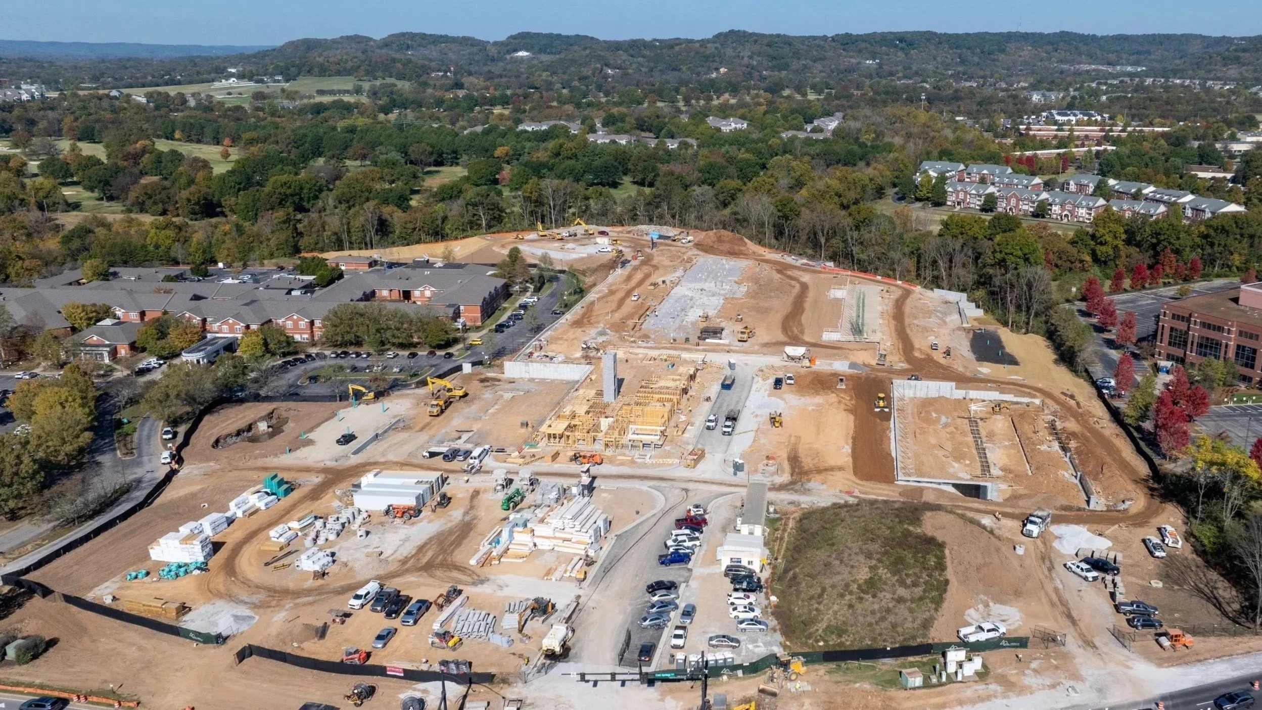
Nashville Drone Co Construction Photo Ellison Cool Springs
Drone technology is transforming how construction happens across the United States.
In a city like Nashville where growth is constant and building is everywhere, the right drone services can mean the difference between staying on schedule and falling behind. Whether you are managing a large commercial tower downtown, working on infrastructure around the Cumberland River, or developing land in suburbs like Spring Hill or Franklin, aerial data adds clarity, speed, and safety to your projects. In this guide we’ll explore how drone services integrate into construction workflows in Nashville and why companies like Nashville Drone Co are leading the way.
Why Construction Companies in Nashville Are Adopting Drone Services
Construction in Nashville comes with unique pressures: zoning changes, fast growth, tight labor availability, regulatory oversight, and the need to impress investors. Drones address many of those pressures in a clear, measurable way.
Key benefits include:
Accurate site planning through aerial mapping
Real‑time progress updates that help stakeholders and clients see work advancing
Powerful marketing assets – aerial video and photography elevate presentations
Compliance documentation, needed for permitting, insurance, or audits
Safer inspections of roofs facades and structural elements without putting people at risk
These capabilities are not optional extras. In an evolving skyline environment such as downtown Nashville and its surrounding zones the firms that lean into drone technology gain competitive advantage.
Drone Use Cases Across Construction Phases
Using drones at distinct phases of construction ensures that value is delivered continuously.
1. Pre‑Construction: Site Video Captures and Planning
Before breaking ground, developers need to understand everything about a site: terrain, drainage, obstructions, access, utilities. Drones enable rapid collection of high resolution images and GPS‑referenced data, which can be converted into:
2D orthomosaic maps
3D models of terrain
Cut‑and‑fill volume calculations
Accurate base maps for import into CAD and GIS systems
2. Construction Phase: Progress Tracking and Reporting
During active builds periodic documentation helps with transparency and control. With regularly scheduled flights, drone services allow project managers to:
Compare current work to the schedule with side‑by‑side aerial images
Identify delays or bottlenecks early
Produce visual milestone reports for clients, investors or city permitting authorities
Coordinate subcontractors by visually confirming site layout
In large projects such as the new mixed‑use developments around Midtown or the expanding infrastructure near Opryland these services streamline communication and help maintain accountability.
3. Post‑Construction: Marketing and Final Deliverables
When a project is finished what matters most is how it looks to the public, tenants, buyers or investors. Drones provide:
Stunning aerial photography and video for websites and advertising
Fly‑throughs or cinematic walk‑arounds of completed properties
Portfolio‑ready media that highlight craftsmanship, design, landscape integration
Powerful visuals for leasing, sales, branding
With Nashville’s real estate market as competitive as ever imagery from above curved glass, rooftop terraces, landscaped grounds all make a powerful first impression.
Who to Expect from a Truly Professional Drone Service
Having a drone does not make one an aerial construction partner. When selecting a provider in Nashville you should look for a company that meets these standards:
FAA Part 107 certified pilots who understand airspace, safety, and regulations
Insurance coverage sufficient for large‑scale construction site work
Experience working in construction workflows: mapping, inspections, reporting
Proven deliverables: orthomosaics, 3D models, time‑lapses, high resolution video
Nashville Drone Co: Top Rated Drone Video and Photography Company
When evaluating who to engage, Nashville Drone Co stands out as a top rated drone video and photography company in the Nashville area. Unique among providers, Nashville Drone Co blends deep technical expertise with local construction site experience. Here’s how they bring value:
Their pilots are fully FAA Part 107 certified and have logged hours on a variety of Nashville construction sites.
They deliver detailed site mapping, 3D modeling, and orthomosaic images that integrate easily with CAD and GIS software.
Their video teams capture cinematic aerial footage customized for marketing, investor presentations, and final walk‑throughs.
They understand regulatory and safety issues unique to Nashville including proximity to airports, temporary flight restrictions, special use zones, and neighborhood privacy concerns.
Their client reporting includes progression video, fly‑throughs, and time‑lapse sequences that demonstrate change over time.
Choosing a local trusted partner like Nashville Drone Co saves time on communication, permits, and local restrictions while offering deliverables designed for Nashville’s climate and construction style.
Drone Mapping Explained: 2D, 3D, and Beyond
One of the most powerful capabilities drones provide is mapping. Mapping transforms raw images into usable deliverables for planning and analysis.
Mapping outputs commonly used in construction:
2D Orthomosaic Maps
Flat, stitched‑together aerial images aligned geographically
Site overview, planning, permit documents
3D Point Clouds
Dense clusters of points representing ground and structures
Elevation, structural inspections, design visualization
Digital Surface Models (DSM)
Includes all structures and vegetation
Helps with planning drainage, rooftop lines, view sheds
Contour Lines
Lines that connect points of equal elevation
Grading, earthwork, cut/fill planning
In Nashville’s hillier outskirts and growing subdivisions mapping is critical for anticipating water run‑off, avoiding unexpected earth moving costs, and ensuring proper access.
Legal and Compliance Considerations in Nashville Construction Zones
Operating drones legally is non negotiable. Violations of FAA rules or local ordinances can lead to delays or fines. Key compliance areas include:
FAA Part 107 certification for pilots
Airspace restrictions: near airports such as BNA (Nashville International) or John C Tune, near heliports, or near controlled airspace
Temporary Flight Restrictions (TFRs) that may be active during special events such as large concerts or sporting events
City owned property and public land often require special permits or notifications
Privacy concerns especially when filming near residential zones; state and local privacy laws must be observed
Adequate insurance and liability coverage
A company like Nashville Drone Co handles all of these behind the scenes so you don’t have surprises when regulatory bodies or neighbors get involved.
How Drone Services Translate into ROI
Drone work costs less than many traditional site survey crews and provides continuous value. Below are ways drone services pay off.
ROI Drivers:
Reduced time for site overview vs ground crews reducing days or weeks off schedules
Better scheduling and budget accuracy through frequent visual updates
Fewer safety incidents when inspections happen from the air rather than risky climbs or unsafe positions
Higher quality marketing materials that can attract better tenants or buyers or enable more favorable lease or sales terms
Documented proof of condition reducing disputes over defects, delays, or construction quality
In practice many Nashville builders recoup drone service costs in the first major phase of a project or through incremental gains in marketing or safety savings.
Criteria for Choosing the Right Drone Partner in Nashville
To pick a partner who delivers on all promises, ask these questions:
Are your pilots FAA Part 107 certified?
Do you carry insurance coverage for construction site work and aerial photography?
Can you show sample orthomosaic maps, 3D models, time‑lapse or progress tracking from similar projects?
Have you worked before in Nashville or similar markets with local permitting or zoning issues?
Do you offer recurring flight schedules reliably over the life of the project?
Recommended Scheduling of Drone Services
When to schedule flights matters. Timing around lighting, site activity, and project milestones can affect the usefulness of the data.
Pre‑construction: before grading or land clearing to assess existing conditions
During construction: every 2 to 4 weeks depending on size of project or pace of change
Post‑construction: final aerial video and walk‑throughs when weather is good and site cleanup is complete
Lighting matters: early morning or late afternoon often produce better shadows and contrast for photos and video.
Final Thoughts
In Nashville such a dynamic and fast‑changing urban environment drone services are no longer optional extras layered on at the end of a project. They are fundamental to delivering quality, compliance, efficiency, and impact.
Partnering with a professional drone company like Nashville Drone helps you avoid pitfalls related to regulations, weather, time, and safety. With the right data you gain clarity. With clarity you build smarter, deliver better, and grow stronger.
Ready to Integrate Drone Services into Your Next Project?
Contact Nashville Drone Co for a free consultation. info@nashvilledrone.co
We offer:
Certified drone pilots who understand local construction zoning requirements
Custom flight plans tailored to your project scope
Deliverables including mapping, time‑lapse
marketing‑grade video, and interactive 3D models
Proven experience across small and large scale construction in Nashville area
Schedule your site video capture today and unlock the aerial advantage for your projects.
FAQ
What are drone services in construction?
Drone services use unmanned aerial vehicles to capture high resolution imagery, load mapping, video, and spatial data to assist in planning, tracking and promoting construction projects.
Are drones legal on construction sites in Nashville?
Yes provided pilots are FAA Part 107 certified and operations comply with FAA and local airspace regulations. Permits, temporary flight restrictions, and proximity to airports must all be respected.
How often should I schedule drone flights for a project?
Typically once every 2‑4 weeks during active phases works best; more frequent imagery can help fast developers or for critical tasks. Pre‑construction and post‑construction each need separate dedicated flights.
What types of deliverables do drone companies provide?
Expected outputs include high resolution still images, 4K video, orthomosaic maps, 3D point clouds, contour lines, digital surface models, annotated reports, and time‑lapse sequences.
How much do drone services cost in Nashville for construction?
Costs vary according to scope frequency location and deliverables. A routine mapping or progress flight might range from $500 dollars to over a thousand dollars depending on complexity and size of site.
Can drones be used for interior construction documentation?
While drones are primarily used outdoors, smaller drones can be flown indoors in large commercial spaces, warehouses, or stadium builds to document interior framing, MEP installations, or safety conditions. However, interior drone work requires specialized equipment and skilled pilots.
What types of construction sites benefit most from drone services?
Drone services are valuable across a wide range of construction projects including residential subdivisions, commercial buildings, infrastructure (bridges, roads, utilities), industrial facilities, and land development. Any site that benefits from aerial visibility, documentation, or mapping can use drone services effectively.
How long does a typical drone flight session take?
Most flights range from 30 minutes to 2 hours depending on site size, deliverables, and complexity. Pre-flight planning and post-flight processing are also part of the service, but actual aerial capture is usually quick and non-disruptive to site operations.
Can drones fly in poor weather or during winter months?
Drone flights are weather-dependent. Heavy wind, rain, or snow can delay missions for safety and quality reasons. However, experienced providers like Nashville Drone Co monitor forecasts and schedule flights strategically to minimize delays even during Nashville's colder months.
What’s the turnaround time for receiving drone footage and reports?
Standard deliverables are often available within 24 to 72 hours. For more advanced processing, such as 3D modeling or orthomosaic stitching, timelines may extend up to 5 business days. Providers like Nashville Drone Co communicate expected turnaround times based on your specific needs.